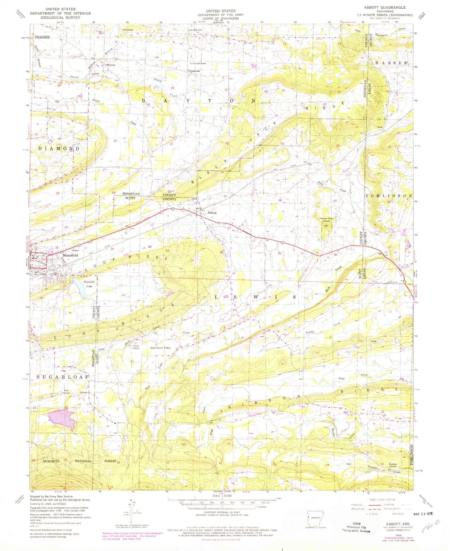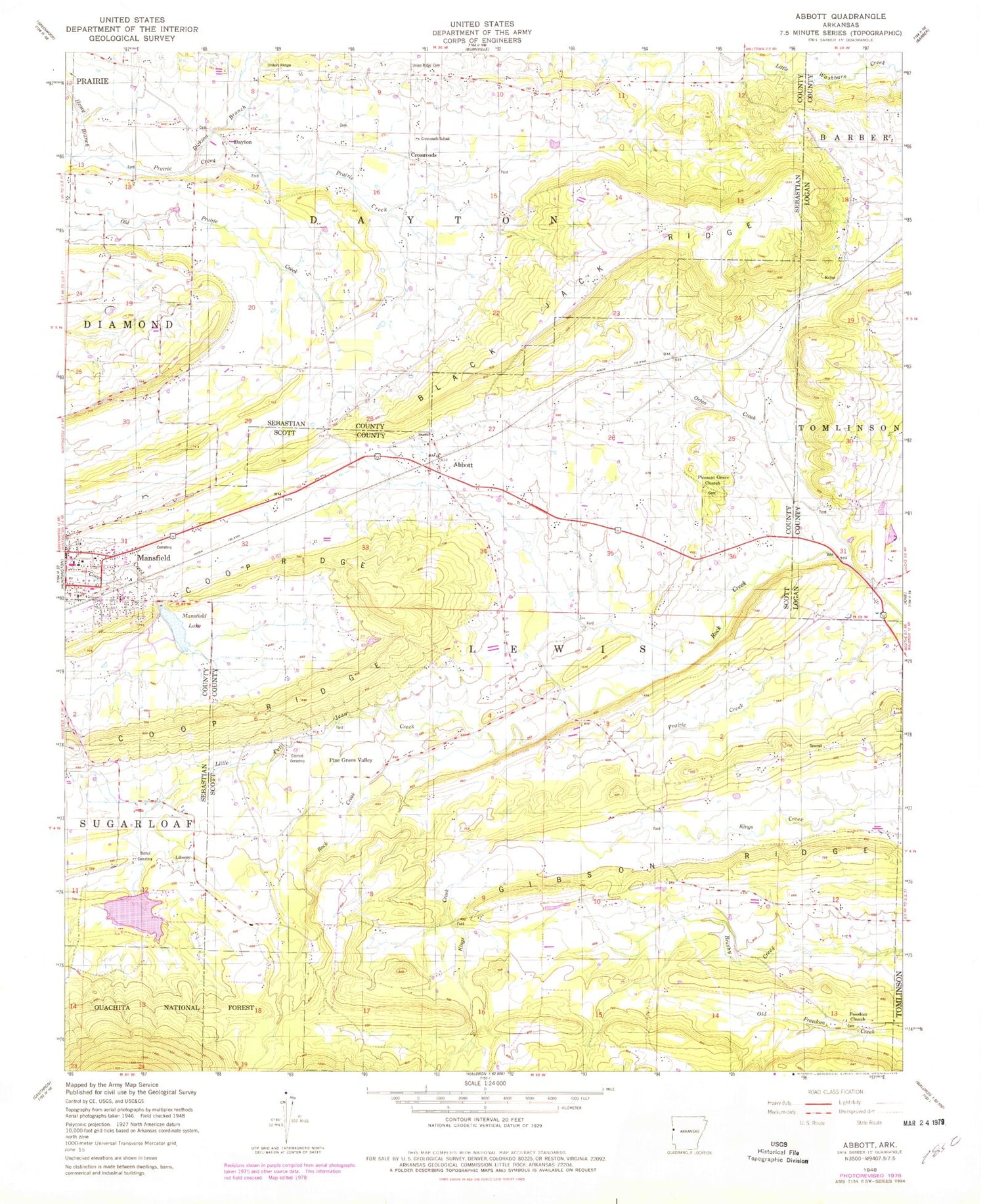
MyTopo
Classic USGS Abbott Arkansas 7.5'x7.5' Topo Map
Couldn't load pickup availability
Historical USGS topographic quad map of Abbott in the state of Arkansas. Map scale may vary for some years, but is generally around 1:24,000. Print size is approximately 24" x 27"
This quadrangle is in the following counties: Logan, Scott, Sebastian.
The map contains contour lines, roads, rivers, towns, and lakes. Printed on high-quality waterproof paper with UV fade-resistant inks, and shipped rolled.
Contains the following named places: Abbott, Bennett Cemetery, Bethel Cemetery, Black Jack Ridge, Bluff Ridge, Bull Cemetery, Calvary Church, Cantrell Cemetery, City of Mansfield, Coop Prairie Cemetery, Coop Prairie Cumberland Presbyterian Church, Coop Prairie Valley School, Coop Ridge, Cross Roads School, Crossroads, Dayton, Dickson Branch, Echo, Freedom Church, Gibson Ridge, Green Floyd Bethel Cemetery, Henry Branch, Kings Creek, Lake Spur, Lake Spur Dam, Lewis, Lewis Cemetery, Liberty, Little Petit Jean Creek, Looper Cemetery, Mansfield Dam, Mansfield Elementary School, Mansfield Gas Field, Mansfield High School, Mansfield Lake, Mansfield Middle School, Mansfield Post Office, Northwest Scott County Volunteer Fire Department Station 1, Northwest Scott County Volunteer Fire Department Station 2, Orten Creek, Pine Grove Valley, Pinkston Cemetery, Pleasant Grove Cemetery, Pleasant Grove Number 3 Baptist Church, Rock Creek Church, Slate Cemetery, Sorrels Cemetery, Township of Dayton, Township of Lewis, Union Ridge, Union Ridge Cemetery, ZIP Code: 72944