MyTopo
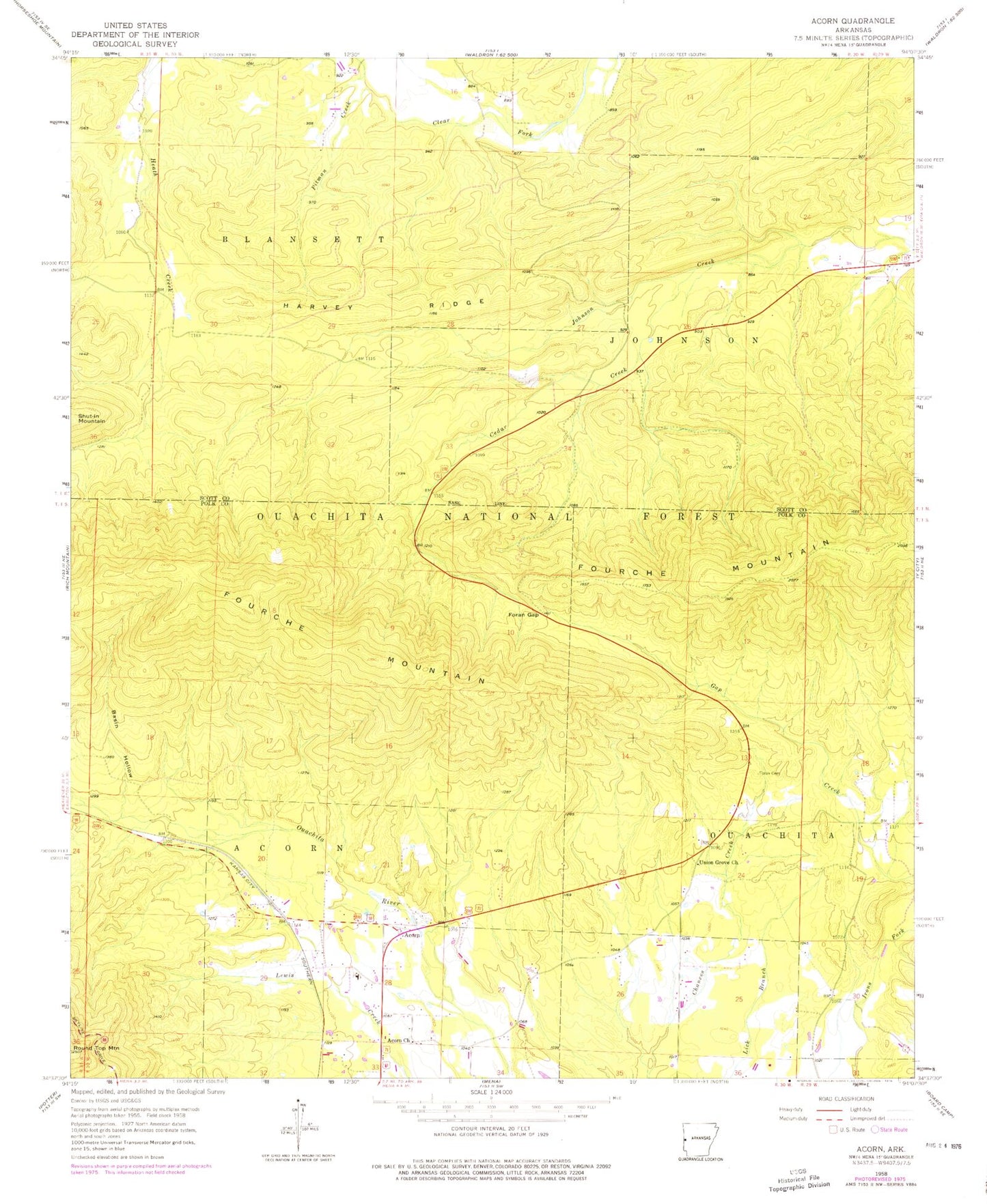
Classic USGS Acorn Arkansas 7.5'x7.5' Topo Map
Couldn't load pickup availability
Historical USGS topographic quad map of Acorn in the state of Arkansas. Map scale may vary for some years, but is generally around 1:24,000. Print size is approximately 24" x 27"
This quadrangle is in the following counties: Polk, Scott.
The map contains contour lines, roads, rivers, towns, and lakes. Printed on high-quality waterproof paper with UV fade-resistant inks, and shipped rolled.
Contains the following named places: Acorn, Acorn Census Designated Place, Acorn Elementary School, Acorn Fire Station District 6, Acorn High School, Acorn Methodist Church, Acorn School, Basin Hollow, Cedar Creek, Foran Cemetery, Foran Gap, Gap Creek Valley, Gate, Harvey Ridge, Irons Fork Creek Watershed Site 1 Dam, Pitman Creek, Township of Johnson, Union Grove Freewill Baptist Church