MyTopo
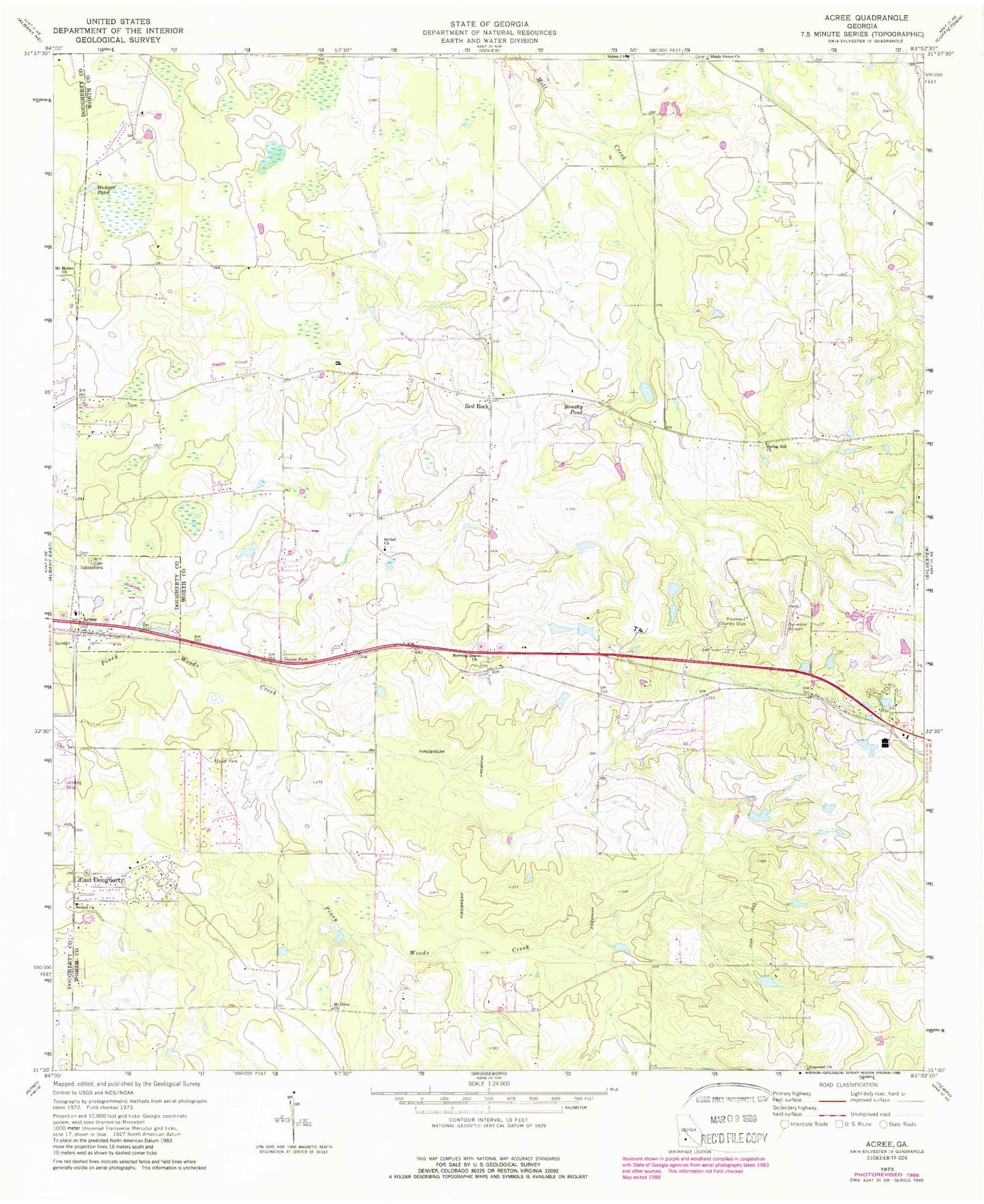
Classic USGS Acree Georgia 7.5'x7.5' Topo Map
Couldn't load pickup availability
Historical USGS topographic quad map of Acree in the state of Georgia. Map scale may vary for some years, but is generally around 1:24,000. Print size is approximately 24" x 27"
This quadrangle is in the following counties: Dougherty, Worth.
The map contains contour lines, roads, rivers, towns, and lakes. Printed on high-quality waterproof paper with UV fade-resistant inks, and shipped rolled.
Contains the following named places: Acree, Artesia, Aultmans Store, Bethel Cemetery, Bethel Church, Beulah Church, Black Lake, Bonnie Pond, Brushy Pond, County Line Church, County Line Volunteer Fire Department Station 1, Crowe Airport, Deep Pond, Deerfield Farm Estates, East Dougherty, Evergreen School, First Baptist Church, Gammage, Gammage Pond, Hill Cemetery, Hopewell Church, Hudson Pond, Jackson Grove School, Morning Star Cemetery, Morning Star Church, Morning Star School, Mossy Oaks, Mount Holder Cemetery, Mount Holder Church, Mount Olive Church, New Mount Olive Church, Nike Site TU-28C, Nike Site TU-28L, Pineknoll Country Club, Porters Corner School, Red Rock, Red Rock School, Red Rock Volunteer Fire Department Station 6, Rocky Branch Pond, Salem Missionary Baptist Church, Shady Grove Cemetery, Shady Grove Church, Shady Grove School, Sinners Friend Church, Sowega Youth Home, Spring Hill Church, Spring Hill School, Springhill, Sylvester Airport, Sylvester Division, Thigpens Lake, Thigpens Lake Dam, Thomas Acres, Waving Pond, Willingham, Yellow Pond, ZIP Code: 31791