MyTopo
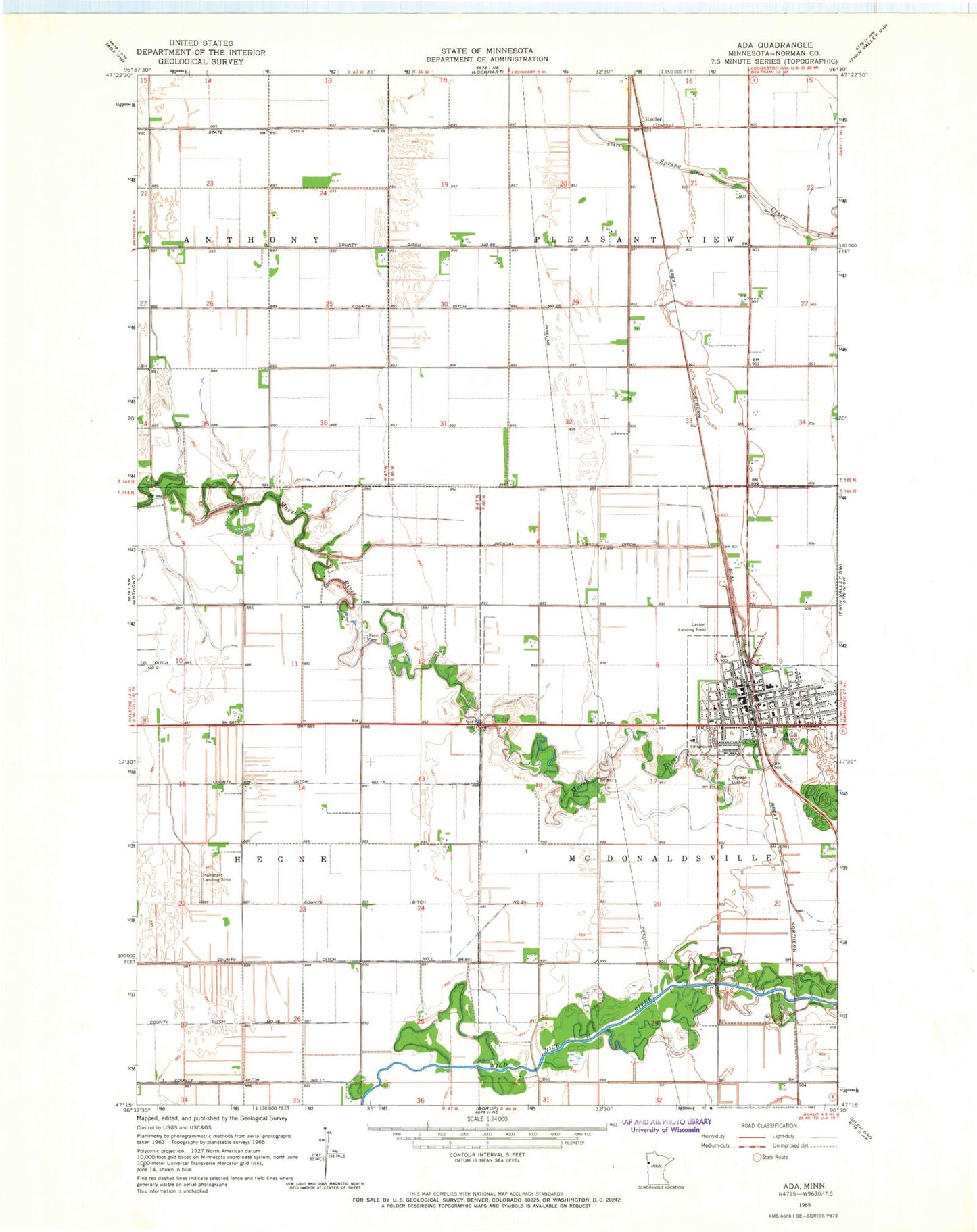
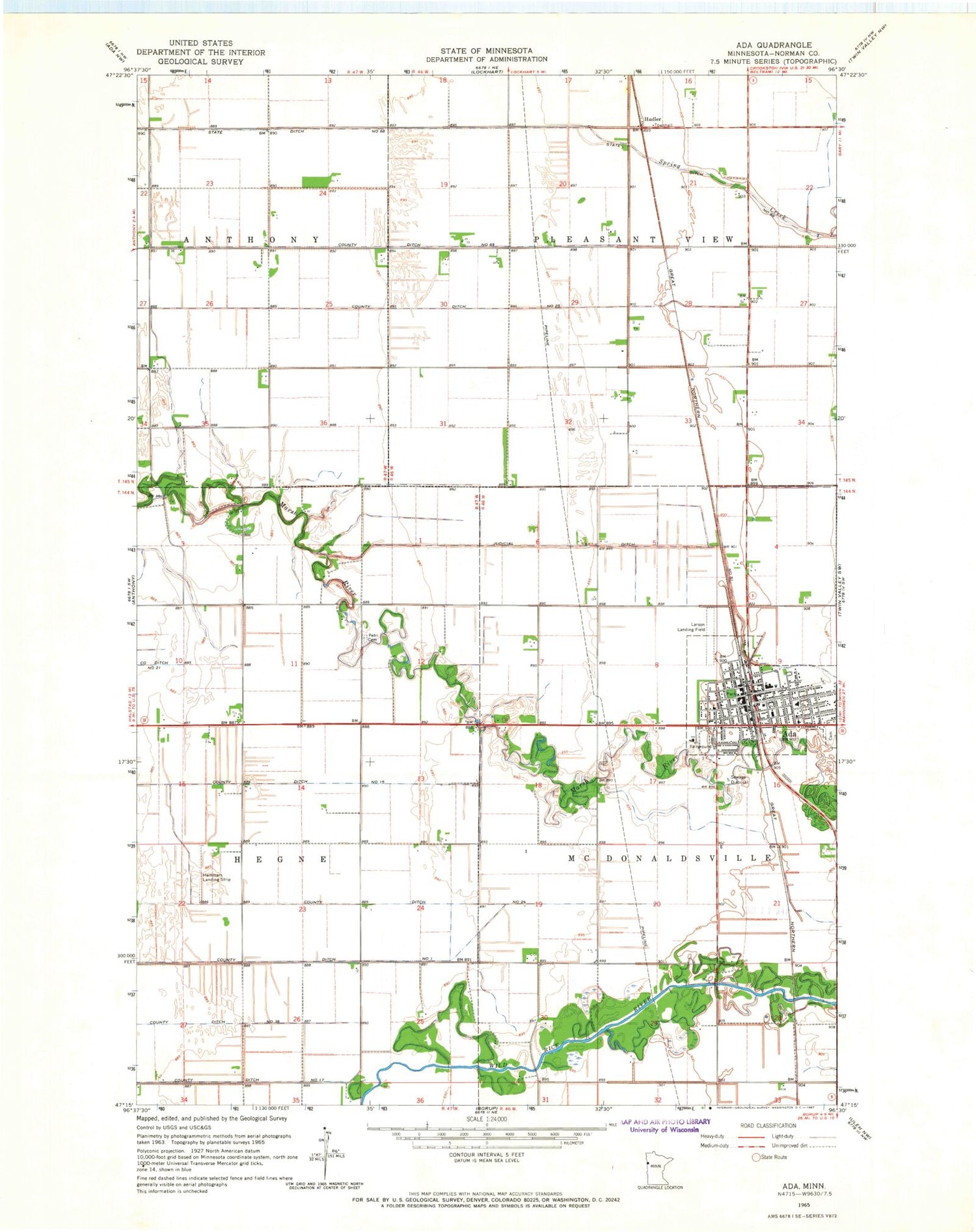
Classic USGS Ada Minnesota 7.5'x7.5' Topo Map
Couldn't load pickup availability
Historical USGS topographic quad map of Ada in the state of Minnesota. Map scale may vary for some years, but is generally around 1:24,000. Print size is approximately 24" x 27"
This quadrangle is in the following counties: Norman.
The map contains contour lines, roads, rivers, towns, and lakes. Printed on high-quality waterproof paper with UV fade-resistant inks, and shipped rolled.
Contains the following named places: Ada, Ada Cemetery, Ada City Library, Ada Elementary School, Ada Junior-Senior High School, Ada Police Department, Ada Post Office, Ada Station, Ada Volunteer Fire Department, Beltrami United Methodist Church, Bosworth Park, Bridges Care Community, City of Ada, County Ditch Number Fifteen, County Ditch Number Seventeen, County Ditch Number Sixtynine, County Ditch Number Thirtysix, County Ditch Number Twentyfive, County Ditch Number Twentyfour, Dekko Park, East Side Park, Essentia Health Ada Clinic and Hospital, Evangelical Free Church, Faith United Church, Grace Lutheran Church, Hadler, Hadler Post Office, Hadler Station, Hammars Farm Airport, Heart of the Valley Golf Club, KRJB-FM (Ada), Merry Lane Mobile Home Park, Norman County Courthouse, Norman County Fairgrounds, Norman County Jail, Norman County Sheriff's Office, Petri Cemetery, Saint Joseph Catholic Church, SonRise Evangelical Free Church, State Ditch Number Sixtyeight, Township of Pleasant View, West Side Park, Zion Lutheran Church, ZIP Code: 56510