MyTopo
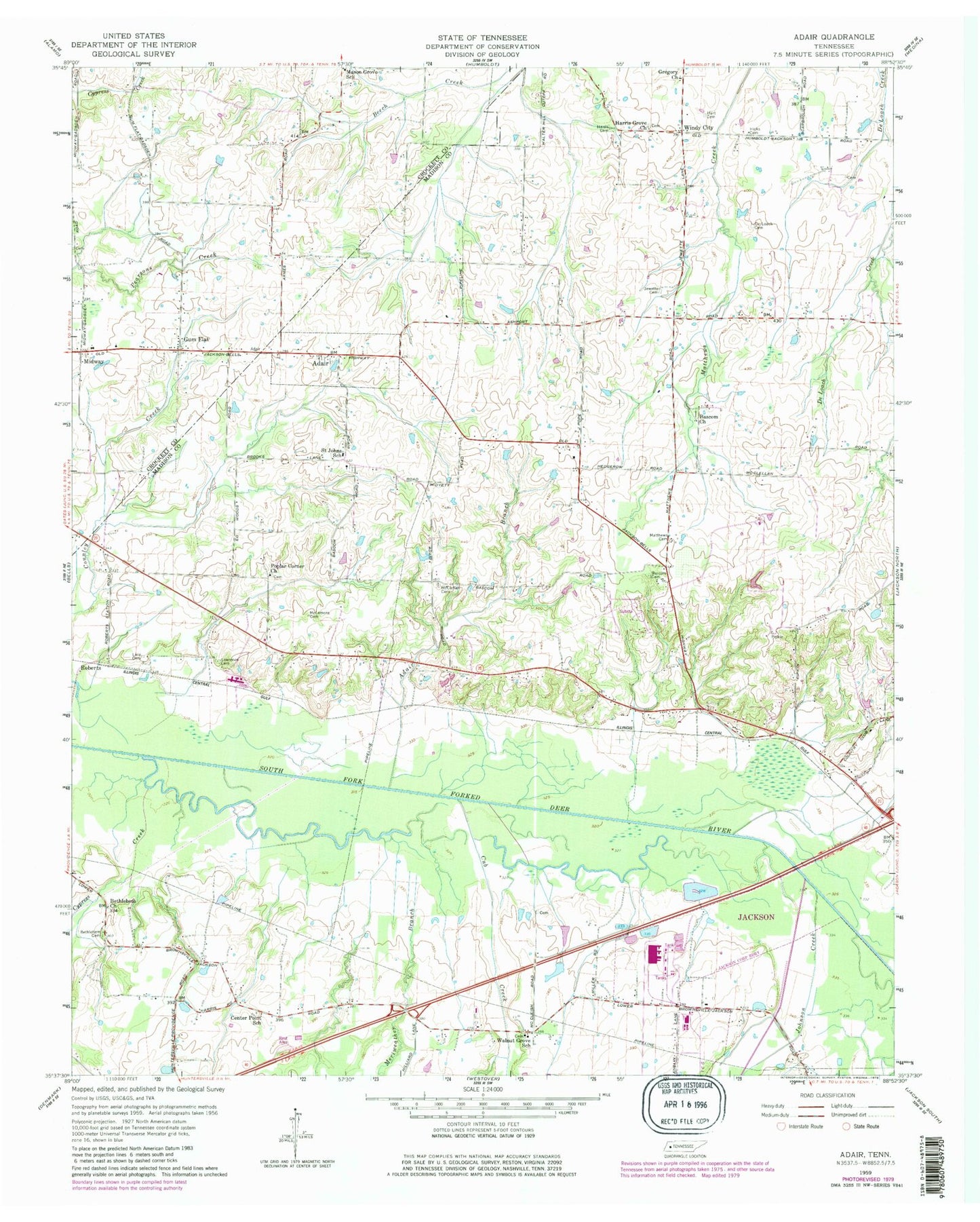
Classic USGS Adair Tennessee 7.5'x7.5' Topo Map
Couldn't load pickup availability
Historical USGS topographic quad map of Adair in the state of Tennessee. Map scale may vary for some years, but is generally around 1:24,000. Print size is approximately 24" x 27"
This quadrangle is in the following counties: Crockett, Madison.
The map contains contour lines, roads, rivers, towns, and lakes. Printed on high-quality waterproof paper with UV fade-resistant inks, and shipped rolled.
Contains the following named places: Adair, Adair Branch, Bascom Christian Methodist Episcopal Church Cemetery, Bascom Church, Bethlehem Cemetery, Bethlehem Church, Center Point School, Commissioner District 3, Commissioner District 9, Cross Road School, Cub Creek, Cypress Creek, De Loach Cemetery, Gregory Church, Gum Flat, Harris Cemetery, Harris Grove Church, Hart Cemetery, Hicks Cemetery, Jewett Cemetery, Johnson Creek, Lacy Cemetery, Lawrence Cemetery, Madison County Fire Department Station 10, Madison West Industrial Park, Mason Grove School, Matthews Cemetery, McClellan Cemetery, McLemore Cemetery, Meriweather Branch, Midway, Midway Baptist Church, Pope Division, Poplar Corner Church, Randolph Family Cemetery, Roberts, Saint John Baptist Church, Saint Johns School, Walnut Grove Baptist Church, Walnut Grove School, Windy City, Wirt Seminary