MyTopo
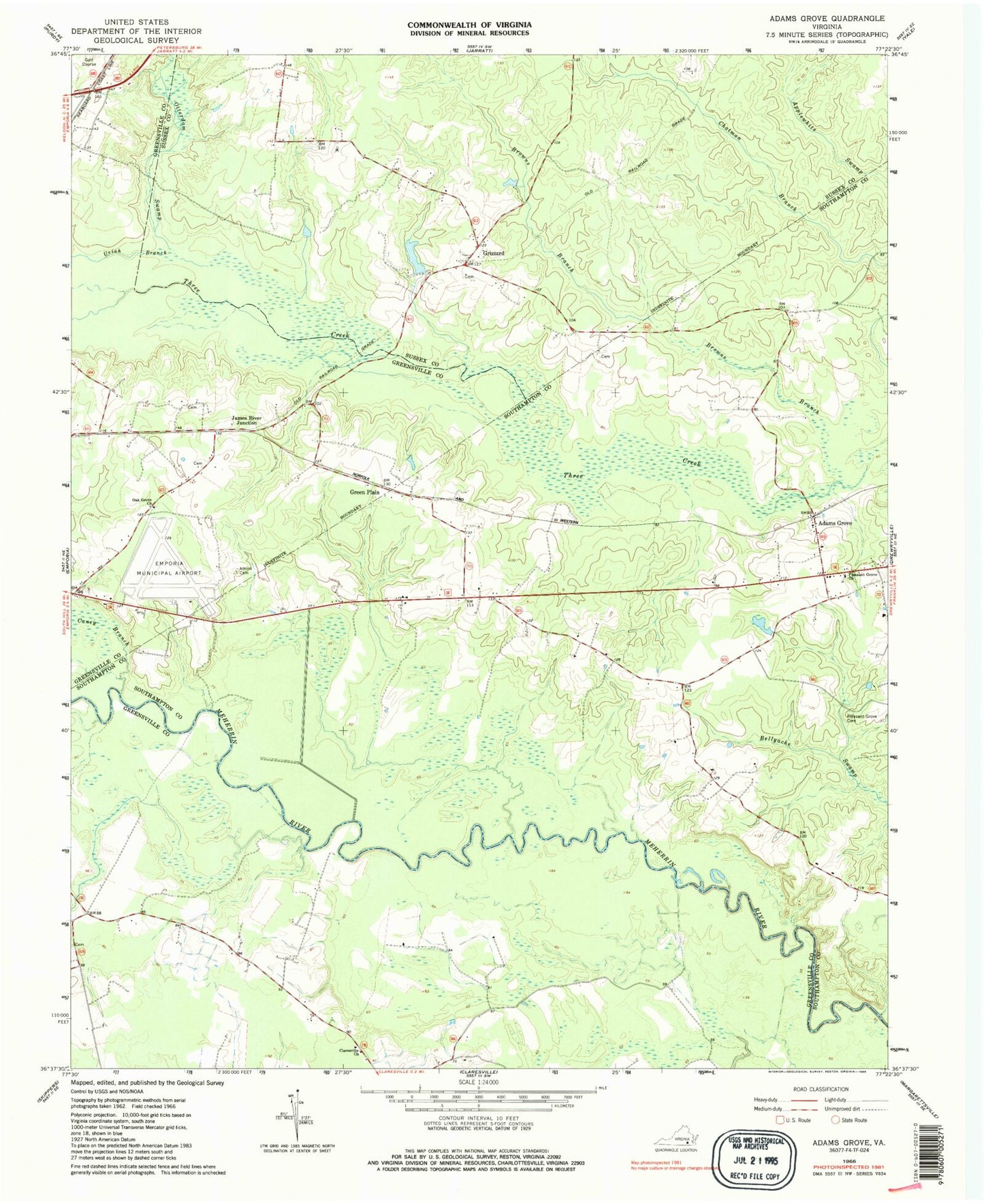
Classic USGS Adams Grove Virginia 7.5'x7.5' Topo Map
Couldn't load pickup availability
Historical USGS topographic quad map of Adams Grove in the state of Virginia. Map scale may vary for some years, but is generally around 1:24,000. Print size is approximately 24" x 27"
This quadrangle is in the following counties: Greensville, Southampton, Sussex.
The map contains contour lines, roads, rivers, towns, and lakes. Printed on high-quality waterproof paper with UV fade-resistant inks, and shipped rolled.
Contains the following named places: Adams Grove, Big Branch, Browns Branch, Caney Branch, Claresville Church, Emporia Country Club, Emporia-Greensville Regional Airport, Faison School, Faisons Mobile Home Park, Friendship Church of God in Christ, Green Plain, Grizzard, Grizzard School, Harrell Pond, Holly Square School, J B Harrell Dam, James River Junction, Newsom Grove School, Oak Grove Baptist Church, Otterdam Swamp, Pleasant Grove Cemetery, Pleasant Grove Church, Uriah Branch