
MyTopo
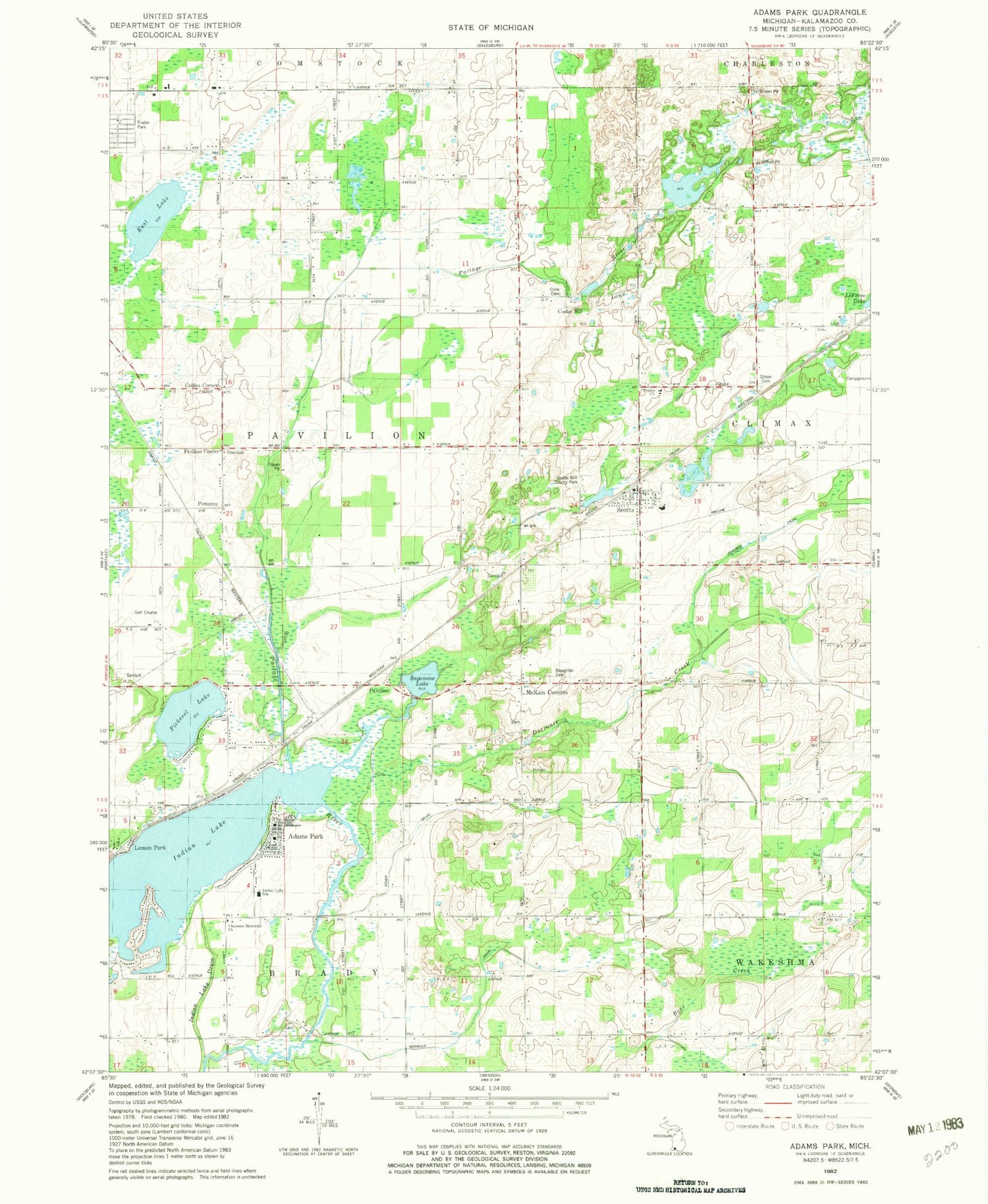
Classic USGS Adams Park Michigan 7.5'x7.5' Topo Map
Couldn't load pickup availability
Historical USGS topographic quad map of Adams Park in the state of Michigan. Map scale may vary for some years, but is generally around 1:24,000. Print size is approximately 24" x 27"
This quadrangle is in the following counties: Kalamazoo.
The map contains contour lines, roads, rivers, towns, and lakes. Printed on high-quality waterproof paper with UV fade-resistant inks, and shipped rolled.
Contains the following named places: Adams Park, Asher Drain, Bond School, Boughton Cemetery, Chapman Memorial Church, Climax-Scotts Elementary School, Collins Corner, Cook Cemetery, Cooks Mill, Cooley School, Country Christian Evangelical Free Church, Dorrance Creek, East Lake, East Lake Airport, Gilson Cemetery, Hull School, Indian Lake, Indian Lake Drain, Indian Lake School, Lemon Park, McKain Cemetery, McKain Corners, Morse School, Pavilion, Pavilion Post Office, Pavilion Station, Pavilion Township Fire Department Station 1, Pavillion Center, Pavillion Estates Mobile Home Park, Pickerel Lake, Pomeroy, Prairie Church, Reinbold Drain, Sagamaw Lake, Scotts, Scotts Census Designated Place, Scotts Mill County Park, Scotts Post Office, Scotts Station, Scotts United Methodist Church, Timberlake Campground, Township of Pavilion, Universal Life Church, Wakeshma Tabernacle, Wolcott Cemetery, ZIP Code: 49088


