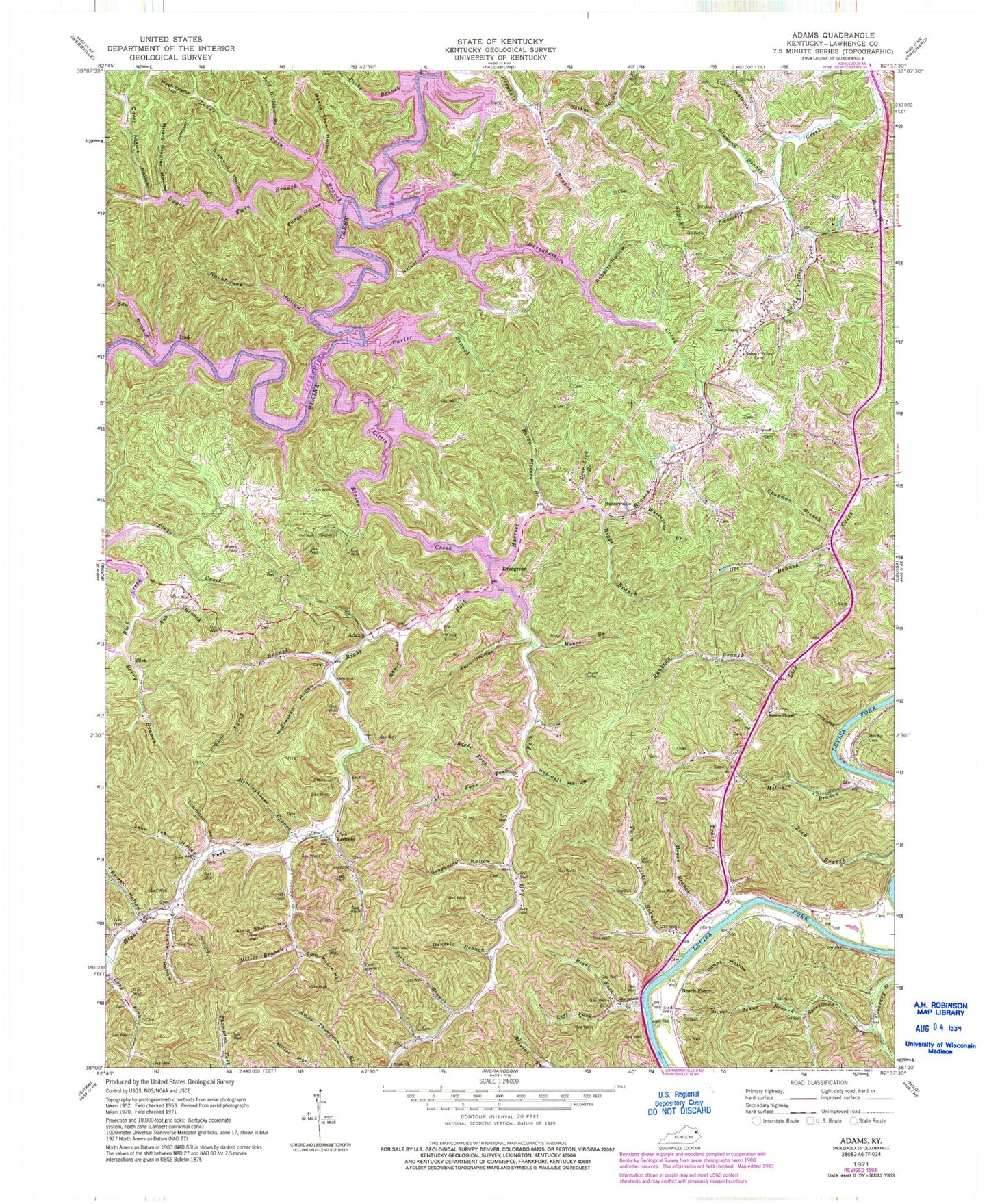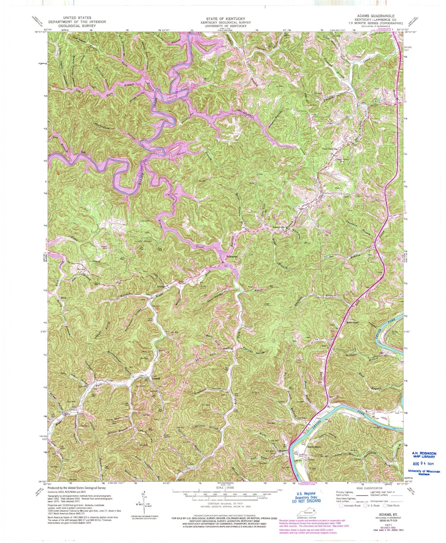
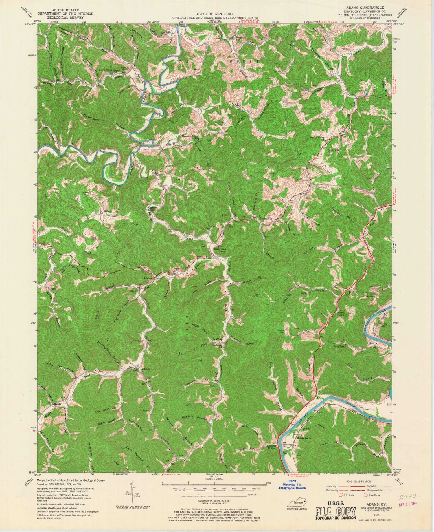
MyTopo
Classic USGS Adams Kentucky 7.5'x7.5' Topo Map
Couldn't load pickup availability
Historical USGS topographic quad map of Adams in the state of Kentucky. Typical map scale is 1:24,000, but may vary for certain years, if available. Print size: 24" x 27"
This quadrangle is in the following counties: Lawrence.
The map contains contour lines, roads, rivers, towns, and lakes. Printed on high-quality waterproof paper with UV fade-resistant inks, and shipped rolled.
Contains the following named places: Aaron Branch, Alvie Short Hollow, Ash Branch, Barker Hollow, Beech Farm, Beech Hollow, Berry Branch, Biggs Branch, Board Tree Hollow, Carter Branch, Carters Chapel, Chapman Branch, Cover Adams Hollow, Daniels Branch, Deer Lick Branch, Diamond Branch, Diamond Hollow, Dicky Branch, Fern Hollow, Fudge Hollow, Grapevine Hollow, Greenbrier Creek, Hardin Cemetery, Harriet Branch, Horse Picture Branch, House Branch, Hugh Sparks Hollow, Hutchison Cemetery, Jeff Gilliam Branch, John Tee Hollow, Johns Branch, Johns Hollow, Kaiser Hollow, Ledocio, Left Fork Little Blaine Creek, Left Fork Shannon Branch, Left Fork Trap Branch, Little Blaine Creek, Long Branch, Lower Twin Branch, Luke Watkins Hollow, Mattie Church, McClure Branch, McCracken Hollow, Meetinghouse Branch, Midway Church, Milard Bradley Hollow, Miller Branch, Moore Branch, Moore Cemetery, Moore Cemetery, Moores Chapel, Nelson Hollow, Newcombe Hollow, Noris Church, Prince Cemetery, Rhubens Branch, Right Fork Little Blaine Creek, Right Fork Shannon Branch, Right Fork Trap Branch, Roberts Hollow, Robinett Hollow, Rockhouse Hollow, San Branch, See Branch, Shannon Branch, Smoky Valley Cemetery, Smoky Valley Church, Smoky Valley Fork, Spencer Branch, Spicewood Fork, Thompson Hollow, Tom Moore Hollow, Trace Branch, Trace Branch, Trap Branch, Twin Bottom Branch, Upper Twin Branch, Whetstone Branch, Adams, Busseyville, Ellen, Evergreen, Irad, Lawrence County, Lower Twin Branch School (historical), WSAC-FM (Louisa), Deephole (historical), Webbs Mill (historical), Adams Post Office (historical), Busseyville Post Office (historical), Irad Post Office (historical), Ivory Post Office (historical), Ledocio Post Office (historical), Alley Cemetery, Carter Covered Bridge (historical), Adkins Cemetery, Busseyville United Methodist Church Cemetery, Shannon Cemetery, Yatesville Memorial Gardens, Busseyville United Methodist Church (historical), Dry Ridge Church (historical), Evergreen Methodist Church, Barker Boat Ramp, Jordans Mill (historical), Pleasant Ridge Recreational Area, Prince's Mill (historical), Ellen Post Office (historical), Pleasant Ridge, Adams School (historical), Blackburn School (historical), Busseyville School (historical), Dry Ridge School (historical), Evergreen School (historical), Ledocio Public Bee Hive School (historical), Pleasant Ridge School (historical), Yatesville Lake State Park, Yatesville Lake