MyTopo
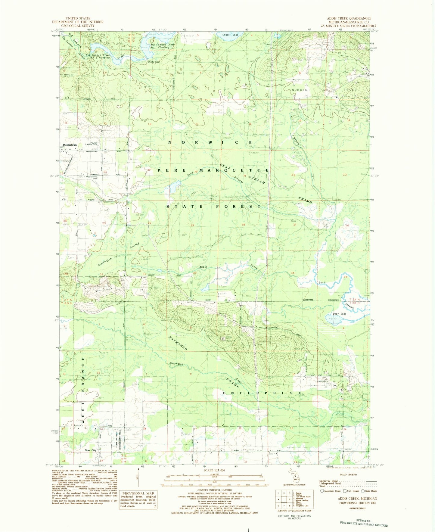
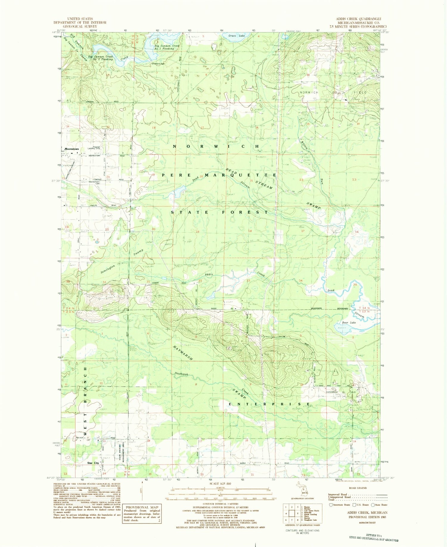
Classic USGS Addis Creek Michigan 7.5'x7.5' Topo Map
Couldn't load pickup availability
Historical USGS topographic quad map of Addis Creek in the state of Michigan. Typical map scale is 1:24,000, but may vary for certain years, if available. Print size: 24" x 27"
This quadrangle is in the following counties: Missaukee.
The map contains contour lines, roads, rivers, towns, and lakes. Printed on high-quality waterproof paper with UV fade-resistant inks, and shipped rolled.
Contains the following named places: Addis Creek, Bear Lake, Dead Stream Swamp, Haymarsh Swamp, Moorestown Cemetery, Remington Swamp, Willow Run, Big Cannon Creek Swamp, Enterprise Oil Field, Norwich Oil Field, Moorestown Airpark, Township of Enterprise, Township of Norwich, Big Cannon Creek Number One Flooding, Stratford Dam, Big Cannon Creek Number Two Flooding, Pownell Landing Strip (historical)