MyTopo
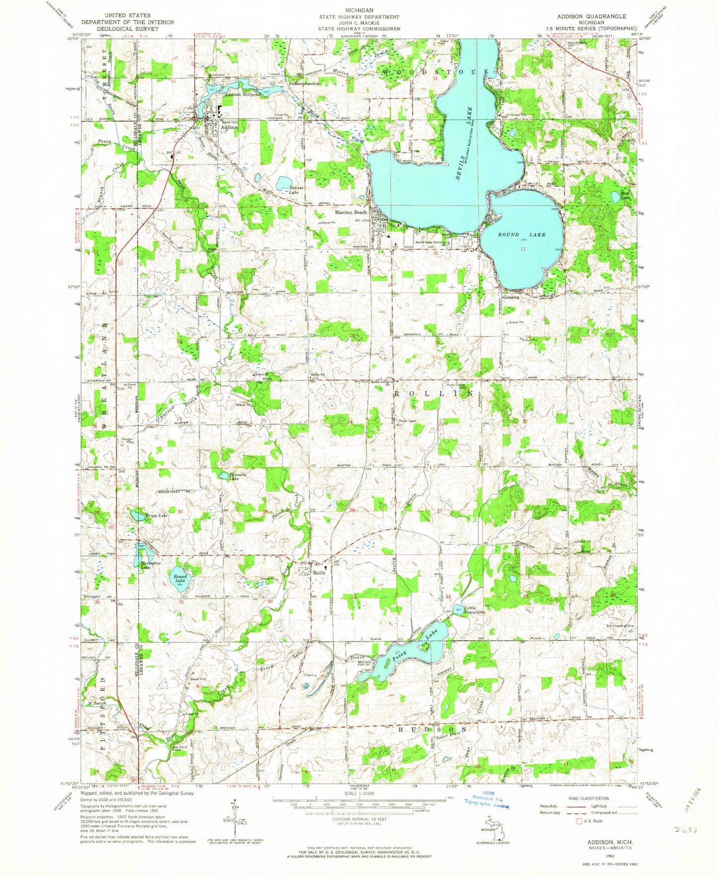
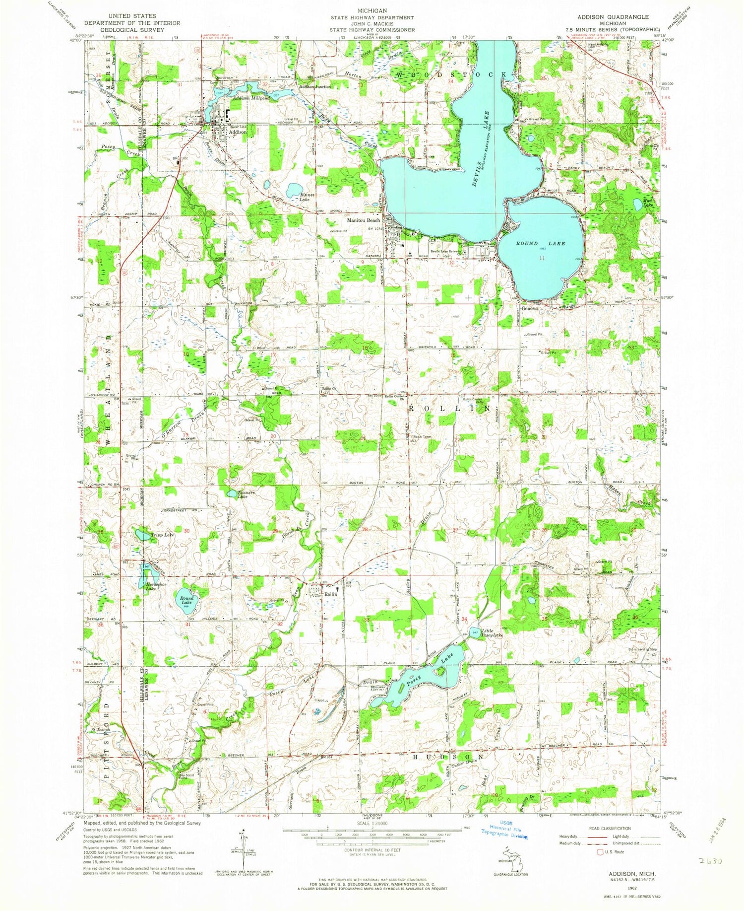
Classic USGS Addison Michigan 7.5'x7.5' Topo Map
Couldn't load pickup availability
Historical USGS topographic quad map of Addison in the state of Michigan. Map scale may vary for some years, but is generally around 1:24,000. Print size is approximately 24" x 27"
This quadrangle is in the following counties: Hillsdale, Lenawee.
The map contains contour lines, roads, rivers, towns, and lakes. Printed on high-quality waterproof paper with UV fade-resistant inks, and shipped rolled.
Contains the following named places: Addison, Addison Community Schools, Addison Fire Department, Addison Fire Department Station 3, Addison Junction, Addison Methodist Church, Addison Millpond, Addison Post Office, Addison Public Library, Binnes Lake, Bowen Drain, Branch Creek, Brownell-Binns Cemetery, Devils Lake, Devils Lake Drive-in Church, Devil's Lake Estates, Fisk Drain, Fitts Cemetery, Friends Cemetery, Geneva, Geneva Post Office, Greens Lakeside Cemetery, Hand Hillside Cemetery, Hillside Cemetery, Horseshoe Lake, Jack Tibbs Park, Jehovah's Witnesses, Kempton Drain, Ketcham Drain, Little Posey Lake, Lutheran Church of the Lakes, Manitou Beach, Manitou Beach Post Office, Manitou Beach Station, Manitou Beach-Devils Lake Census Designated Place, Manitou Road Baptist Church, Morehouse Grave, Mud Lake, O'Harrow Drain, Patrick Drain, Posey Creek, Posey Lake, Posey Lake Drain, Quaker Cemetery, Quaker Post Office, Rollin, Rollin Center Cemetery, Rollin Center Church, Rollin Church, Rollin Post Office, Rollin Township Hall, Rollin Village Cemetery, Round Lake, Round Lake Estates, Saint Joseph Creek, Saint Mary on the Lake Catholic Church, Seeley Drain, Sherman Farm Cemetery, Tanners Lake, Townley Post Office, Townley Station, Township of Rollin, Tripp Lake, Tucker Drain, Village of Addison, ZIP Codes: 49220, 49253