
MyTopo
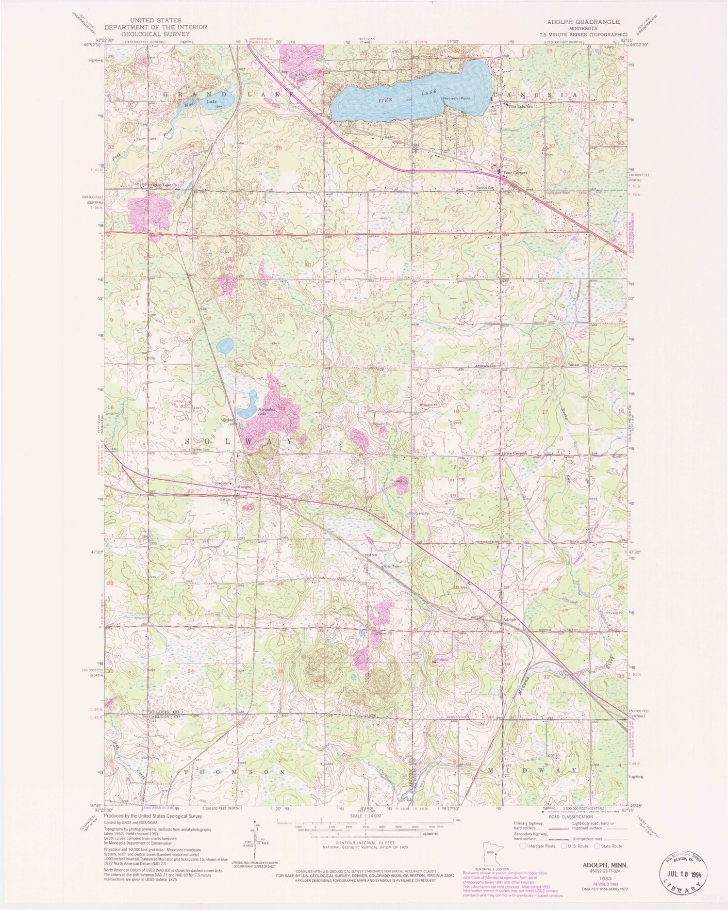
Classic USGS Adolph Minnesota 7.5'x7.5' Topo Map
Couldn't load pickup availability
Historical USGS topographic quad map of Adolph in the state of Minnesota. Map scale may vary for some years, but is generally around 1:24,000. Print size is approximately 24" x 27"
This quadrangle is in the following counties: Carlton, St. Louis.
The map contains contour lines, roads, rivers, towns, and lakes. Printed on high-quality waterproof paper with UV fade-resistant inks, and shipped rolled.
Contains the following named places: Adolph, Adolph Post Office, Adolph Station, Canosia Cemetery, Canosia Post Office, Canosia Volunteer Fire Department, Faith Baptist Church, Five Corners, Four Corners, God's Country Church of Munger, Grace Lutheran Church, Grand Lake Church, Hermantown Volunteer Fire Department Station 3, Horseshoe Lake, Lennartson Airport, Mud Lake, Munger, Munger Post Office, Munger Station, Ne-i-ash-i Point, Pike Lake, Pike Lake School, Rocky Run, Saint Raphael's Church, Simar, Solway Cemetery, Solway Township Volunteer Fire Department, Sundby Post Office, Sundby Station, Township of Solway, ZIP Code: 55810


