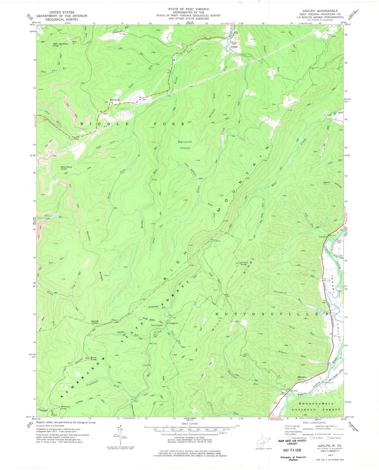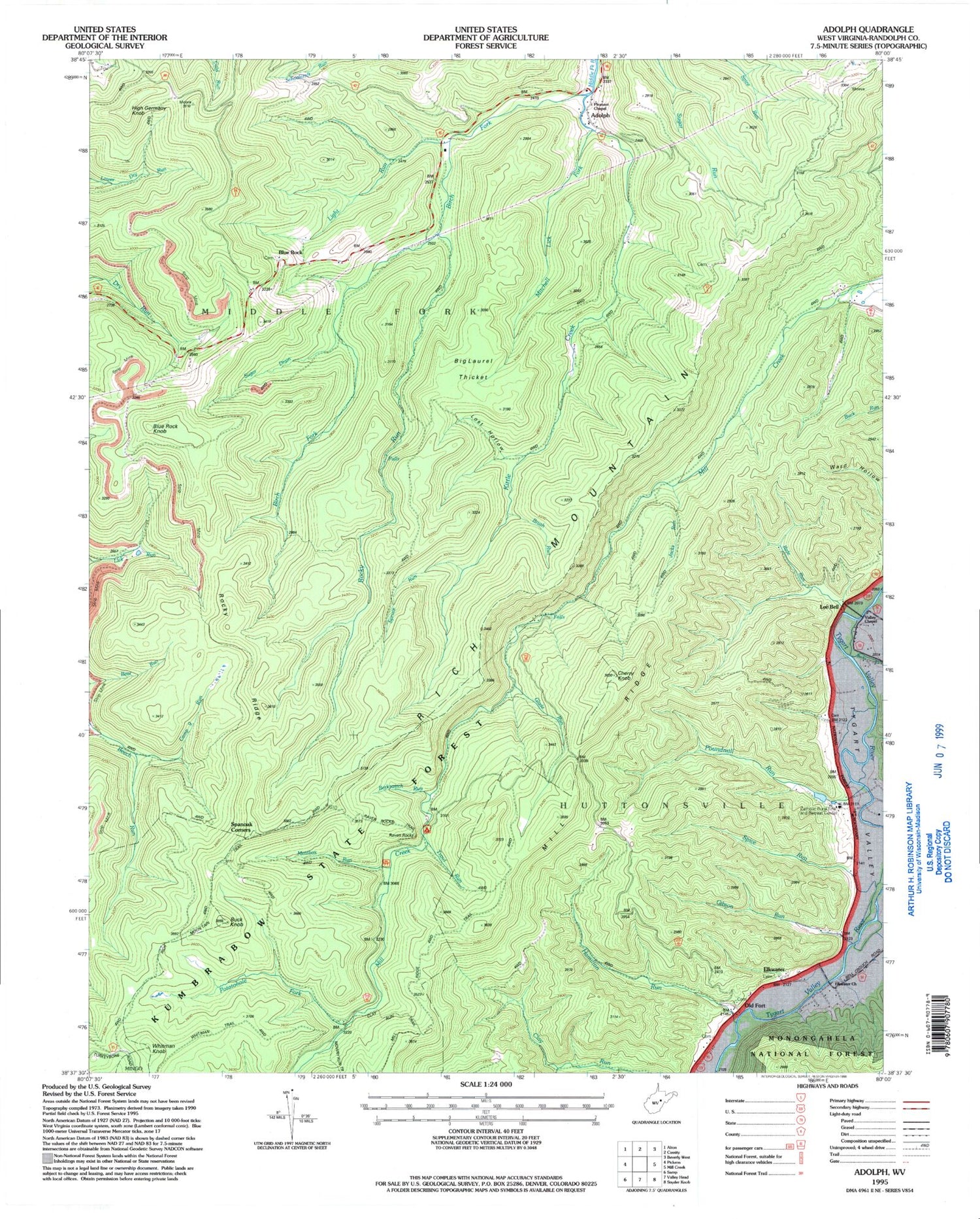
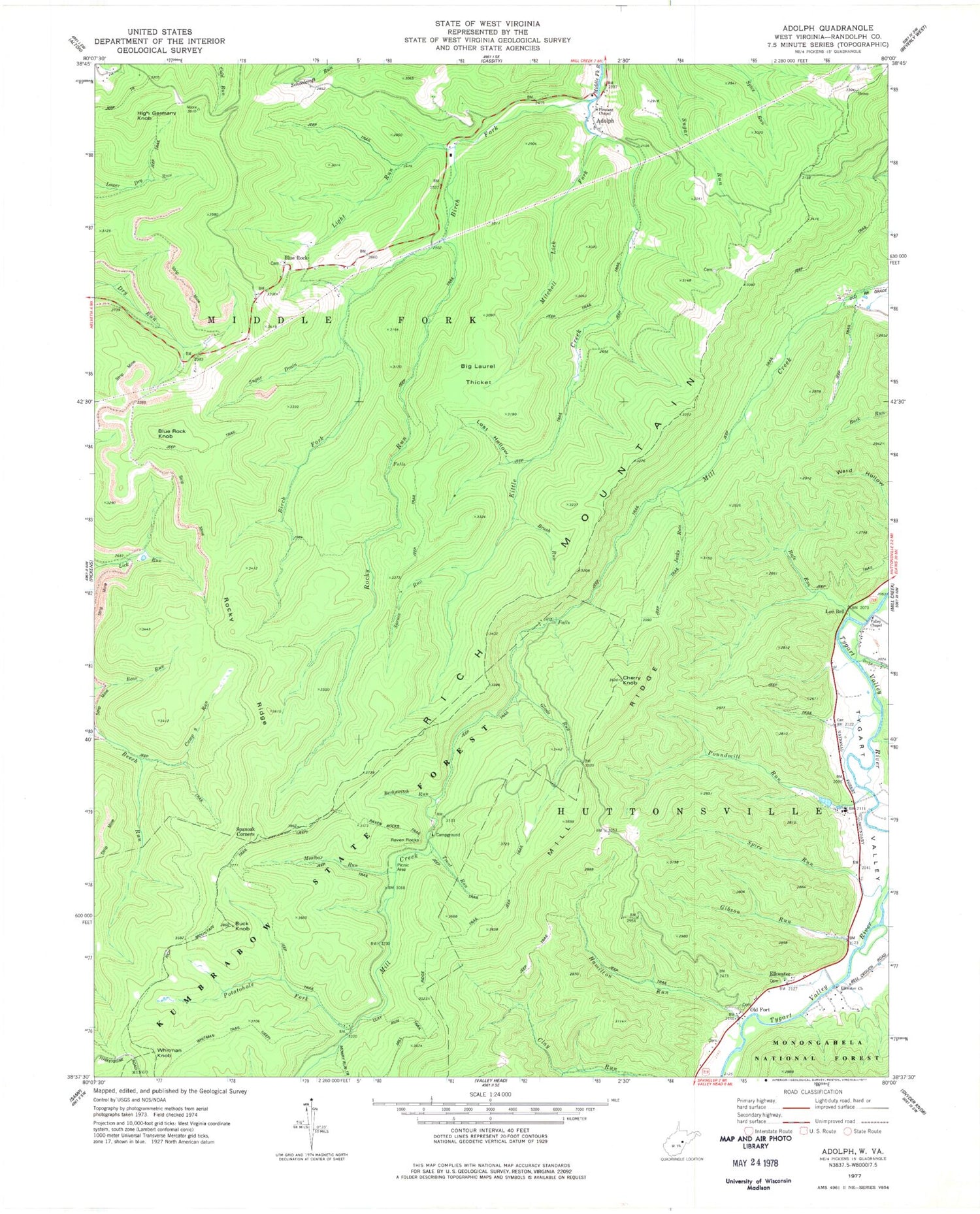
MyTopo
Classic USGS Adolph West Virginia 7.5'x7.5' Topo Map
Couldn't load pickup availability
Historical USGS topographic quad map of Adolph in the state of West Virginia. Typical map scale is 1:24,000, but may vary for certain years, if available. Print size: 24" x 27"
This quadrangle is in the following counties: Randolph, Upshur.
The map contains contour lines, roads, rivers, towns, and lakes. Printed on high-quality waterproof paper with UV fade-resistant inks, and shipped rolled.
Contains the following named places: Becky Creek, Berkswitch Run, Big Laurel Thicket, Birch Fork, Brush Run, Buck Knob, Camp 9 Run, Cherry Knob, Clay Run Trail, Elkwater, Elkwater Church, Gibson Run, Glade Run, Hamilton Run, Jacks Run, Kittle Creek, Kumbrabow State Forest, Lee Bell, Light Run, Lost Hollow, Meatbox Run, Mill Ridge Trail, Mitchell Lick Fork, Mowry Run Trail, Old Fort, Pleasant Chapel, Potatohole Fork, Poundmill Run, Rafe Run, Raven Rocks, Raven Rocks Trail, Rich Mountain, Rich Mountain Trail, Rocky Ridge, Rocky Run, Spanoak Corners, Spice Run, Spruce Run, Sugar Drain, Trout Run, Valley Chapel, Whitman Trail, Catholic Rural Life and Retreat Center, Adolph, Blue Rock, Blue Rock Knob, High Germany Knob, Whitman Knob, Camp Tygart Dam, Kumbrabow Forest Spring, Beech Run (historical), Bennetts Camp (historical), Camp Nine (historical), Middle Fork District