
MyTopo
Classic USGS Agua Caliente Springs California 7.5'x7.5' Topo Map
Couldn't load pickup availability
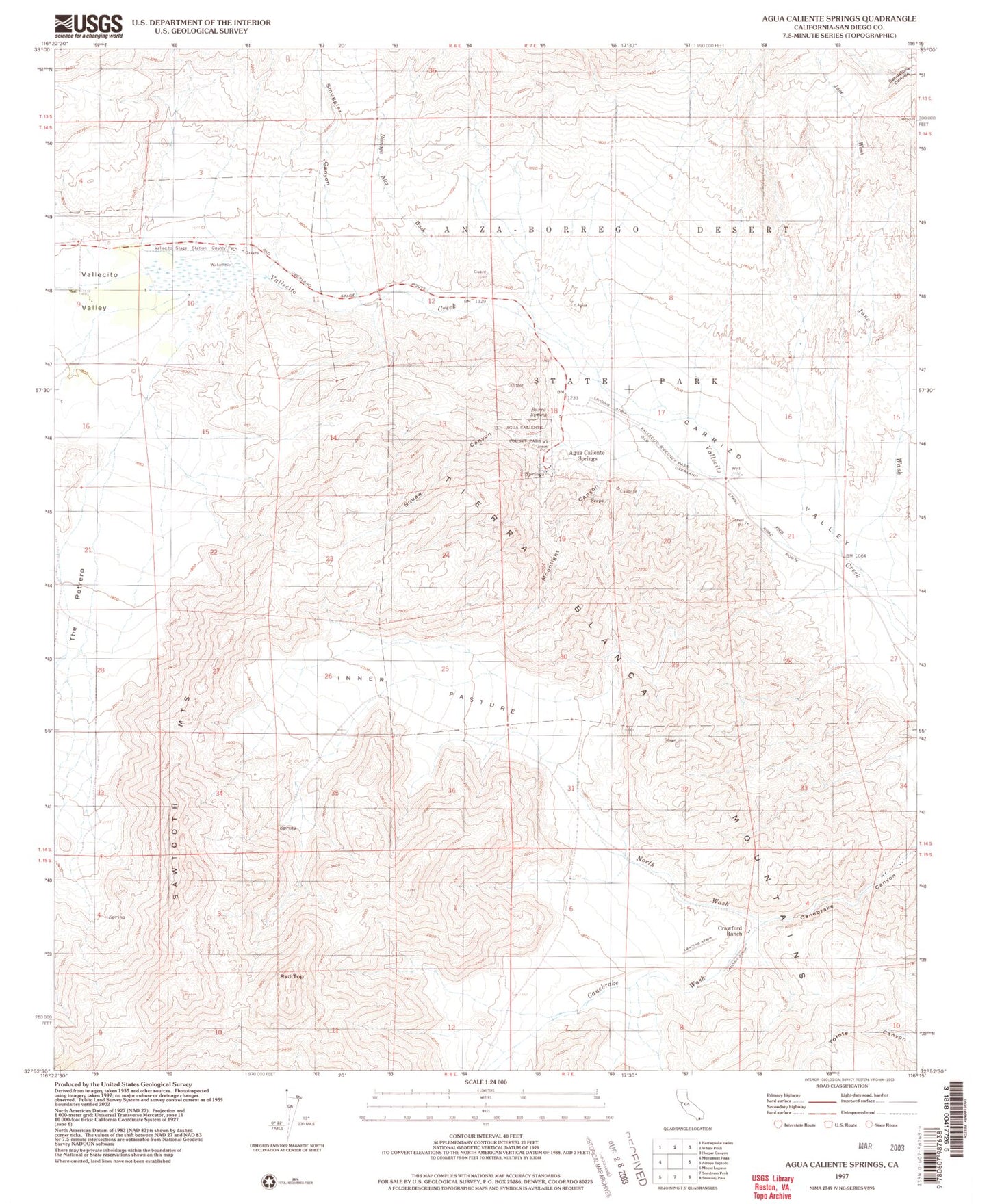
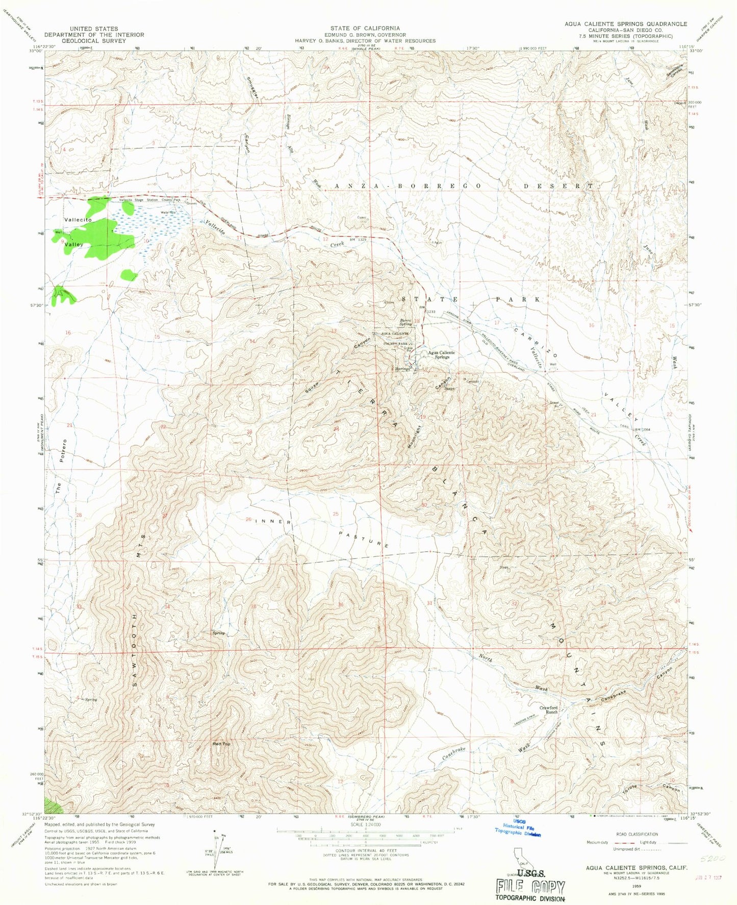
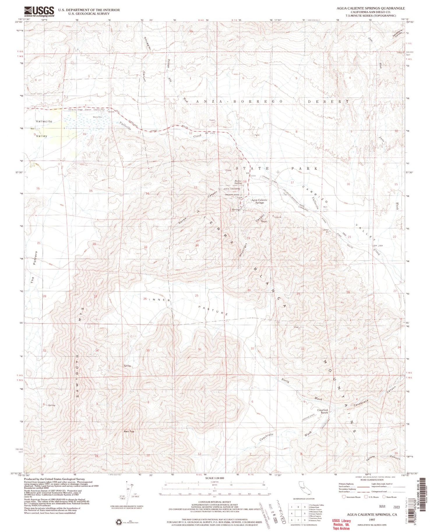
Historical USGS topographic quad map of Agua Caliente Springs in the state of California. Typical map scale is 1:24,000, but may vary for certain years, if available. Print size: 24" x 27"
This quadrangle is in the following counties: San Diego.
The map contains contour lines, roads, rivers, towns, and lakes. Printed on high-quality waterproof paper with UV fade-resistant inks, and shipped rolled.
Contains the following named places: Agua Caliente County Park, Agua Caliente Springs, Bisnaga Alta Wash, Burro Spring, Canebrake Canyon, Crawford Ranch, Inner Pasture, June Wash, Moonlight Canyon, North Wash, Red Top, Sawtooth Mountains, Smuggler Canyon, Squaw Canyon, Vallecito Stage Station County Park, Vallecito Valley, Agua Caliente Springs Airport, Sawtooth Mountains Wilderness, Ironwood Wash, Ironwood Canyon, East Fork Ironwood Wash, East Fork Ironwood Canyon, Vallecito Stage Station Cemetery