MyTopo
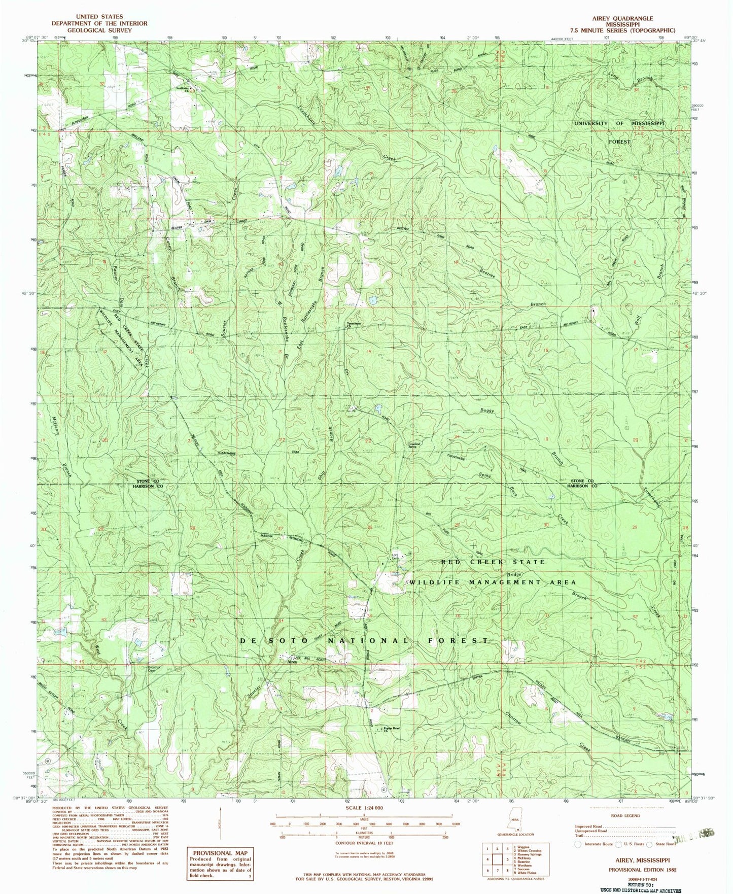
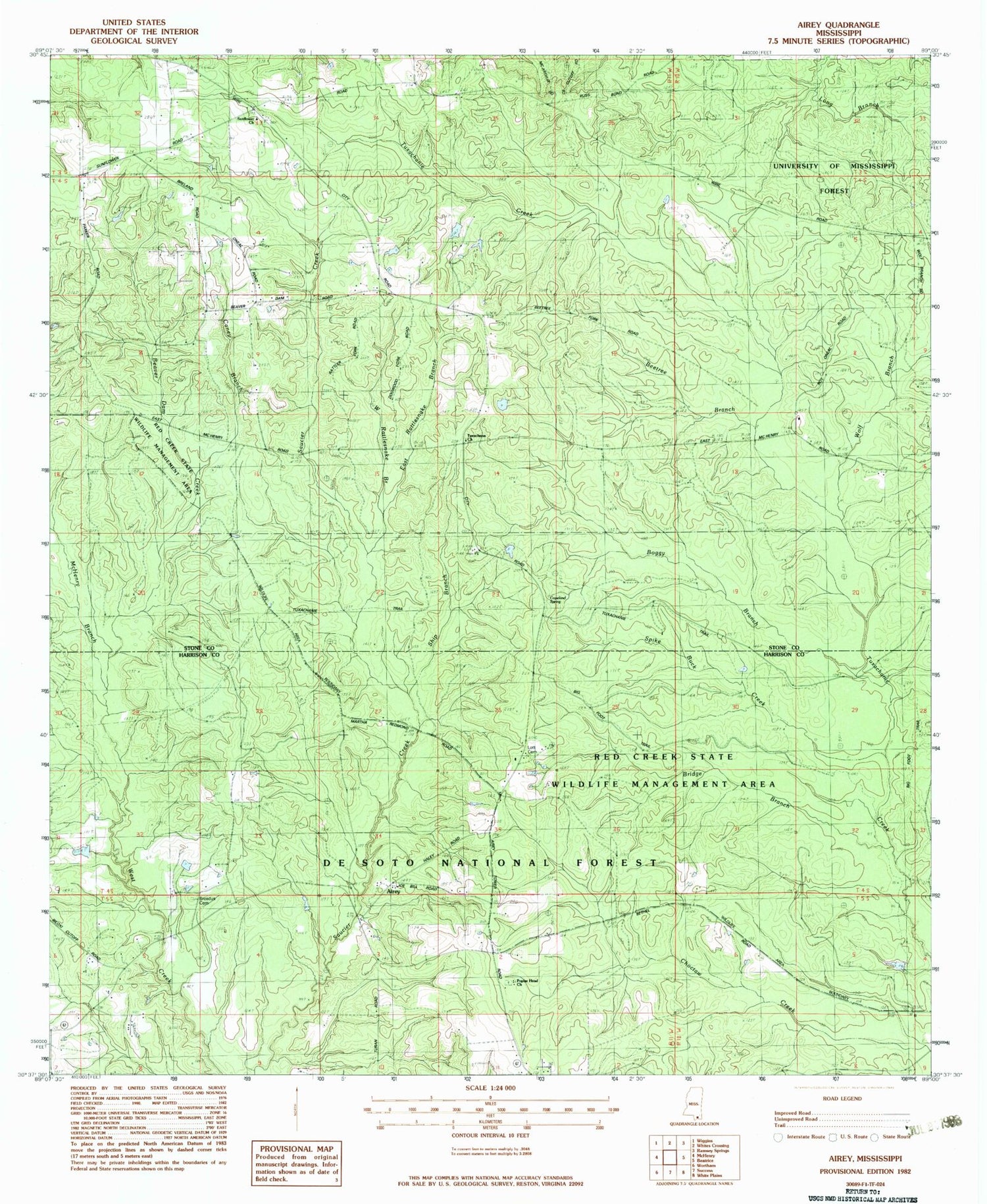
Classic USGS Airey Mississippi 7.5'x7.5' Topo Map
Couldn't load pickup availability
Historical USGS topographic quad map of Airey in the state of Mississippi. Typical map scale is 1:24,000, but may vary for certain years, if available. Print size: 24" x 27"
This quadrangle is in the following counties: Harrison, Stone.
The map contains contour lines, roads, rivers, towns, and lakes. Printed on high-quality waterproof paper with UV fade-resistant inks, and shipped rolled.
Contains the following named places: Airey, Beaver Dam Creek, Beetree Branch, Boggy Branch, Bridge Branch, Broadus Cemetery, Caney Branch, McHenry Branch, Poplar Head Church, East Rattlesnake Branch, Ship Branch, Spike Buck Creek, Sunflower Landmark Missionary Baptist Church, West Rattlesnake Branch, Wolf Branch, WLOX-TV (Biloxi), Broadus Lake Dam, Edwards Lake Dam, Copeland Spring, Big Foot Trail, Lott Cemetery, Tuxachanie Trail, Bigfork Trail Riders Campground, Airey Work Center, Experiment Forest Headquarters, Tuxechena Church, Harrison Experimental Forest, Tuxachena (historical), Pow Camp Recreation Area, Airey Lookout Tower, Airey Lake Recreation Area, Bigfoot Trail Camp Recreation Area, Supervisor District 4, McHenry Volunteer Fire Department Sunflower Substation