MyTopo
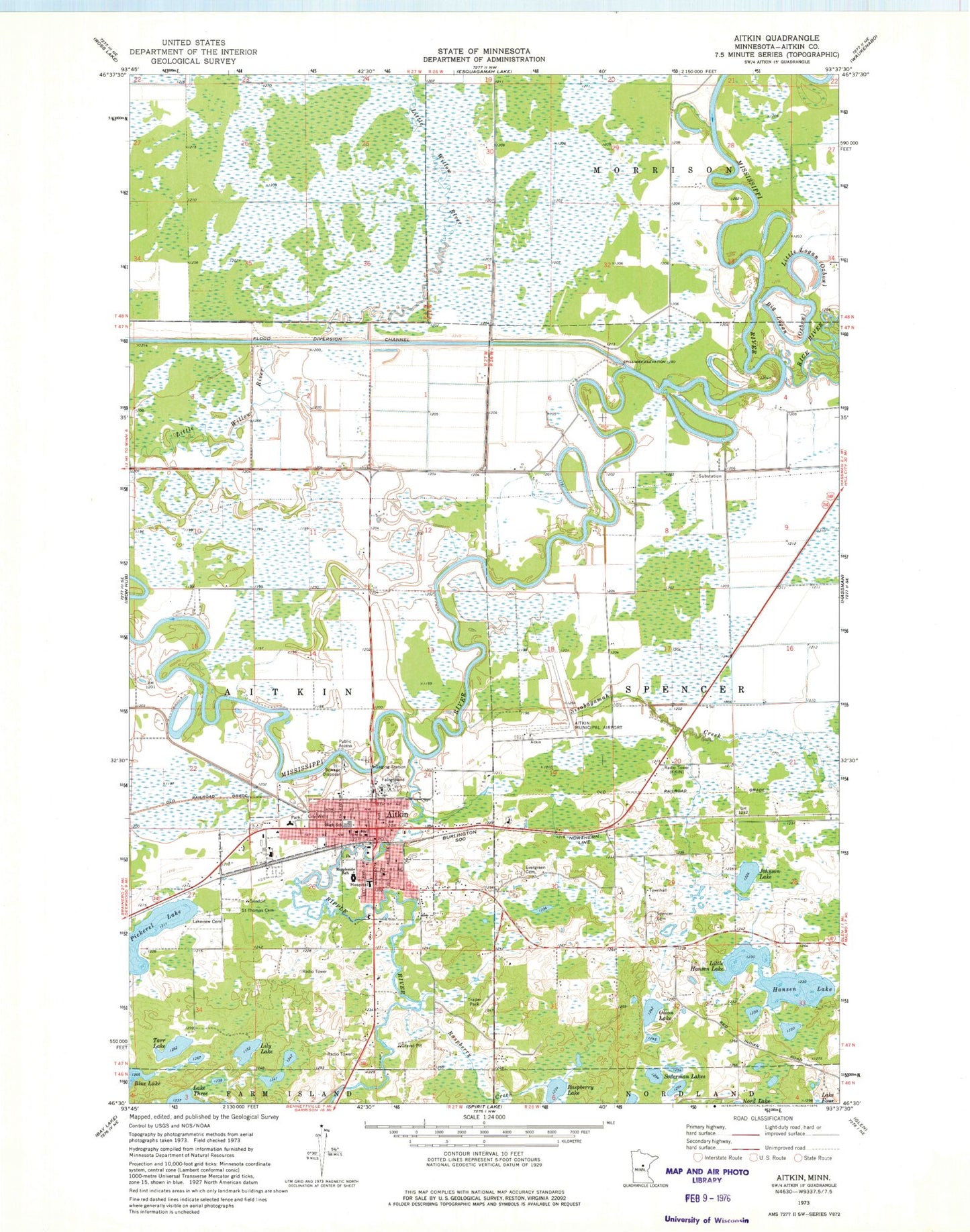
Classic USGS Aitkin Minnesota 7.5'x7.5' Topo Map
Couldn't load pickup availability
Historical USGS topographic quad map of Aitkin in the state of Minnesota. Map scale may vary for some years, but is generally around 1:24,000. Print size is approximately 24" x 27"
This quadrangle is in the following counties: Aitkin.
The map contains contour lines, roads, rivers, towns, and lakes. Printed on high-quality waterproof paper with UV fade-resistant inks, and shipped rolled.
Contains the following named places: Aitkin, Aitkin Campground, Aitkin City Hall, Aitkin City Park, Aitkin Clinic, Aitkin County Courthouse, Aitkin County Fairgrounds, Aitkin County Jail, Aitkin County Sheriff's Office, Aitkin Fire Department, Aitkin Municipal Airport-Steve Kurtz Field, Aitkin Police Department, Aitkin Post Office, Big Logan, City of Aitkin, Depot Museum, Evergreen Cemetery, First Congregational Church, First lutheran Church, Hanson Lake, Johnson Lake, KKIN-AM (Aitkin), Lakeview Cemetery, Lily Lake, Little Hanson Lake, Little Logan, Minnesota Department of Natural Resources Aitkin Area Office, North Memorial Health Ambulance - Brainerd Region, Olson Lake, Pickerel Lake, Raspberry Creek, Raspberry Lake, Rice River, Ripple River, Rippleside School, Riverwood Healthcare Center, Riverwood Healthcare Center - Extended Care, Saint John's Episcopal Church, Saint John's Lutheran Church, Saint Thomas Cemetery, Sisabagamah Creek, Soderman Lakes, Spencer Cemetery, Tarr Lake, United Methodist Church, Welshons Company Mobile Home Park, Westside Church