MyTopo
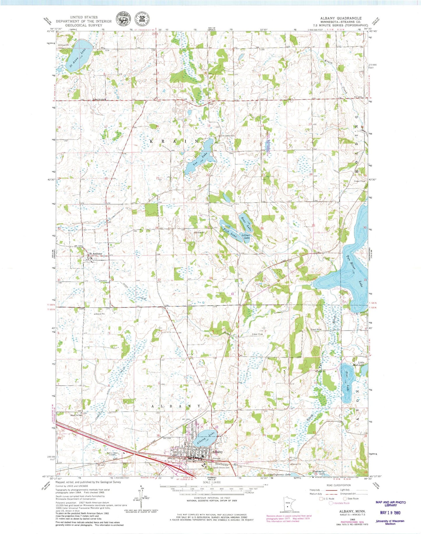
Classic USGS Albany Minnesota 7.5'x7.5' Topo Map
Couldn't load pickup availability
Historical USGS topographic quad map of Albany in the state of Minnesota. Map scale may vary for some years, but is generally around 1:24,000. Print size is approximately 24" x 27"
This quadrangle is in the following counties: Stearns.
The map contains contour lines, roads, rivers, towns, and lakes. Printed on high-quality waterproof paper with UV fade-resistant inks, and shipped rolled.
Contains the following named places: Albany, Albany Area Hospital and Medical Center, Albany Fire Department, Albany Golf Club, Albany Medical Center, Albany Police Department, Albany Post Office, Albany Public Library, Albany Senior High School, Albany Softball Park, Bear Lake, City of Albany, City of Saint Anthony, County Ditch Number Fifteen, County Ditch Number Twentytwo, Ebenezer Cemetery, Fish Lake, Holy Family School, KASM-AM (Albany), Little Mud Lake, Littner Lake, Mother of Mercy Nursing Home, North Lake, Our Saviour's Lutheran Church, Pine Lake, Saint Anna Lake, Saint Anthony, Saint Anthony Church, Saint Anthony Post Office, Saint Johns Cemetery, School Number 2031, School Number 2043, School Number 2077, School Number 2081, Seven Dolors Cemetery, Seven Dolors School, Shamrock Mobile Home Park, Skalicky Airstrip, Township of Krain, Two River Lake, Vos Lake, Warga Dairy Farm, ZIP Code: 56307