MyTopo
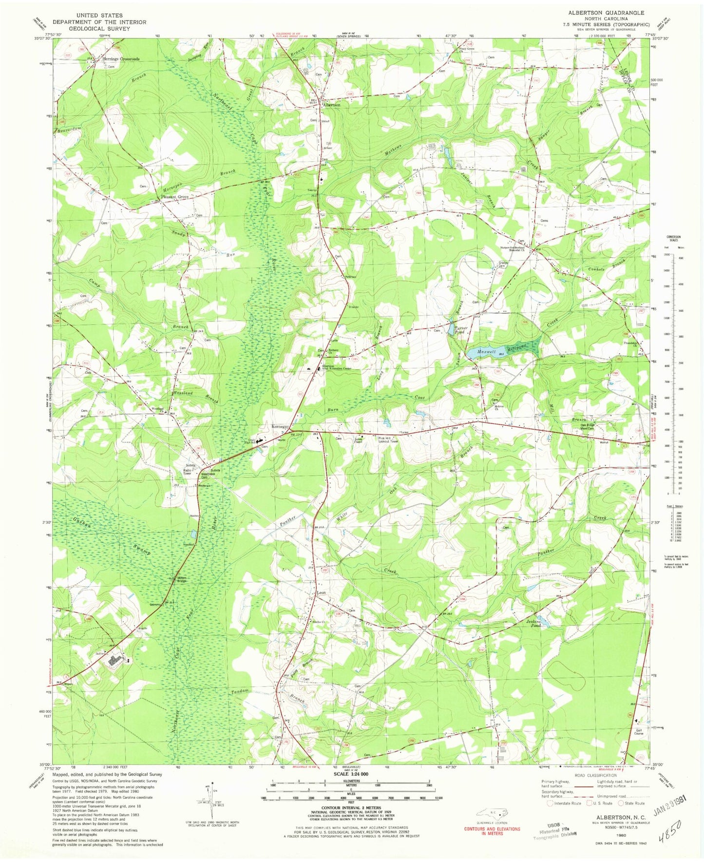
Classic USGS Albertson North Carolina 7.5'x7.5' Topo Map
Couldn't load pickup availability
Historical USGS topographic quad map of Albertson in the state of North Carolina. Map scale may vary for some years, but is generally around 1:24,000. Print size is approximately 24" x 27"
This quadrangle is in the following counties: Duplin, Lenoir.
The map contains contour lines, roads, rivers, towns, and lakes. Printed on high-quality waterproof paper with UV fade-resistant inks, and shipped rolled.
Contains the following named places: Albertson, Albertson Adult Education Center, Albertson Post Office, Albertson Volunteer Fire Department, Beaverdam Branch, Bethany Church, Branch School, Burn Coat Creek, Camp Branch, Cowhole Branch, Deavers Chapel, Duplin County Emergency Medical Services Medic 6, Friendship Church, Goshen Swamp, Grady High School, Gradys Cemetery, Great Branch, Harper-Southerland Memorial Church, Hebron Church, Herrings Crossroads, Horsepen Branch, Housland Branch, Jenkins Pond, Jones Chapel, Jumping Run, Juniper Branch, Kornegay, Leon, Long Branch, Mathews Creek, Maxwell Millpond, Mill Branch, Millers Bridge, Oak Ridge Memorial Cemetery, Panther Creek, Piney Grove Church, Pink Hill Lookout Tower, Pleasant Grove, Pleasant Grove Volunteer Fire Department, Poley Branch, Resaca, Salem Chapel, Sandy Run, Sawyer Branch, Smiths Church, Sutton Branch, Tandam Branch, Township of Albertson, Township of Smith, Turner Pond, Westbrook Cemetery, White Oak Branch, Will Taylor Cemetery, Woodland Church, ZIP Code: 28508