
MyTopo
Classic USGS Alcova Wyoming 7.5'x7.5' Topo Map
Couldn't load pickup availability
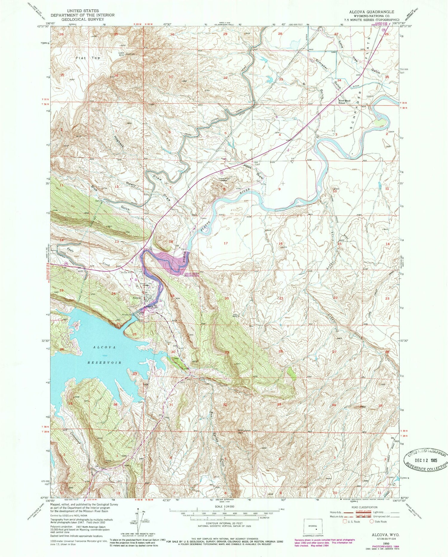
Historical USGS topographic quad map of Alcova in the state of Wyoming. Map scale may vary for some years, but is generally around 1:24,000. Print size is approximately 24" x 27"
This quadrangle is in the following counties: Natrona.
The map contains contour lines, roads, rivers, towns, and lakes. Printed on high-quality waterproof paper with UV fade-resistant inks, and shipped rolled.
Contains the following named places: Alcova, Alcova Area Mine, Alcova Cemetery, Alcova Census Designated Place, Alcova Dam, Alcova Hot Springs, Alcova Po, Alcova Post Office, Alcova Reservoir, Alcova School, Bear Spring Creek, Blue Gulch, Cottonwood Creek, Eagle Creek, Flat Top, Gray Reef Dam, Gray Reef Reservoir, H C Dam, H C Reservoir, Hogback Draw, Ledge Creek, Lone Tree Gulch, Mowry Draw, Old Alcova Cemetery, Petes Draw, River Bend School, Rollins Dam, Rollins Reservoir, S Gulch, Schrader Flats, Schrader Gulch, Tunnel Number 2


