MyTopo
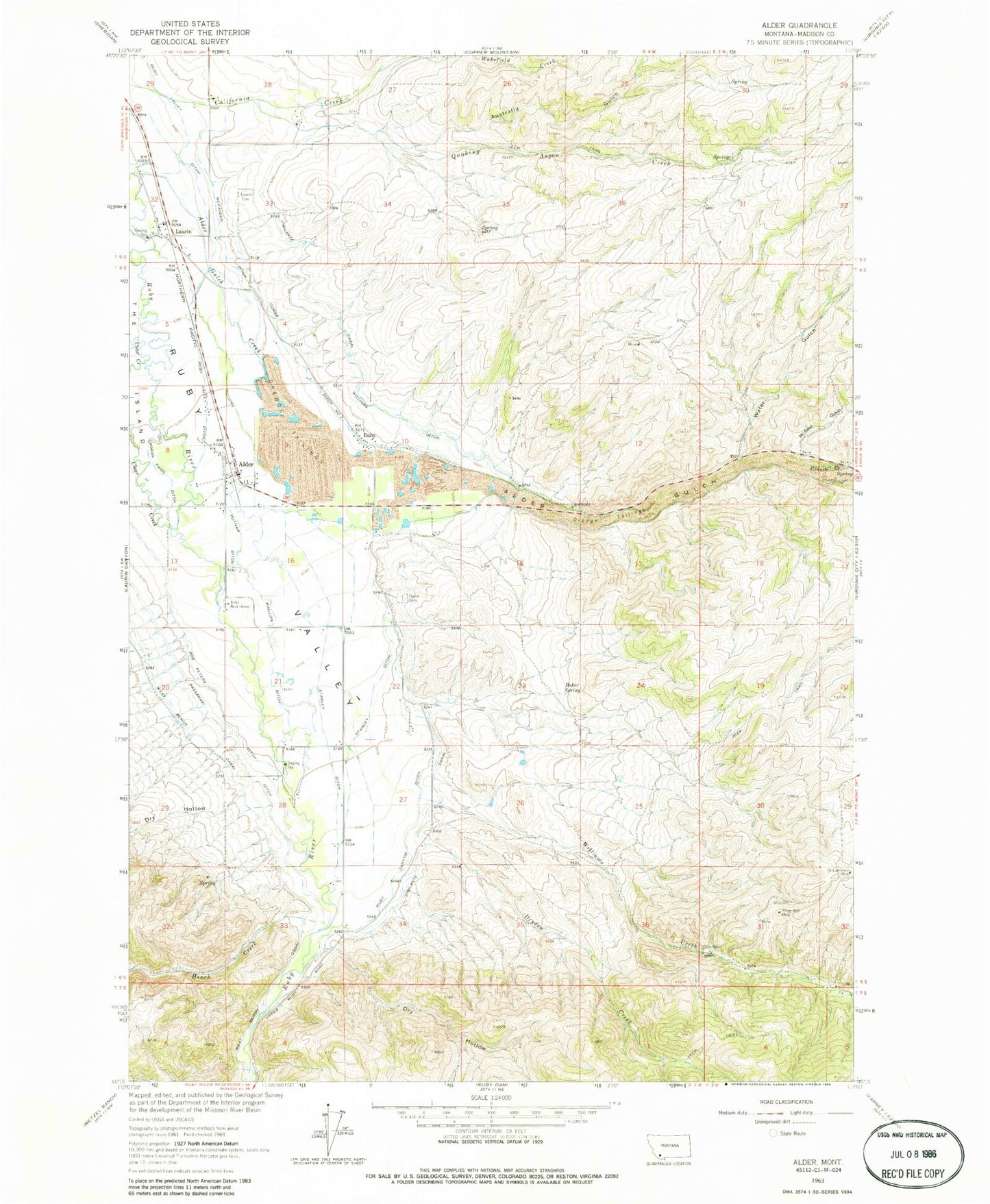
Classic USGS Alder Montana 7.5'x7.5' Topo Map
Couldn't load pickup availability
Historical USGS topographic quad map of Alder in the state of Montana. Map scale may vary for some years, but is generally around 1:24,000. Print size is approximately 24" x 27"
This quadrangle is in the following counties: Madison.
The map contains contour lines, roads, rivers, towns, and lakes. Printed on high-quality waterproof paper with UV fade-resistant inks, and shipped rolled.
Contains the following named places: 05S04W28DDBB01 Well, 06S04W05AACB01 Well, 06S04W10CDCC01 Well, 06S04W15CDDC01 Well, 06S04W28ADDD01 Well, 06S04W28BDAA01 Well, Alder, Alder Census Designated Place, Alder Gulch, Alder KOA Kampground, Alder Post Office, Alder Rest Home, Alder Rural Fire District, Alder School, Australia Gulch, Baker Spring, Beatch Canyon, Bob Peters Ditch, California Ranch, Charlie Ray Mine, Combs Ditch Number Two, Cook Mine, DeHorty Flat, Dry Hollow, Dryden Creek, Geel Mine, Golden Overlook Mine, Grace Community Fellowship Church, Granite Creek, Harris Creek, Hinch Creek, Laurin, Laurin Cemetery, Laurin Post Office, Laurin School, McFadden Ditch, McNeal Gulch, Moran Paige Ditch, NE NE Section 32 Mine, NE Section 31 Mine, NE SW Section 1/Cal Creek Mine, Passamari Ditch, Phillips Ditch, Putnam Ditch, Quaking Aspen Creek, Ruby, Ruby Canyon Ditch, Ruby Post Office, Ruby School, Ruby Valley Historical Marker, Saint Lawrence Mine, Saint Mary of the Assumption Parish, SE Section 1/Cal Creek Mine, Silver Bell Mine, Stanley Ditch, SW Section 31 Mine, Taylor Cemetery, Water Gulch, Wilcox Canyon, Williams Creek, Williams Ditch