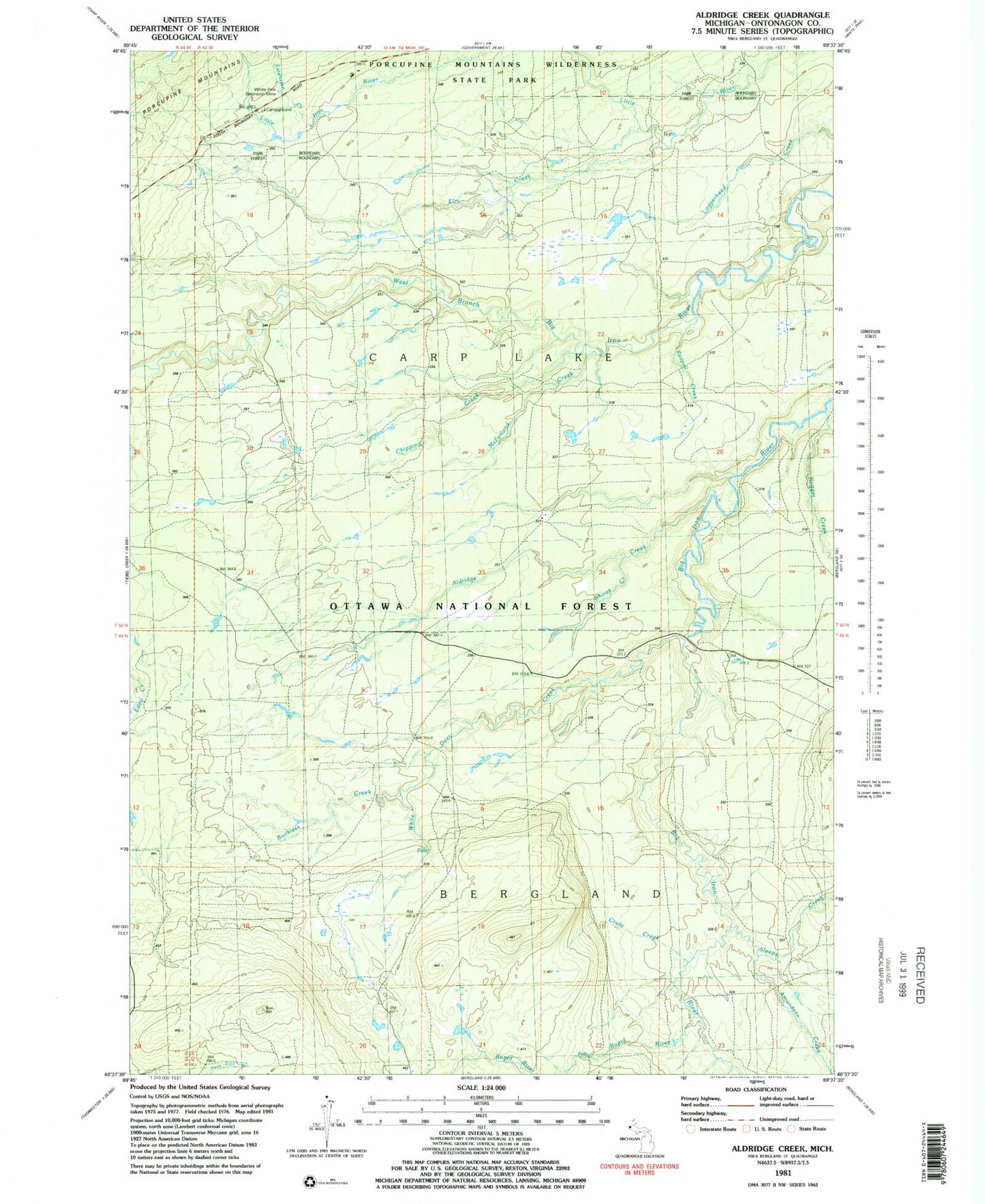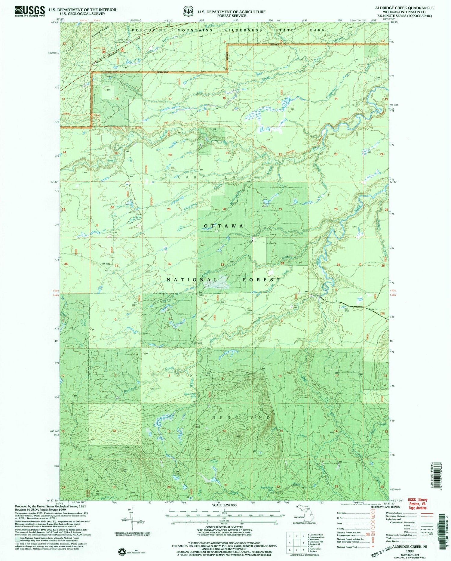
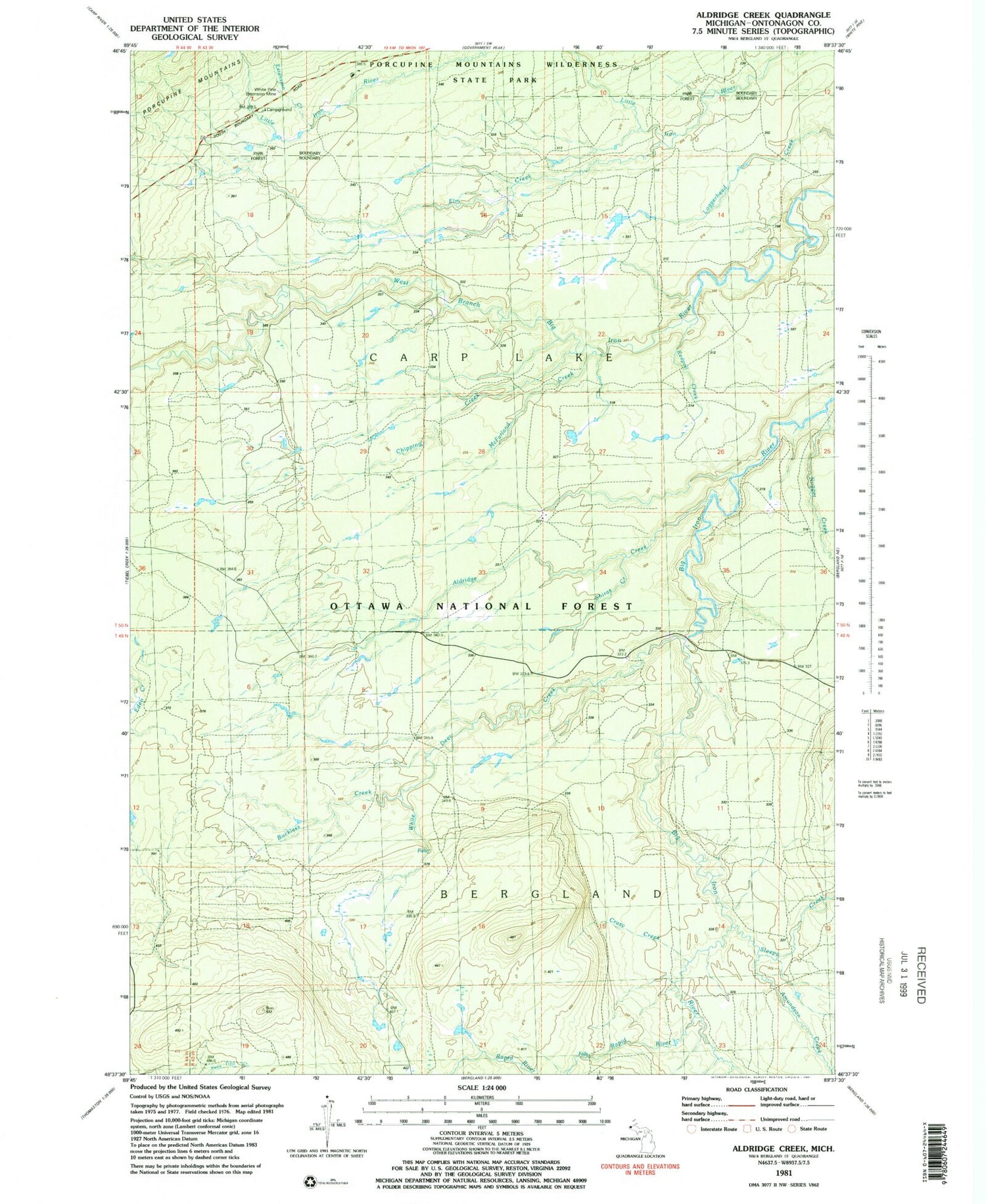
MyTopo
Classic USGS Aldridge Creek Michigan 7.5'x7.5' Topo Map
Couldn't load pickup availability
Historical USGS topographic quad map of Aldridge Creek in the state of Michigan. Typical map scale is 1:24,000, but may vary for certain years, if available. Print size: 24" x 27"
This quadrangle is in the following counties: Ontonagon.
The map contains contour lines, roads, rivers, towns, and lakes. Printed on high-quality waterproof paper with UV fade-resistant inks, and shipped rolled.
Contains the following named places: Aldridge Creek, Chipping Creek, McFarland Creek, Rapid River Falls, Shiras Creek, White Pine Extension Mine, Amundsan Creek, Buckless Creek, Crazy Creek, Elm Creek, Nugget Creek, Rapid River, Redpoll Creek, Sleepy Creek, White Deer Creek, White Pine Camp and Picnic Area, Deer Creek Falls, Extension Creek, Township of Carp Lake