MyTopo
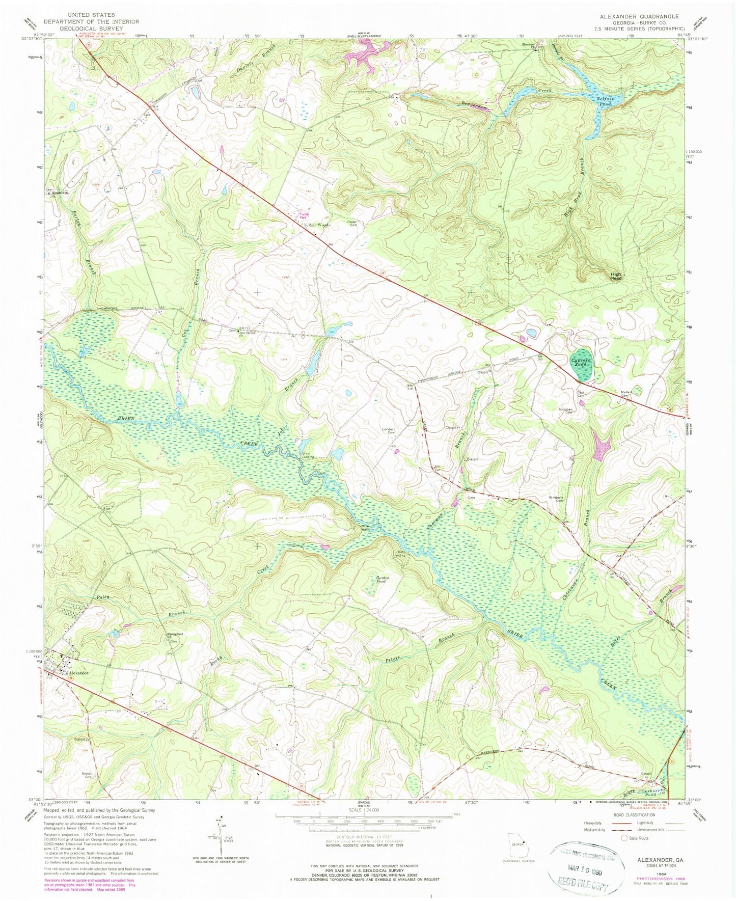
Classic USGS Alexander Georgia 7.5'x7.5' Topo Map
Couldn't load pickup availability
Historical USGS topographic quad map of Alexander in the state of Georgia. Map scale may vary for some years, but is generally around 1:24,000. Print size is approximately 24" x 27"
This quadrangle is in the following counties: Burke.
The map contains contour lines, roads, rivers, towns, and lakes. Printed on high-quality waterproof paper with UV fade-resistant inks, and shipped rolled.
Contains the following named places: Alexander Cemetery, Bargeron School, Barton Branch, Bates Branch, Bells Landing, Bethel Associate Reformed Presbyterian Church, Bethel Cemetery, Boggy Gut, Botsford Cemetery, Botsford Church, Burke County Emergency Management Agency Engine Company 10, Burke County Emergency Management Agency Engine Company 11, Chatman Branch, Chickasaw Branch, Clark Cemetery, Cox Branch, Cushner Pond, Cypress Pond, Daniels Branch, Ebenezer Church, Fenwick Lake, Fenwick Lake Dam, Foster Cemetery, Gordon Pond, Hickman Cemetery, High Head, High Head Branch, Hodgson Institute, Job Spring School, Jobs Branch, Jobs Spring Church, Lambert Cemetery, Little Hell, Mallard Cemetery, Peters Branch, Poley Branch, Rockville School, Rocky Creek, Sims Landing, Springfield Church, Springfield School, Telfair Pond, Telfair Pond Dam, Telfair Woods, Telfairs Mill, Wimberly Cemetery