
MyTopo
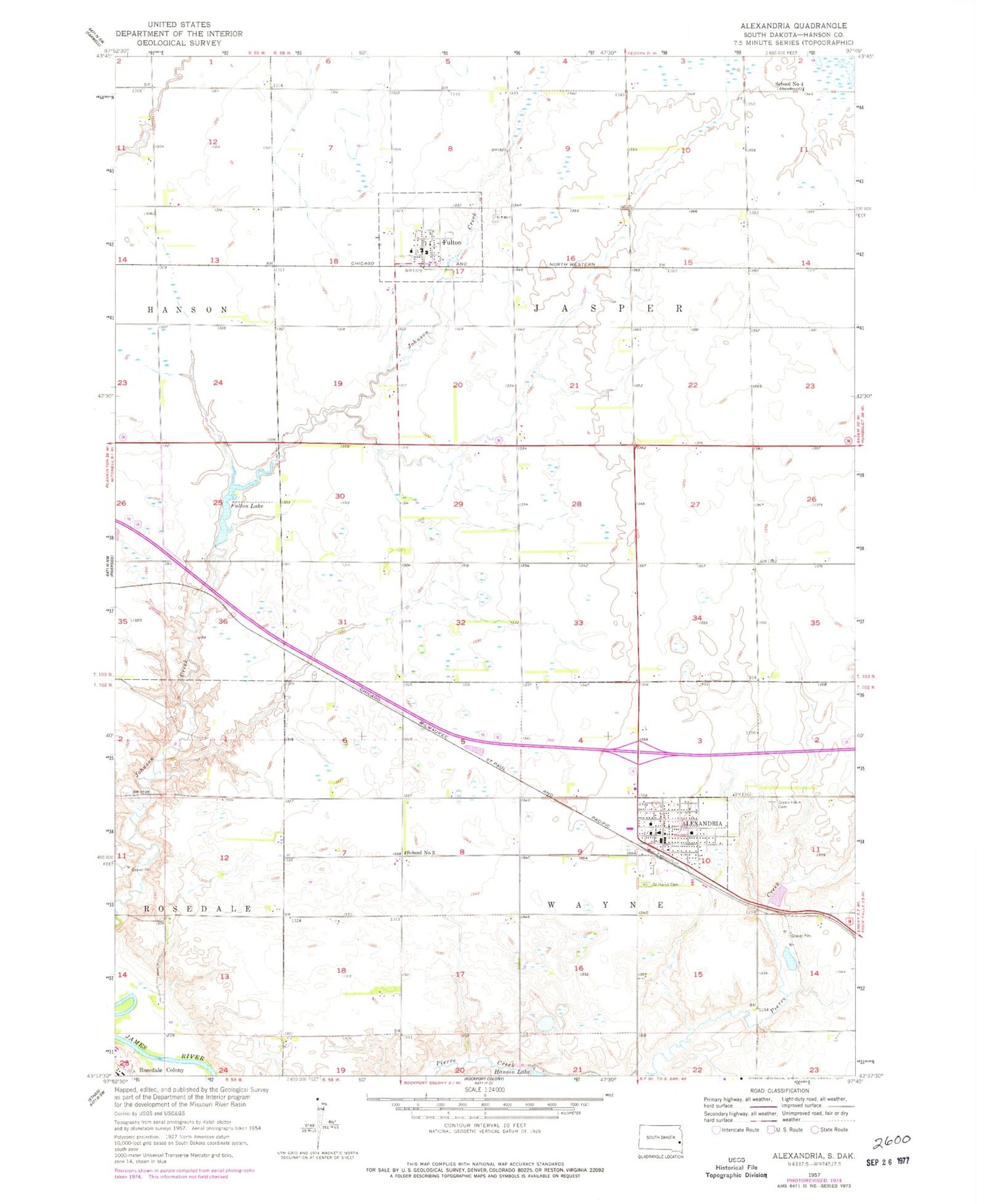
Classic USGS Alexandria South Dakota 7.5'x7.5' Topo Map
Couldn't load pickup availability
Historical USGS topographic quad map of Alexandria in the state of South Dakota. Map scale may vary for some years, but is generally around 1:24,000. Print size is approximately 24" x 27"
This quadrangle is in the following counties: Hanson.
The map contains contour lines, roads, rivers, towns, and lakes. Printed on high-quality waterproof paper with UV fade-resistant inks, and shipped rolled.
Contains the following named places: Alexandria, Alexandria City Hall, Alexandria Fire Department and First Responders, Alexandria Post Office, Alexandria Public Library, City of Alexandria, Fulton, Fulton Dam, Fulton Lake, Fulton Post Office, Graceland Cemetery, Green Hill Cemetery, Hanson County, Hanson County Courthouse, Hanson County Sheriff, Hanson Dam, Hanson Elementary School, Hanson High School, Hanson Middle School, Millbrook Colony, Millbrook Colony Census Designated Place, Millbrook Colony Elementary School, Rosedale Colony, Rosedale Fire Department, Saint Marys Cemetery, School Number 3, School Number 4, Town of Fulton, Township of Jasper, Township of Wayne, ZIP Code: 57311


