MyTopo
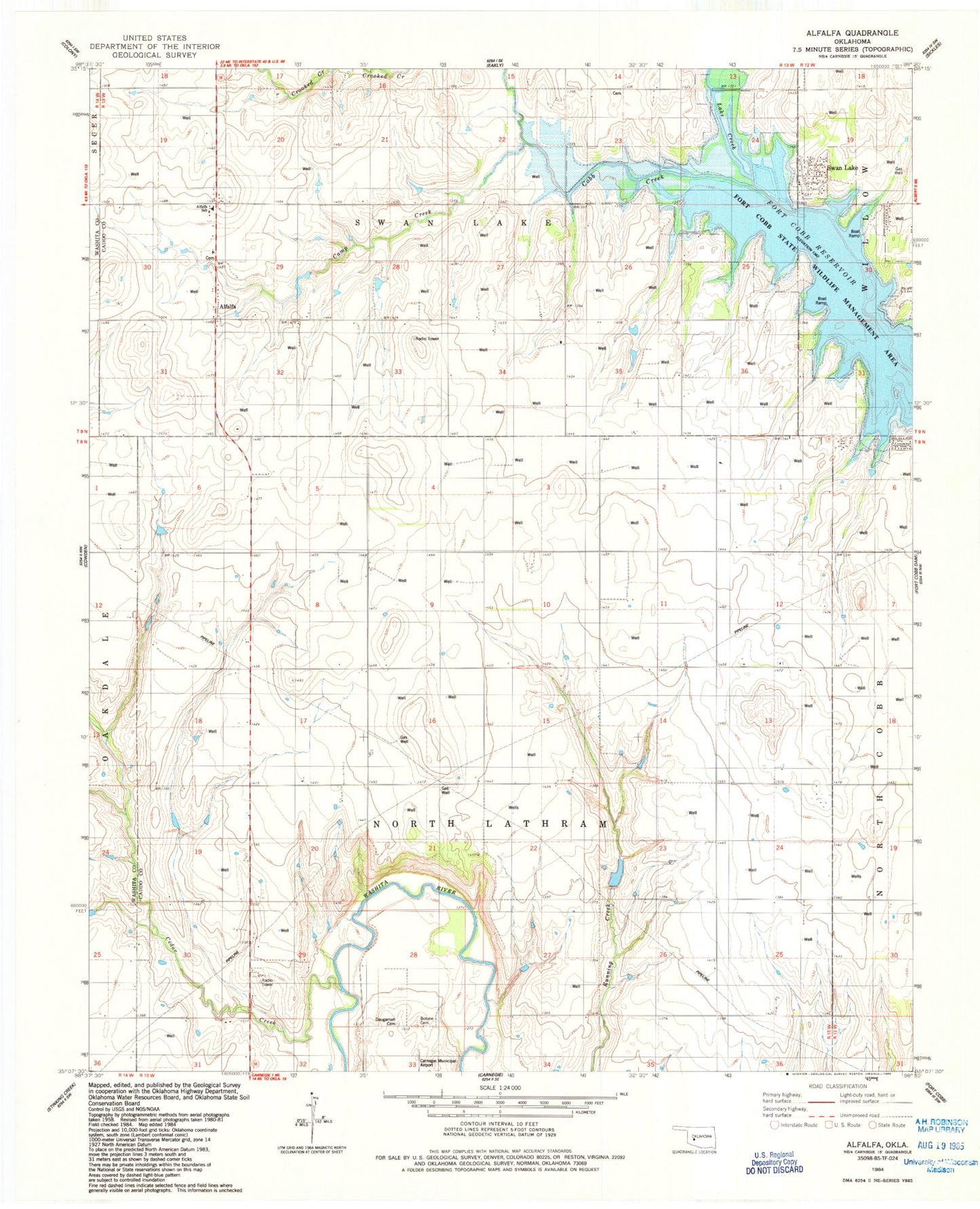
Classic USGS Alfalfa Oklahoma 7.5'x7.5' Topo Map
Couldn't load pickup availability
Historical USGS topographic quad map of Alfalfa in the state of Oklahoma. Map scale may vary for some years, but is generally around 1:24,000. Print size is approximately 24" x 27"
This quadrangle is in the following counties: Caddo, Washita.
The map contains contour lines, roads, rivers, towns, and lakes. Printed on high-quality waterproof paper with UV fade-resistant inks, and shipped rolled.
Contains the following named places: Alfalfa, Alfalfa Cemetery, Alfalfa Rural Volunteer Fire Department, Alfalfa School, Botone Cemetery, Camp Creek, Cedar Creek, Cowden Laterals Site 10 Dam, Cowden Laterals Site 10 Reservoir, Cowden Laterals Site 101 Dam, Cowden Laterals Site 101 Reservoir, Cowden Laterals Site 9 Dam, Cowden Laterals Site 9 Reservoir, Daugamah Cemetery, Fly Inn Number 2 Fire Department, Fort Cobb State Wildlife Management Area, Lake Creek, Oknoname 015004 Dam, Oknoname 015004 Reservoir, Pleasant View Church, Radford Cemetery, Swan Lake, Swan Lake Volunteer Firefighters, Township of North Lathram, Township of Swan Lake