
MyTopo
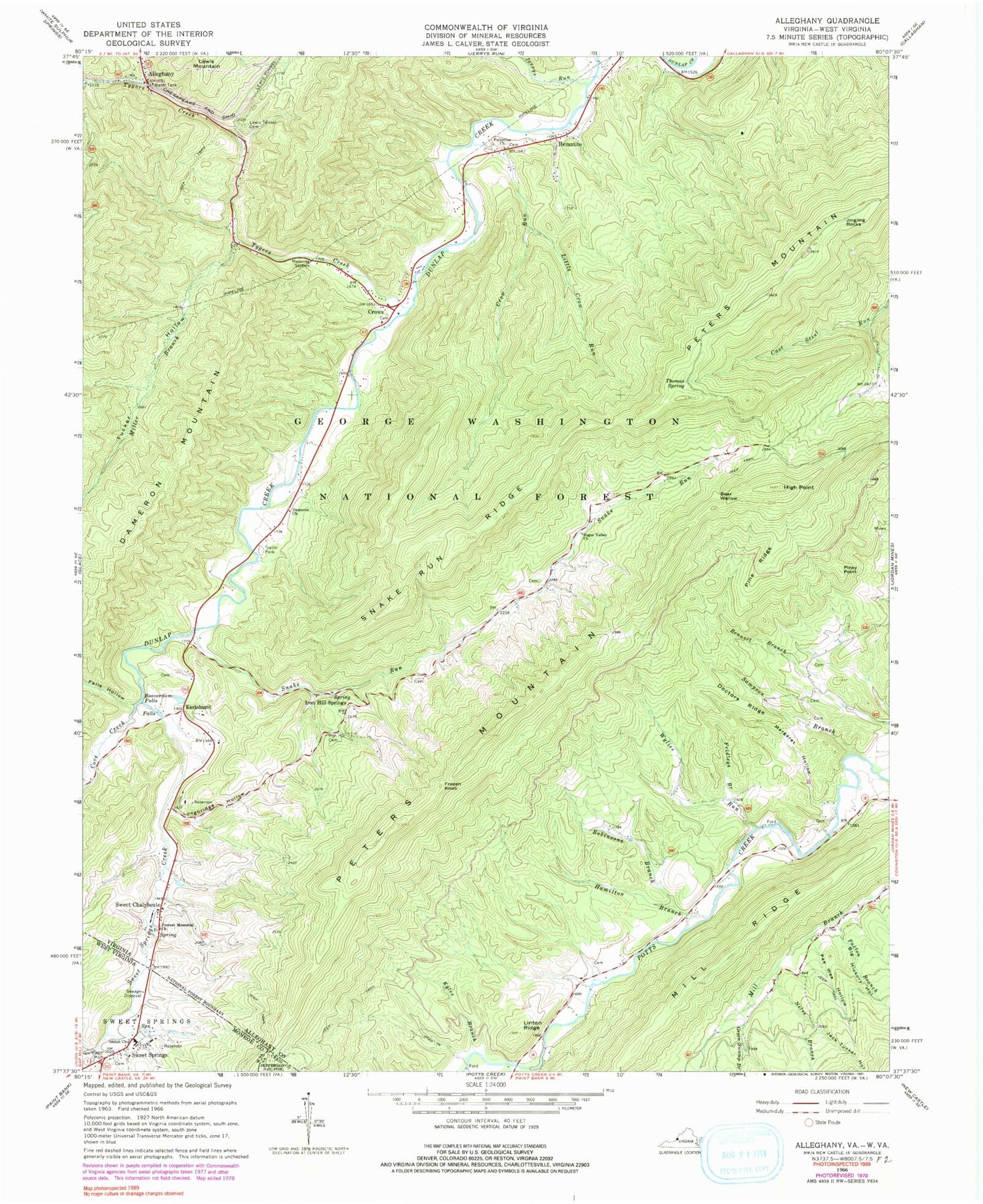
Classic USGS Alleghany Virginia 7.5'x7.5' Topo Map
Couldn't load pickup availability
Historical USGS topographic quad map of Alleghany in the states of Virginia, West Virginia. Map scale may vary for some years, but is generally around 1:24,000. Print size is approximately 24" x 27"
This quadrangle is in the following counties: Alleghany, Craig, Monroe.
The map contains contour lines, roads, rivers, towns, and lakes. Printed on high-quality waterproof paper with UV fade-resistant inks, and shipped rolled.
Contains the following named places: Alleghany, Andrew S Rowan Memorial Home, Bear Wallow, Beaverdam Falls, Bennett Branch, Big Hickory Hollow, Boiling Springs District, Carter Cemetery, Cove Creek, Crow Run, Crows, Dameron Church, Dameron Mountain, Doctors Ridge, Earlehurst, Fall Hollow Branch, Falls Hollow, Forrest Memorial Church, Fridleys Branch, Frozen Knob, Government Floyd Monument, Green Swamp Branch, Hamilton Branch, Hematite, High Point, Iron Hill Church, Iron Hill Springs, Jack Tucker Hollow, Jerrys Run, Jingling Rocks, Kyles Branch, Lewis Tunnel, Lewis Tunnel Cemetery, Linton Ridge, Little Crow Run, Longbridge Hollow, Lynnside Historic District, Lynnside Spring, Margaret Hollow, Mill Ridge, Miller Branch, Nelse Branch, Old Sweet Springs, Palestine Church, Paxton Branch, Pee Wee Hollow, Pine Ridge, Piney Point, Robinson Branch, Rowan Memorial Home Spring, Sampson Branch, Shawvers Run, Shiloh Church, Snake Run, Snake Run Ridge, Sugar Valley Church, Sweet Chalybeate, Sweet Chalybeate Springs, Sweet Spring Creek, Sweet Springs, Sweet Springs Creek, Sweet Springs Mountain, Sweet Springs Post Office, Sweet Springs Valley, Sweet Springs Valley Volunteer Rescue Squad, Thomas Spring, Toms Branch, Tucker Hollow, Tygers Creek, Wylies Run


