MyTopo
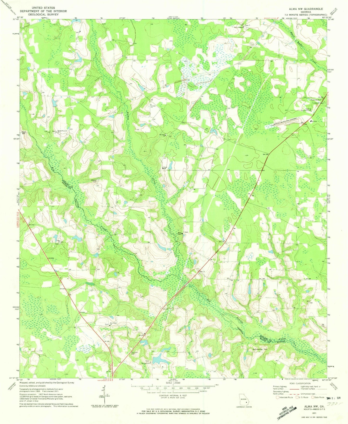
Classic USGS Alma NW Georgia 7.5'x7.5' Topo Map
Couldn't load pickup availability
Historical USGS topographic quad map of Alma NW in the state of Georgia. Map scale may vary for some years, but is generally around 1:24,000. Print size is approximately 24" x 27"
This quadrangle is in the following counties: Appling, Bacon.
The map contains contour lines, roads, rivers, towns, and lakes. Printed on high-quality waterproof paper with UV fade-resistant inks, and shipped rolled.
Contains the following named places: Altman Cemetery, Appling Country Club, Appling County Fire Department County Farm Station, Bar-O-Ranch Lake, Bar-O-Ranch Lake Dam, Baxley Municipal Airport, Bethel Free Will Baptist Church, Big Creek Cemetery, Big Creek Church, Big Satilla Creek Division, Bishop Creek, Bishop Creek Structure Number Six Dam, Bishop Creek Structure Number Six Lake, Corinth Cemetery, Corinth United Methodist Church, Crosby Chapel United Methodist Church, Dyal Elementary School, Harrison Cemetery, Midway Methodist Episcopal Church South, Miles Chapel Cemetery, Miles Chapel Missionary Baptist Church, Mount Olive Baptist Church, New Hope Cemetery, New Hope Church, Sand Hill Creek Freewill Baptist Church, Springfield Cemetery, Springfield Methodist Church, Tanner Lake, Tanner Lake Dam, Unity Cemetery, Unity Church, Warnock Volunteer Fire Station