MyTopo
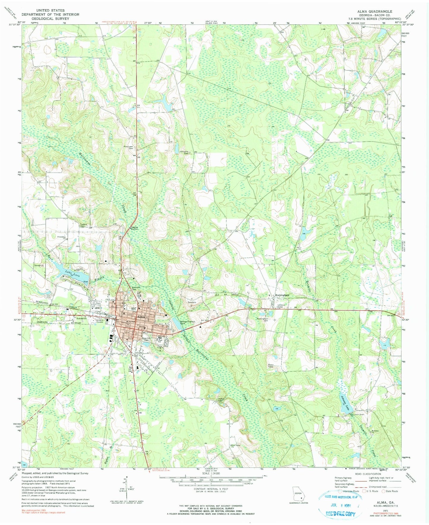
Classic USGS Alma Georgia 7.5'x7.5' Topo Map
Couldn't load pickup availability
Historical USGS topographic quad map of Alma in the state of Georgia. Map scale may vary for some years, but is generally around 1:24,000. Print size is approximately 24" x 27"
This quadrangle is in the following counties: Bacon.
The map contains contour lines, roads, rivers, towns, and lakes. Printed on high-quality waterproof paper with UV fade-resistant inks, and shipped rolled.
Contains the following named places: Abundant Life Family Worship Center, Aldridge and Eason Lake, Aldridge and Eason Lake Dam, Alma, Alma - Bacon County Fire Department, Alma Church, Alma Methodist Church, Alma Police Department, Alma Post Office, Alma Water Pollution Control Center, Bacon County, Bacon County Courthouse, Bacon County Elementary School, Bacon County High School, Bacon County Hospital, Bacon County Jail, Bacon County Middle School, Bacon County Sheriff's Office, Bacon Probation Detention Center, Bead Street Holiness Church, Bear Branch, Blueberry Plantation Golf and Country Club, Church of God, Church of God of Prophecy, City of Alma, East Side Baptist Church, Evangelistic Temple, First African Baptist Church, First Baptist Church of Alma, First Church of the Nazarene, First Community Church, Friendship Church, Gospel of the Kingdom Church, Holton Cemetery, Johnson Lake, Johnson Lake Dam, Johnsons Cemetery, Johnsons Lake Dam, Lake Lure, Lake Lure Dam, Lees Trailer Park, Mount Sinai Church of Jesus Christ, Mullis Lake Dam, New Union Church, Pine Lawn Cemetery, Restored Mission Church, Rockingham, Rockingham Cemetery, Rockingham Census Designated Place, Rockingham Division, Rose Hill Cemetery, Saint James Church, Southside Church of God, Taylors Cemetery, Westside Congregational Methodist Church, WULF-AM (Alma), Zion Chapel Baptist Church, ZIP Code: 31510