MyTopo
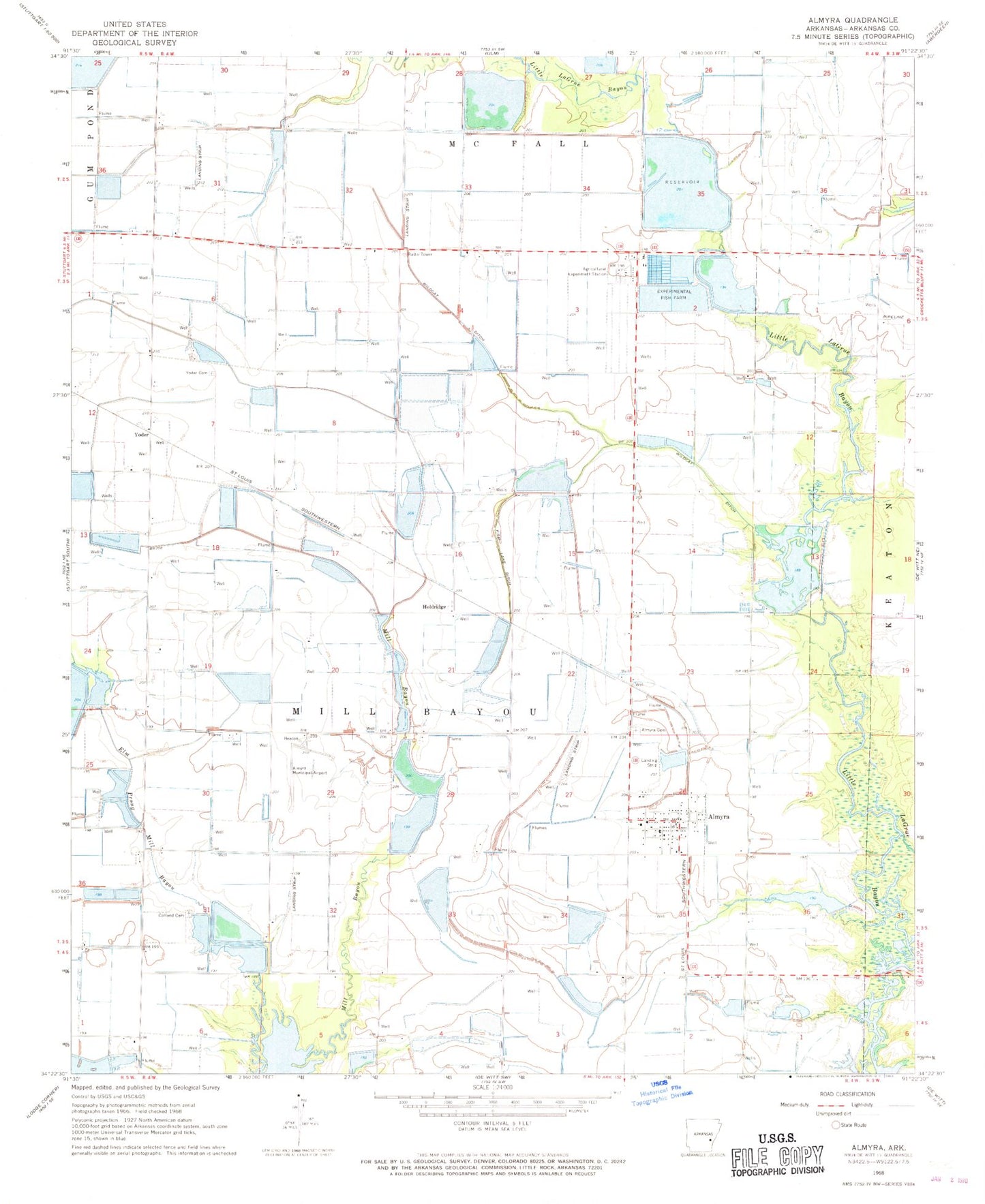
Classic USGS Almyra Arkansas 7.5'x7.5' Topo Map
Couldn't load pickup availability
Historical USGS topographic quad map of Almyra in the state of Arkansas. Map scale may vary for some years, but is generally around 1:24,000. Print size is approximately 24" x 27"
This quadrangle is in the following counties: Arkansas.
The map contains contour lines, roads, rivers, towns, and lakes. Printed on high-quality waterproof paper with UV fade-resistant inks, and shipped rolled.
Contains the following named places: Almyra, Almyra Cemetery, Almyra Municipal Airport, Almyra Post Office, Almyra Volunteer Fire Department, Bennett Reservoir, Coffield Cemetery, Ditch Number 1, Ditch Number 2, Elm Prong Mill Bayou, Hillman Reservoir, Hillman Reservoir Number Two, Holdridge, Knoff Reservoir, KXDX-FM (Stuttgart), McDoogle Reservoir, Prairieville School, Tindall Lake, Tindall Lake Dam, Town of Almyra, Township of Mill Bayou, University of Arkansas Rice Branch Experiment Station, Voss Reservoir, Voss Reservoir Dam, Walworth Reservoir, Wildcat Ditch, Yoder, Yoder Cemetery, Yoder School, ZIP Code: 72003