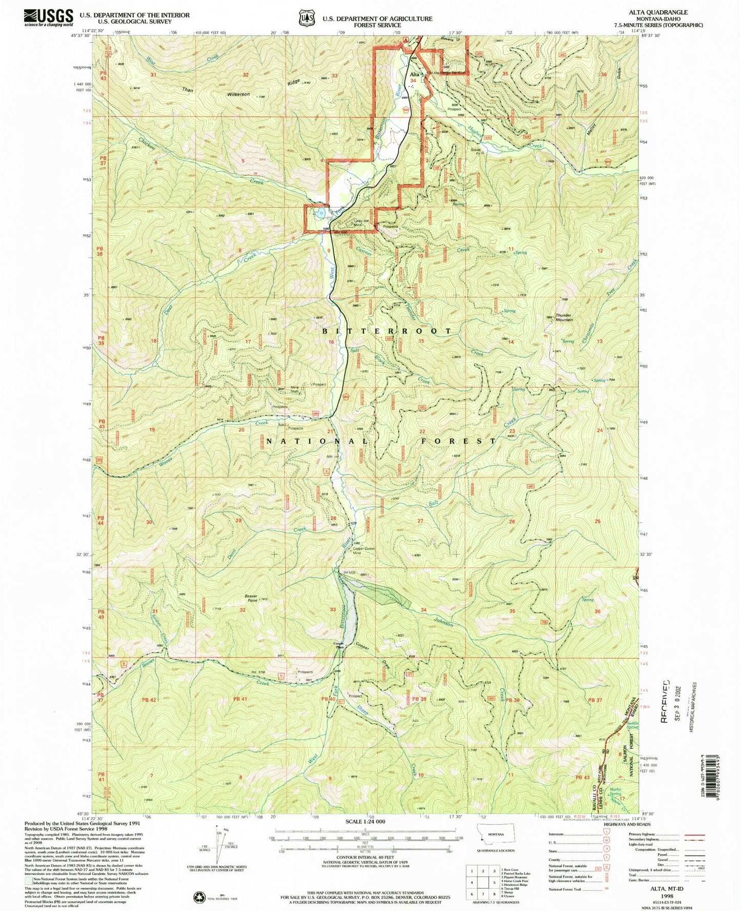
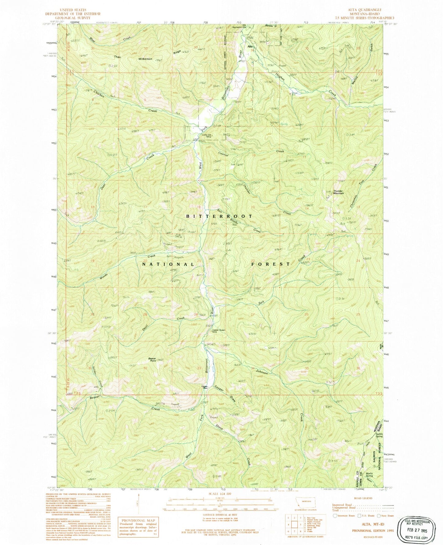
MyTopo
Classic USGS Alta Montana 7.5'x7.5' Topo Map
Couldn't load pickup availability
Historical USGS topographic quad map of Alta in the states of Montana, Idaho. Map scale may vary for some years, but is generally around 1:24,000. Print size is approximately 24" x 27"
This quadrangle is in the following counties: Lemhi, Ravalli.
The map contains contour lines, roads, rivers, towns, and lakes. Printed on high-quality waterproof paper with UV fade-resistant inks, and shipped rolled.
Contains the following named places: Alta, Alta Campground, Alta Forest Service Station, Alta Post Office, Alta Recreation Site, Beaver Creek, Beaver Point, Castner Creek, Chicken Creek, Cooper Draw, Cooper Place, Copper Queen Mine, Deer Creek, Devil Creek, Hughes Creek, Johnson Creek, Lucky Joe Mine, Malloy Gulch, Marlin Spring, NE NE Section 20 Mine, NW NW Section 21 Mine, Saddle Spring, Salt Block Creek, Salt Creek, SE SW Section 3 Mine, Sheep Creek, Sheep Creek Columbite Mine, Solider Creek, SW NW Section 21 Mine, SW SE Section 21 Mine, Than Wilkerson Ridge, Thunder Creek, Thunder Mountain, Woods Creek