MyTopo
Classic USGS Alto Tennessee 7.5'x7.5' Topo Map
Couldn't load pickup availability
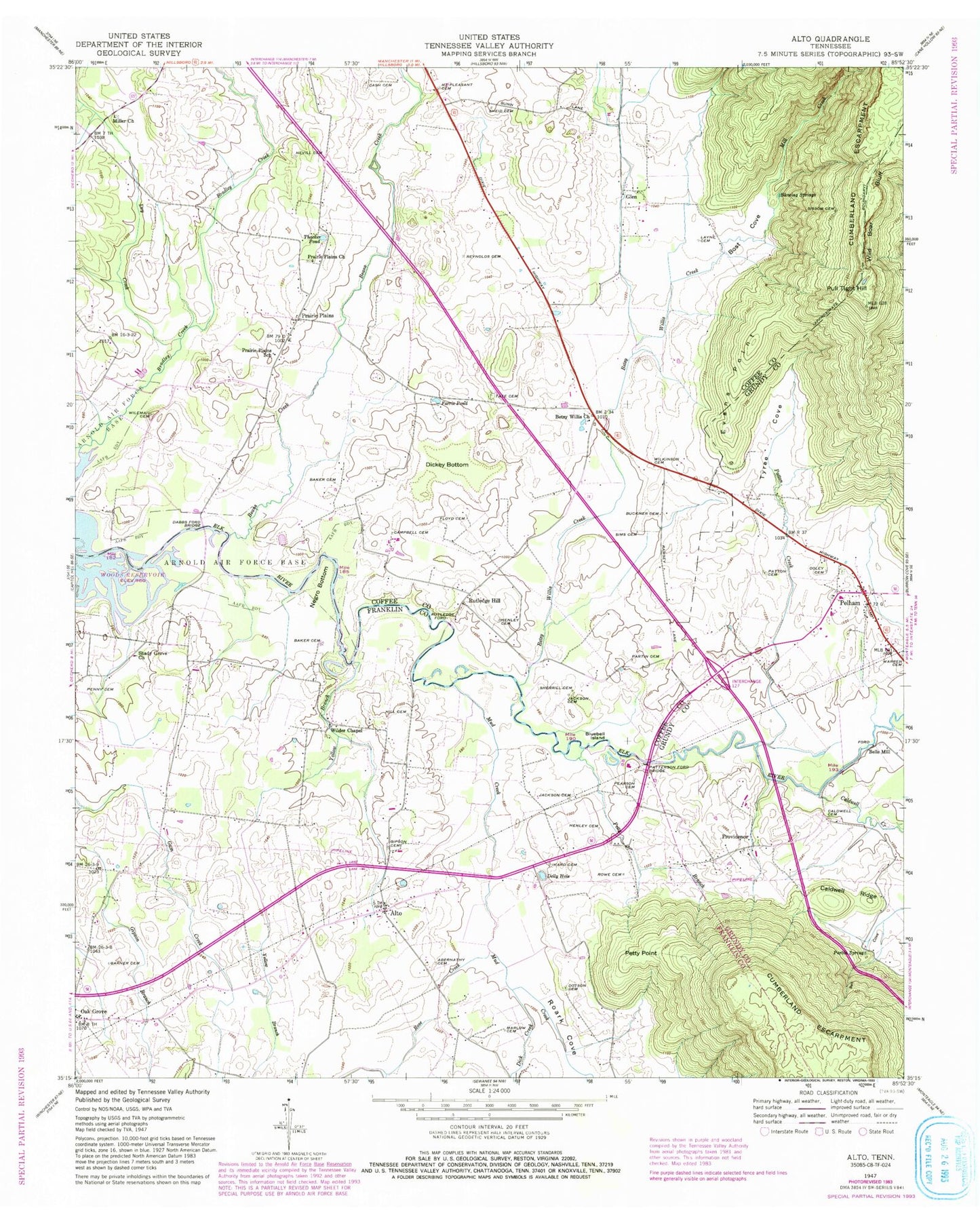
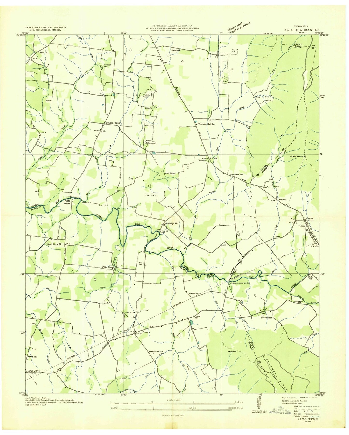
Historical USGS topographic quad map of Alto in the state of Tennessee. Map scale may vary for some years, but is generally around 1:24,000. Print size is approximately 24" x 27"
This quadrangle is in the following counties: Coffee, Franklin, Grundy.
The map contains contour lines, roads, rivers, towns, and lakes. Printed on high-quality waterproof paper with UV fade-resistant inks, and shipped rolled.
Contains the following named places: Alto, Alto - Oak Grove Volunteer Fire Department, Alto Cemetery, Alto School, Baker Cemetery, Beans Creek, Bell Cove, Bells Mill, Betsy Willis, Betsy Willis Church, Betsy Willis Creek, Blowing Springs, Bluebell Island, Bost Cove, Buckner Cemetery, Caldwell Cemetery, Caldwell Creek, Caldwell Ridge, Caldwells Bridge, Campbell Cemetery, Cash Cemetery, Dabbs Ford, Dabbs Ford Bridge, Delly Hole, Dick Creek, Dickey Bottom, Dotson Cemetery, Dry Creek, Evans Point, Farris Pond, Floyd Cemetery, Garner Cemetery, Gipson Branch, Gipson Cemetery, Glen, Goodmans Mill, Henley Cemetery, Hessey Mill, Hill Cemetery, Ikard Cemetery, Jackson Cemetery, Jail Island, Laxon Cemetery, Layne Cemetery, Mill Creek, Miller Church, Morris School, Mount Nebo Church, Mount Pleasant Cemetery, Mud Creek, Negro Bottom, Nevill Cemetery, Oak Grove, Oak Grove Church of Christ, Old Baptist Graveyard, Ooley Cemetery, Partin Cemetery, Partin Spring, Patterson Ford Bridge, Patton Cemetery, Patton Creek, Patton School, Pearson Cemetery, Pelham, Pelham Cemetery, Pelham Church of Christ, Pelham Elementary School, Pelham Post Office, Pelham United Methodist Church, Pelham Valley, Pelham Valley Church, Penny Cemetery, Petty Branch, Petty Point, Prairie Plains, Prairie Plains Church, Prairie Plains School, Providence, Providence Cemetery, Providence School, Providence United Methodist Church, Pull Tight Hill, Reynolds Cemetery, Roark Cove, Rose Creek, Rowe Cemetery, Ruthledge Ford, Ruthledge Hill, Shady Grove, Shady Grove Church, Shake Rag School, Sheid Cemetery, Sherrill Cemetery, Sims Cemetery, Sissom Cemetery, Swann Cemetery, Tate Cemetery, Thacker Pond, Thompson Hall School, Turner Chapel, Tyree Cove, White Oak Grove Church of God, Wild Boar Bluff, Wilder Chapel, Wileman Cemetery, Wilkinson Cemetery, Yellow Branch