
MyTopo
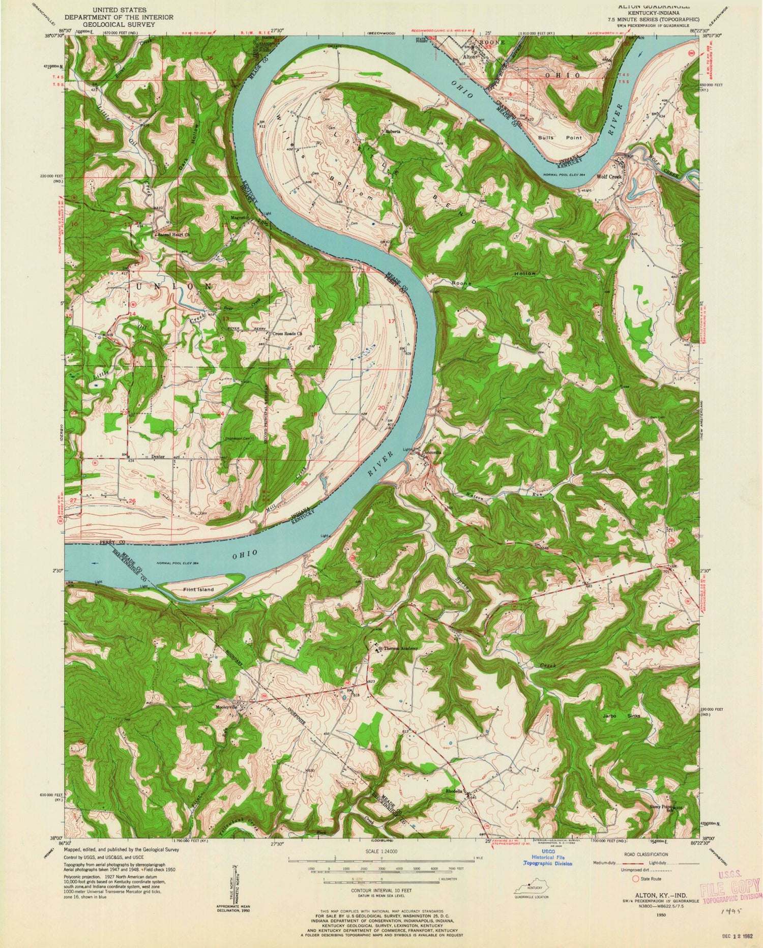
Classic USGS Alton Indiana 7.5'x7.5' Topo Map
Couldn't load pickup availability
Historical USGS topographic quad map of Alton in the states of Indiana, Kentucky. Map scale may vary for some years, but is generally around 1:24,000. Print size is approximately 24" x 27"
This quadrangle is in the following counties: Breckinridge, Crawford, Meade, Perry.
The map contains contour lines, roads, rivers, towns, and lakes. Printed on high-quality waterproof paper with UV fade-resistant inks, and shipped rolled.
Contains the following named places: Alton, Bear Creek, Boone Creek, Boone Hollow, Bulls Point, Buzzard Roost Overlook, Concordia, Cross Roads Church, Dark Hollow, Dexter, Eagle's Nest Airport, Flint Island, Jarbo Sinks, Leavenworth Volunteer Fire Department, Little Bend, Little Blue River, Magnet, Mill Creek, Mooleyville, Owings Cemetery, Parr - Frans Cemetery, Peters Landing, Rhodelia, Rhodelia Fire Department, Rhodelia Post Office, Roberta, Sacred Heart Church, Saint Theresa Academy, Spring Creek, Stephenson Cemetery, Stony Point, Town of Alton, Watson Run, Willets Bottom, Wolf Creek, Wolf Creek Fire Department, ZIP Codes: 40157, 40161


