MyTopo
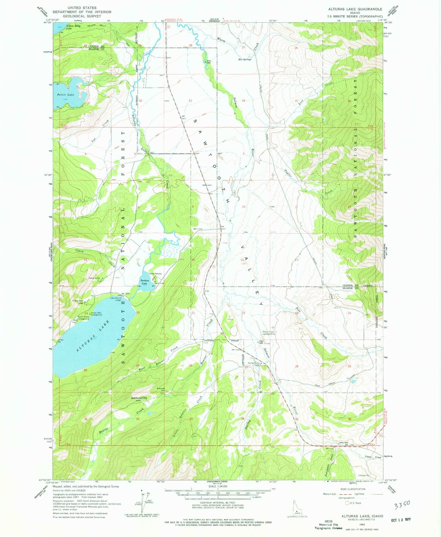
Classic USGS Alturas Lake Idaho 7.5'x7.5' Topo Map
Couldn't load pickup availability
Historical USGS topographic quad map of Alturas Lake in the state of Idaho. Typical map scale is 1:24,000, but may vary for certain years, if available. Print size: 24" x 27"
This quadrangle is in the following counties: Blaine, Custer.
The map contains contour lines, roads, rivers, towns, and lakes. Printed on high-quality waterproof paper with UV fade-resistant inks, and shipped rolled.
Contains the following named places: Alturas Lake, Beaver Creek, Cabin Creek, Camp Creek, Luther Heights Camp, Camp Perkins, Frenchman Creek, Hot Springs, Lake Alturas Lodge, Little Beaver Creek, Lost Creek, North Shore Campground, Perkins Lake, Pole Creek, Sawtooth Cemetery, Smiley Creek, Smilty Creek Lodge, Smoky Bear Lodge, Taylor Creek, Vat Creek, Warm Creek, West Beaver Creek, Yellow Belly Trail, Beaver Creek Store, Smokey Bear Campground, Sawtooth City (historical), Smiley Creek Airport, Pole Creek Ditch, Pettit Lake Fish Barrier Dam, Columbia Sawmill (historical)