MyTopo
Classic USGS Alum Creek West Virginia 7.5'x7.5' Topo Map
Couldn't load pickup availability
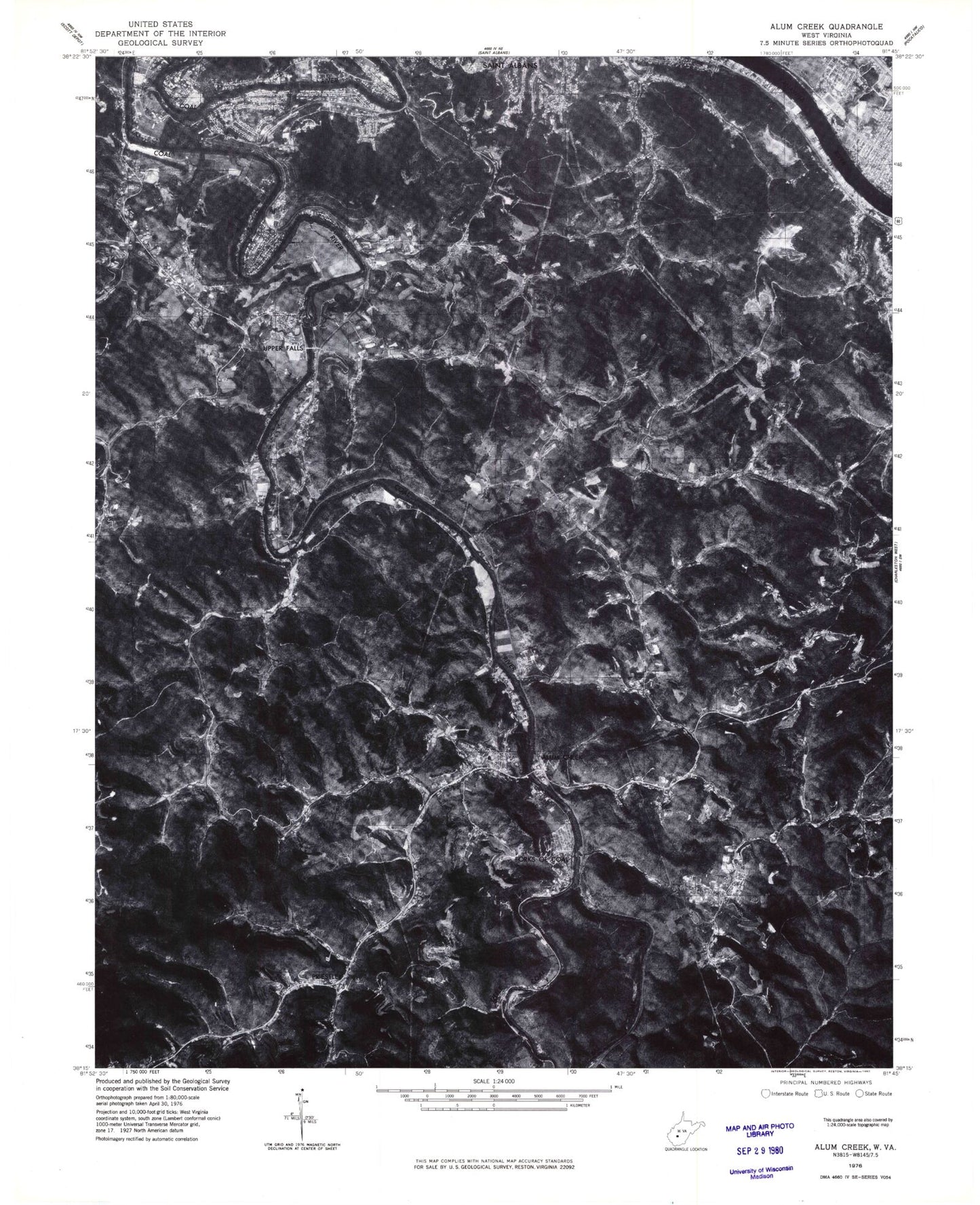
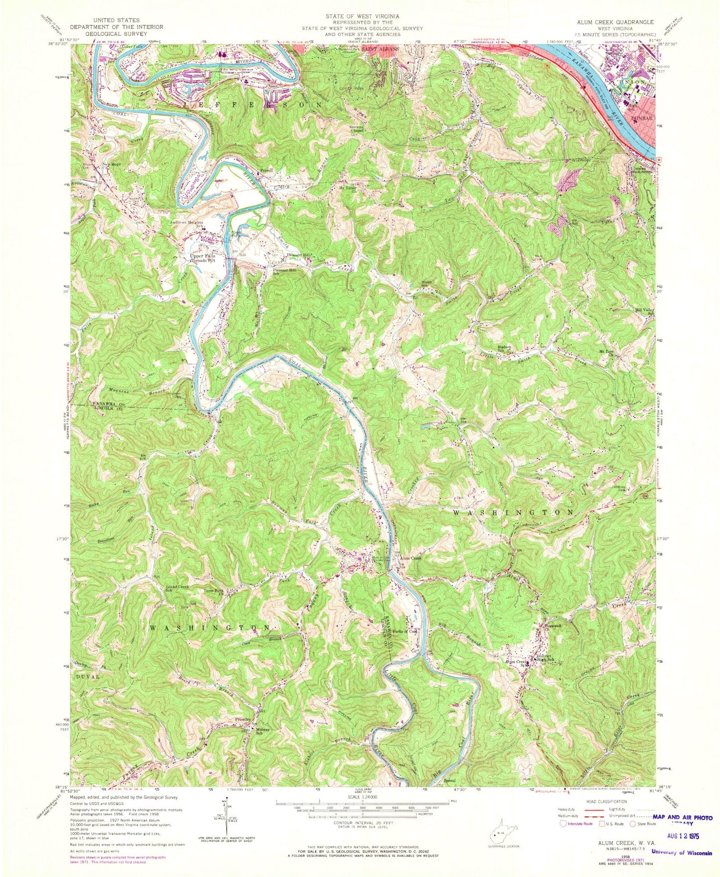
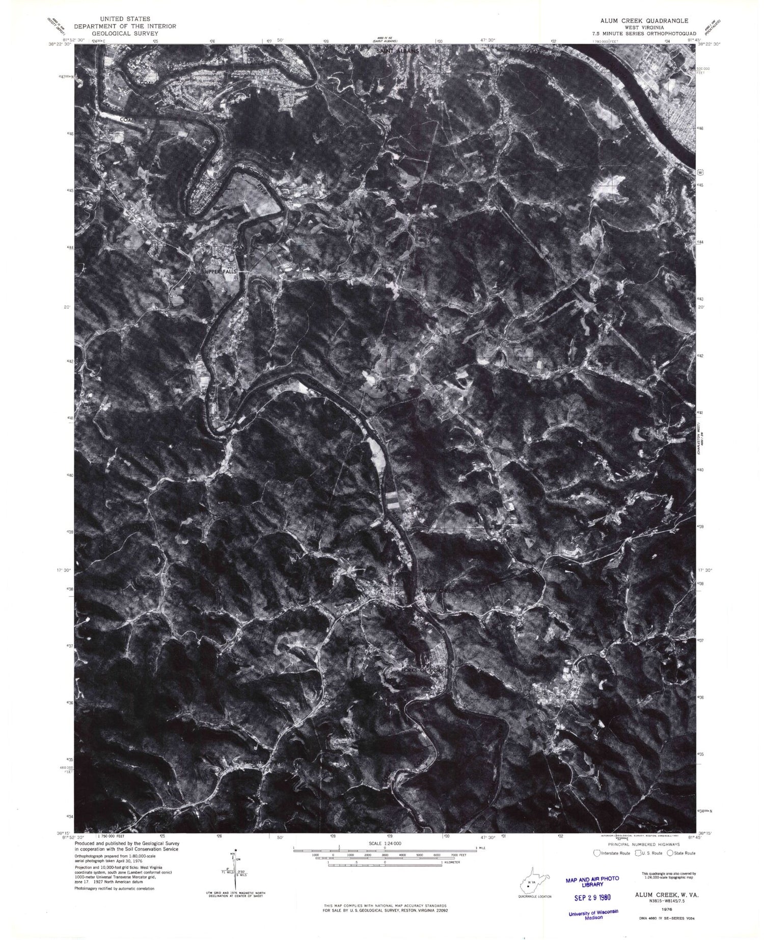
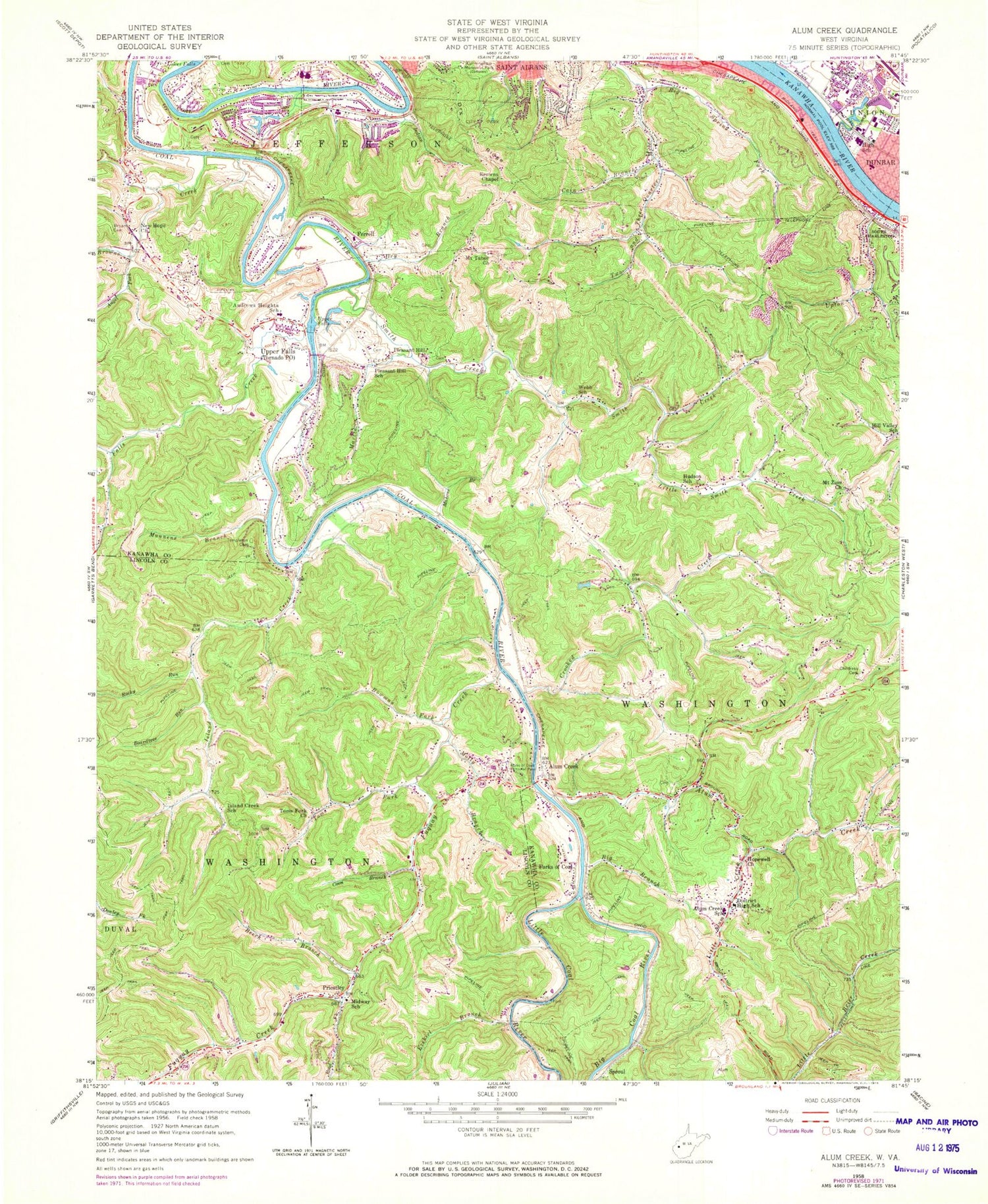
Historical USGS topographic quad map of Alum Creek in the state of West Virginia. Map scale may vary for some years, but is generally around 1:24,000. Print size is approximately 24" x 27"
This quadrangle is in the following counties: Kanawha, Lincoln.
The map contains contour lines, roads, rivers, towns, and lakes. Printed on high-quality waterproof paper with UV fade-resistant inks, and shipped rolled.
Contains the following named places: Alum Creek, Alum Creek Bridge, Alum Creek Census Designated Place, Alum Creek Elementary School, Alum Creek Post Office, Alum Creek Public Library, Alum Creek Volunteer Fire Department Station 1, Alum Creek Volunteer Fire Department Station 2, Andrews Heights Elementary School, Angel Fork, Ballard, Bays Cemetery, Beech Branch, Beech Park Acres, Ben Franklin Career Center, Big Bend Golf Course, Big Branch, Big Coal River, Big Coal River Bridge, Big Spring Fork, Boardtree Run, Bowman Fork, Browns Chapel, Browns Creek, Bryan Cemetery, Cain Branch, Calvert, Childress Cemetery, Coal River Group Science & Education Center, Coon Branch, Crooked Creek, District High School, Dollie Hill Christian Academy, Dry Branch, Dry Ridge, Dunbar Middle School, Dunbar Primary School, Dunlap Cemetery, Ezekiel Branch, Falls Creek, Falls Creek School, Ferrell, Finney Branch, Forks of Coal, Forks of Coal Census Designated Place, Forks of Coal Memorial Park, Fuquay, Fuquay Creek, Grapevine Knob, Green Valley, Green Valley Church of God, Hayes Middle School, Henley Cemetery, Hill Valley School, Hopewell Church, Hudson School, Humphreys Memorial United Methodist Church, Indian, Indian Creek, Island Creek, Island Creek School, James H Tiger Morton Juvenile Center, Jefferson Census Designated Place, Jefferson Volunteer Fire Department, Lakewood Elementary School, Lakewood Volunteer Fire Department, Lincoln, Lincoln Park, Little Alum Creek, Little Coal River, Little Coal River Bridge, Little Smith Creek, Lone Oak Park, Lower Falls, Mahone Branch, Mannens Branch, Martin Creek, Midway Elementary School, Molly Branch, Mount Tabor Church, Mount Zion Church, New Hope Church, Pleasant Hill Church, Pleasant Hill School, Priestley, River Bend, Riverlake, Road Fork, Rocky Run, Saint Albans City Park, Shawnee Community Center, Smith Creek, Sproul, Sun Valley, Sutherland - White Cemetery, Sweet Acres, Tanbark Ridge, Templeton Cemetery, Toms Fork, Toms Fork Church, Tornado, Tornado Bridge, Tornado Census Designated Place, Tornado Post Office, Tornado Volunteer Fire Department, Upper Falls, Upper Falls Beach, Upper Falls Cemetery, Upper Falls Census Designated Place, Upper Falls Channel, Upper Falls Crossing, Upper Falls Dam, Upper Falls Gristmill, Upper Falls Landing, Upper Falls Lock, Upper Falls Lockmaster House, Upper Falls Point, Upper Falls Sawmill, Upper Falls Siding, Upper Falls Station, Upton Creek, Walhonde Upper Falls Walking Trail, WCHS-AM (Charleston), Webb School, West Dunbar, West Dunbar Census Designated Place, West Dunbar School, Workman Development Bridge, ZIP Codes: 25003, 25177, 25202