MyTopo
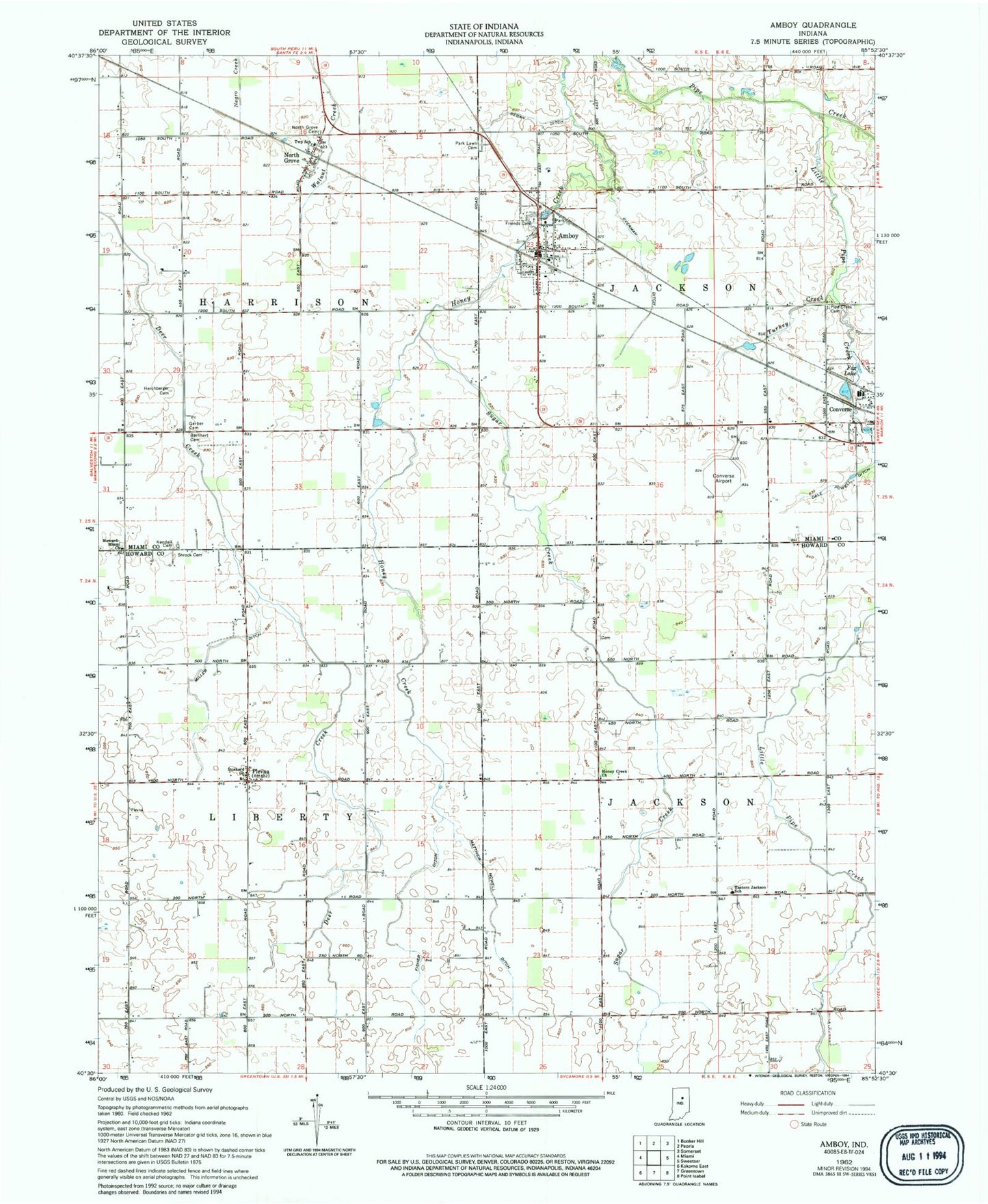
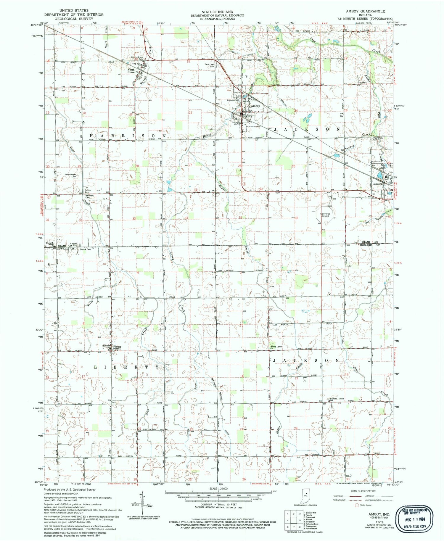
Classic USGS Amboy Indiana 7.5'x7.5' Topo Map
Couldn't load pickup availability
Historical USGS topographic quad map of Amboy in the state of Indiana. Map scale may vary for some years, but is generally around 1:24,000. Print size is approximately 24" x 27"
This quadrangle is in the following counties: Howard, Miami.
The map contains contour lines, roads, rivers, towns, and lakes. Printed on high-quality waterproof paper with UV fade-resistant inks, and shipped rolled.
Contains the following named places: Amboy, Amboy Post Office, Amboy Volunteer Fire Company, Amboy Volunteer Fire Department, Barnhart Cemetery, Converse Airport, Converse Volunteer Ambulance - Substation, Dale Powell Ditch, Dunkard Church, Eastern Jackson School, Fisher Ditch, Fox Lake, Friends Cemetery, Gerber Cemetery, Harper Ditch, Herchberger Cemetery, Honey Creek Church, Howard Miami Church, Kendall Cemetery, Little Pipe Creek, Matthew Howell Ditch, Miller Ditch, North Grove, North Grove Cemetery, Overman Ditch, Park Lawn Cemetery, Pipe Creek Cemetery, Plevna, Regan Ditch, Shrock Cemetery, Sugar Creek, Town of Amboy, Township of Harrison, Township of Jackson, Township of Liberty, Turkey Creek