MyTopo
Classic USGS Amesville Ohio 7.5'x7.5' Topo Map
Couldn't load pickup availability
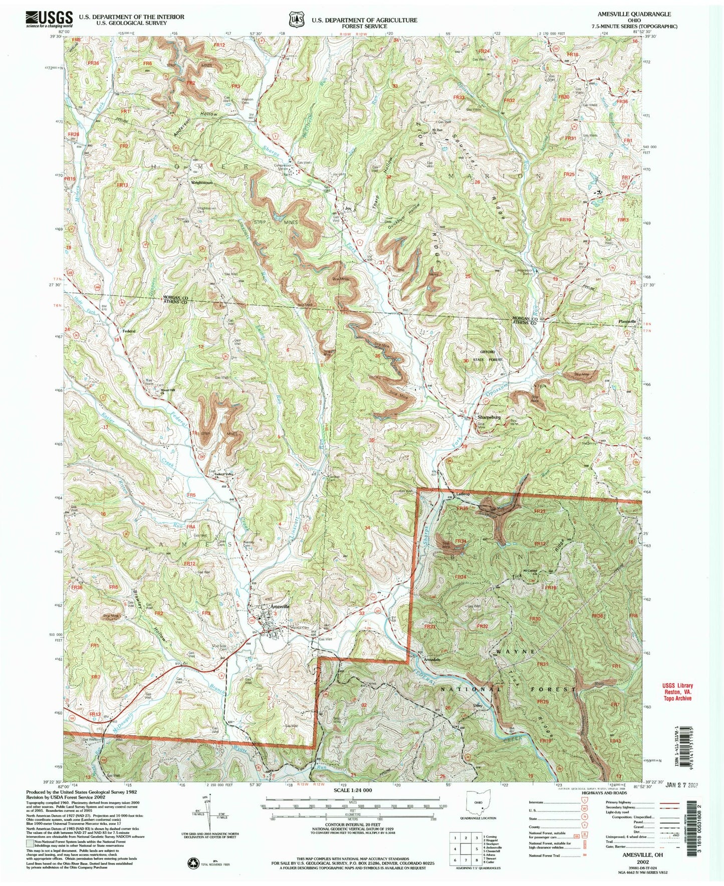
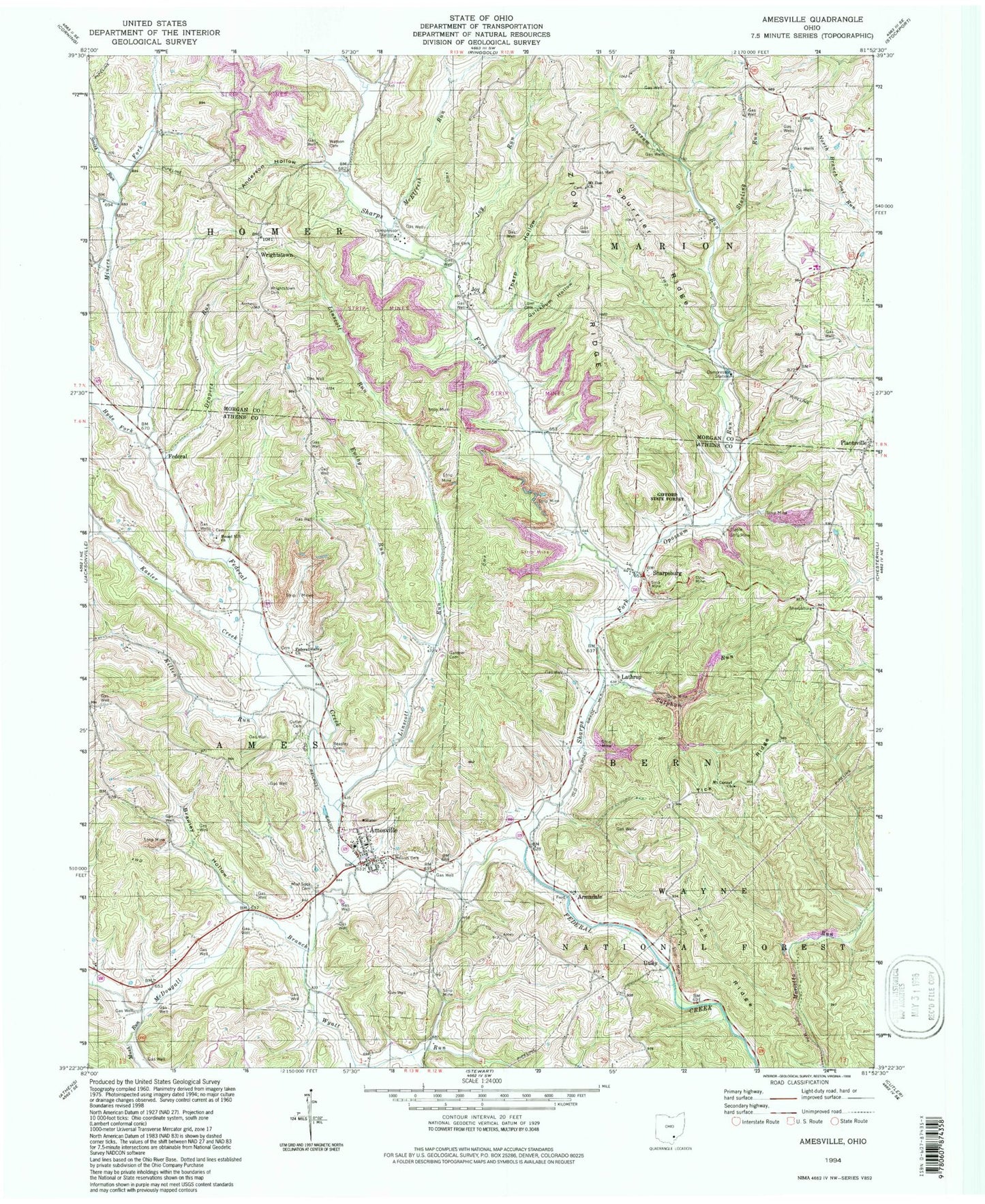
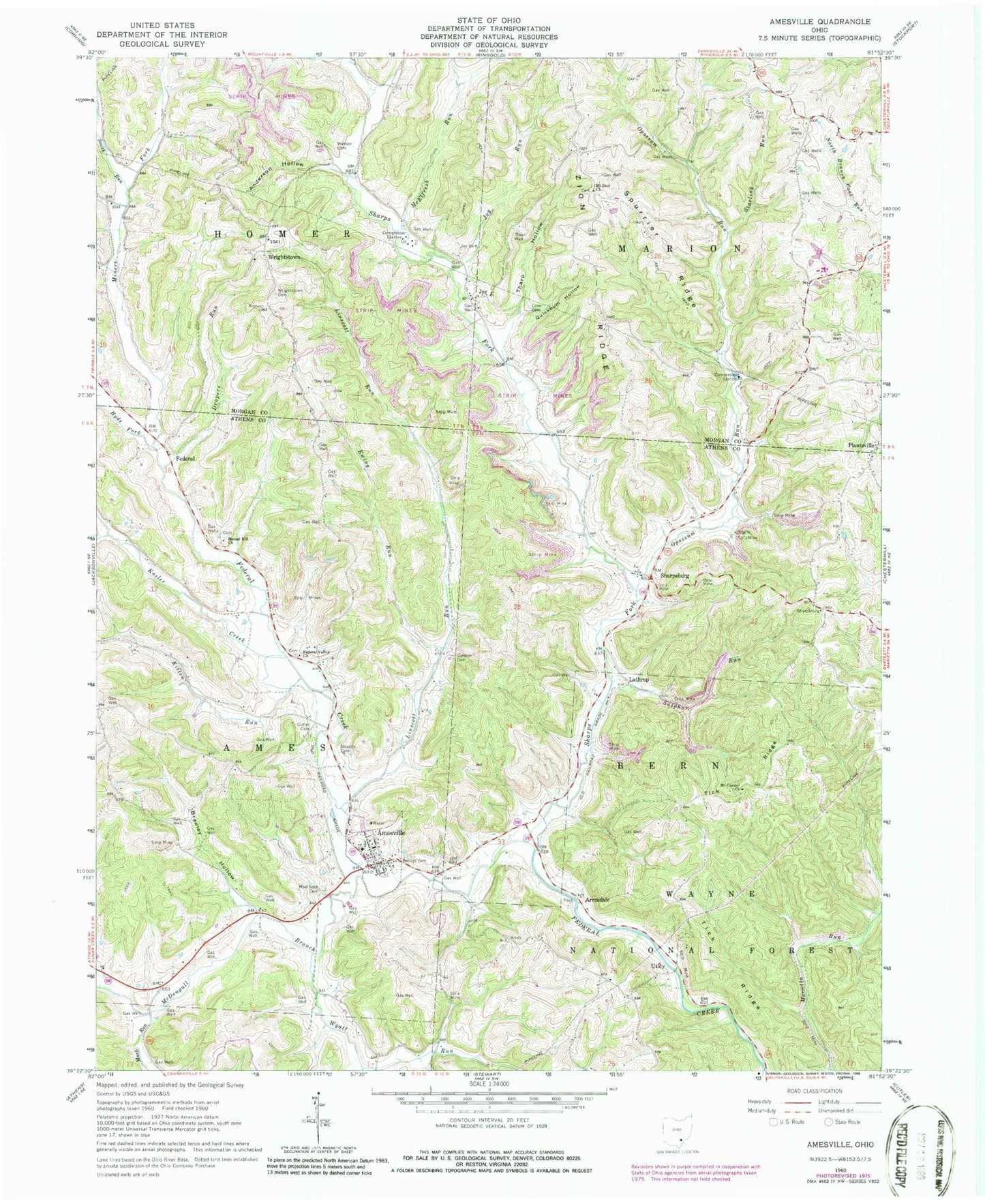
Historical USGS topographic quad map of Amesville in the state of Ohio. Typical map scale is 1:24,000, but may vary for certain years, if available. Print size: 24" x 27"
This quadrangle is in the following counties: Athens, Morgan.
The map contains contour lines, roads, rivers, towns, and lakes. Printed on high-quality waterproof paper with UV fade-resistant inks, and shipped rolled.
Contains the following named places: Amesville Elementary School, McElfresh Run, Curtis Junction (historical), Joy Christian Church, Joy Methodist Episcopal Church (historical), Mount Zion Cemetery, Wrightsville Bible Christian Church, Amesville, Anderson Hollow, Armadale, Beasley Cemetery, Brawley Hollow, Cutler Cemetery, Drapers Run, Ewing Run, Federal, Federal Valley Church, Henrys Cemetery, Hyde Fork, Joy, Joy Cemetery, Joy Run, Kasler Creek, Kitten Run, Lathrop, Linscott Run, Lovel Cemetery, McDougall Branch, Mound Hill Church, Mount Carmel Church, Mount Zion Bible Christian Church, Mud Sock Cemetery, Mush Run, Opossum Run, Plantsville, Quickbum Hollow, Sharps Fork Federal Creek, Sharpsburg, Smith Run, Spurrier Ridge, Starling Run, Sulphur Run, Tharp Hollow, Tick Ridge, Utley, Watson Cemetery, Wrightstown, Wrightstown Cemetery, Wyatt Run, Zion Ridge, Miners Fork, Gifford State Forest, Township of Bern, Township of Marion, Federal Hill Cemetery, Mound Hill Cemetery, Sharpsburg Post Office, Utley Post Office (historical), Armdale Post Office (historical), Amesville Post Office, Joy Post Office (historical), Plantsville Post Office (historical), Village of Amesville, Amesville Ames - Bern Township Volunteer Fire Department, Amesville Elementary School, McElfresh Run, Curtis Junction (historical), Joy Christian Church, Joy Methodist Episcopal Church (historical), Mount Zion Cemetery, Wrightsville Bible Christian Church, Amesville, Anderson Hollow, Armadale, Beasley Cemetery, Brawley Hollow, Cutler Cemetery, Drapers Run, Ewing Run, Federal, Federal Valley Church, Henrys Cemetery, Hyde Fork, Joy, Joy Cemetery, Joy Run, Kasler Creek, Kitten Run, Lathrop, Linscott Run, Lovel Cemetery, McDougall Branch, Mound Hill Church, Mount Carmel Church, Mount Zion Bible Christian Church, Mud Sock Cemetery, Mush Run, Opossum Run, Plantsville, Quickbum Hollow, Sharps Fork Federal Creek, Sharpsburg, Smith Run, Spurrier Ridge, Starling Run, Sulphur Run, Tharp Hollow, Tick Ridge, Utley, Watson Cemetery, Wrightstown, Wrightstown Cemetery, Wyatt Run, Zion Ridge, Miners Fork, Gifford State Forest, Township of Bern, Township of Marion, Federal Hill Cemetery, Mound Hill Cemetery, Sharpsburg Post Office, Utley Post Office (historical), Armdale Post Office (historical), Amesville Post Office, Joy Post Office (historical), Plantsville Post Office (historical), Village of Amesville, Amesville Ames - Bern Township Volunteer Fire Department