MyTopo
Classic USGS Amity Arkansas 7.5'x7.5' Topo Map
Couldn't load pickup availability
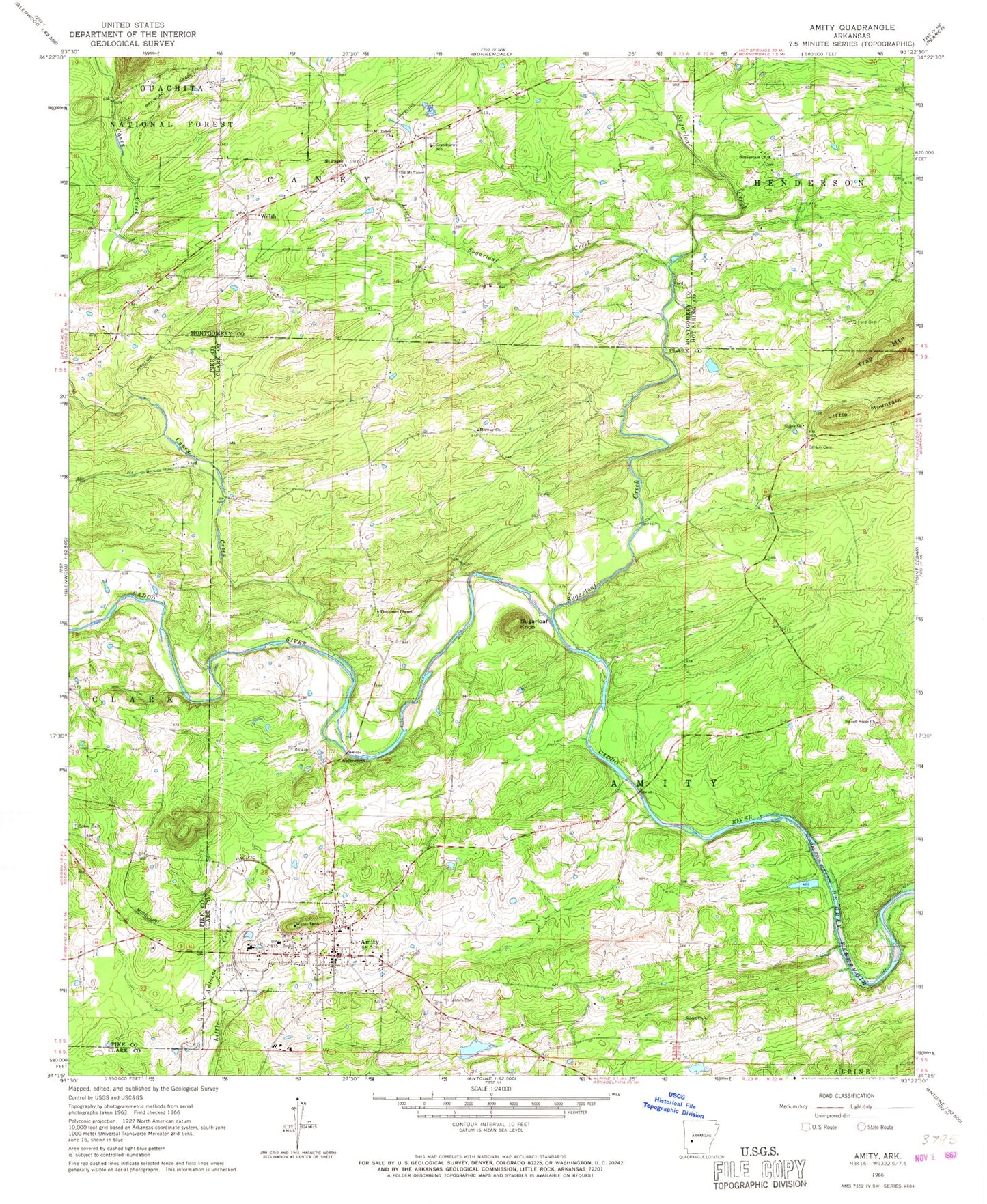
Historical USGS topographic quad map of Amity in the state of Arkansas. Map scale may vary for some years, but is generally around 1:24,000. Print size is approximately 24" x 27"
This quadrangle is in the following counties: Clark, Hot Spring, Montgomery, Pike.
The map contains contour lines, roads, rivers, towns, and lakes. Printed on high-quality waterproof paper with UV fade-resistant inks, and shipped rolled.
Contains the following named places: Amity, Amity Elementary School, Amity High School, Amity Police Department, Amity Post Office, Amity Volunteer Fire Department, Bonner School, Bonnerdale Church, Caney Creek, City of Amity, Coker Cemetery, Dillard Cemetery, Elm, Ewing Cemetery, First Church of the Nazarene, Grandview School, Jones Cemetery, Kirksey Reservoir, Kirksey Reservoir Dam, Little Mountain, Little Sugarloaf Creek, Midway Church, Mount Pisgah Missionary Baptist Church, Mount Tabor Church, Newcomb Cemetery, Old Mount Tabor Church, Pisgah School, Prayer House Tabernacle Church, Salem Church, Shiloh Cemetery, Shiloh Church, Sugarloaf Creek, Sugarloaf Knob, Sweet Home Church, Thompson Chapel, Township of Caney, Welch School, Welsh