MyTopo
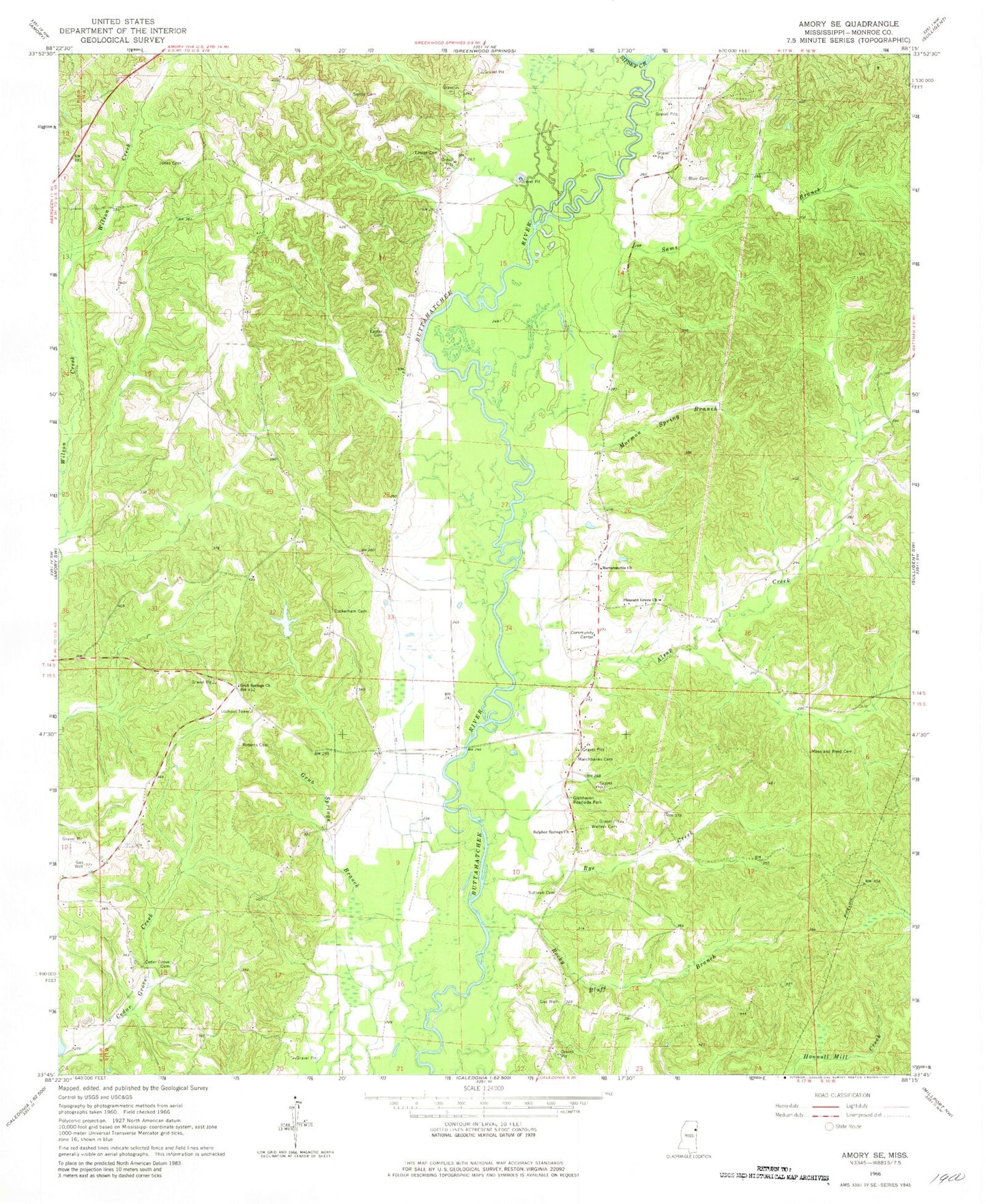
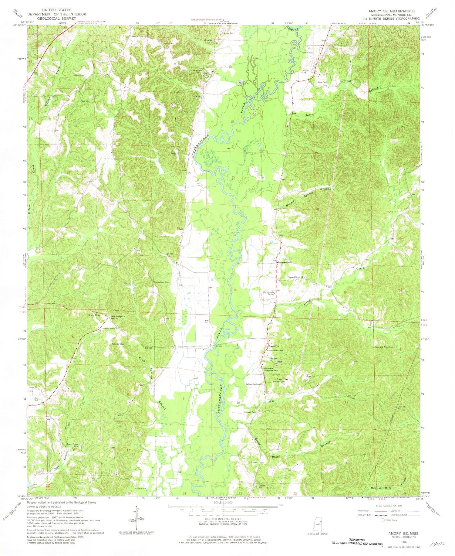
Classic USGS Amory SE Mississippi 7.5'x7.5' Topo Map
Couldn't load pickup availability
Historical USGS topographic quad map of Amory SE in the state of Mississippi. Map scale may vary for some years, but is generally around 1:24,000. Print size is approximately 24" x 27"
This quadrangle is in the following counties: Monroe.
The map contains contour lines, roads, rivers, towns, and lakes. Printed on high-quality waterproof paper with UV fade-resistant inks, and shipped rolled.
Contains the following named places: Alsup Creek, Bartahatchie Baptist Church, Beeks, Blair Cemetery, Buttahatchie, Cedar Grove Cemetery, Cockerham Cemetery, Cockerham Lake, Easter Cemetery, Glenhaven Roadside Park, Grub Springs Branch, Grub Springs Church, Grubb Springs, Jones Cemetery, Marchbanks Cemetery, Mormon Spring Branch, Mormon Springs, Moss and Reed Cemetery, Pleasant Grove Church, Pleasant Ridge Cumberland Presbyterian Church, Roberts Cemetery, Rocky Bluff Branch, Rural Hill Volunteer Fire Department, Rye, Rye Creek, Sams Branch, Sartor Cemetery, Sipsey Creek, Sullivan Cemetery, Sulphur Springs Church, Temperence Hill, Walters Cemetery, ZIP Code: 38844