
MyTopo
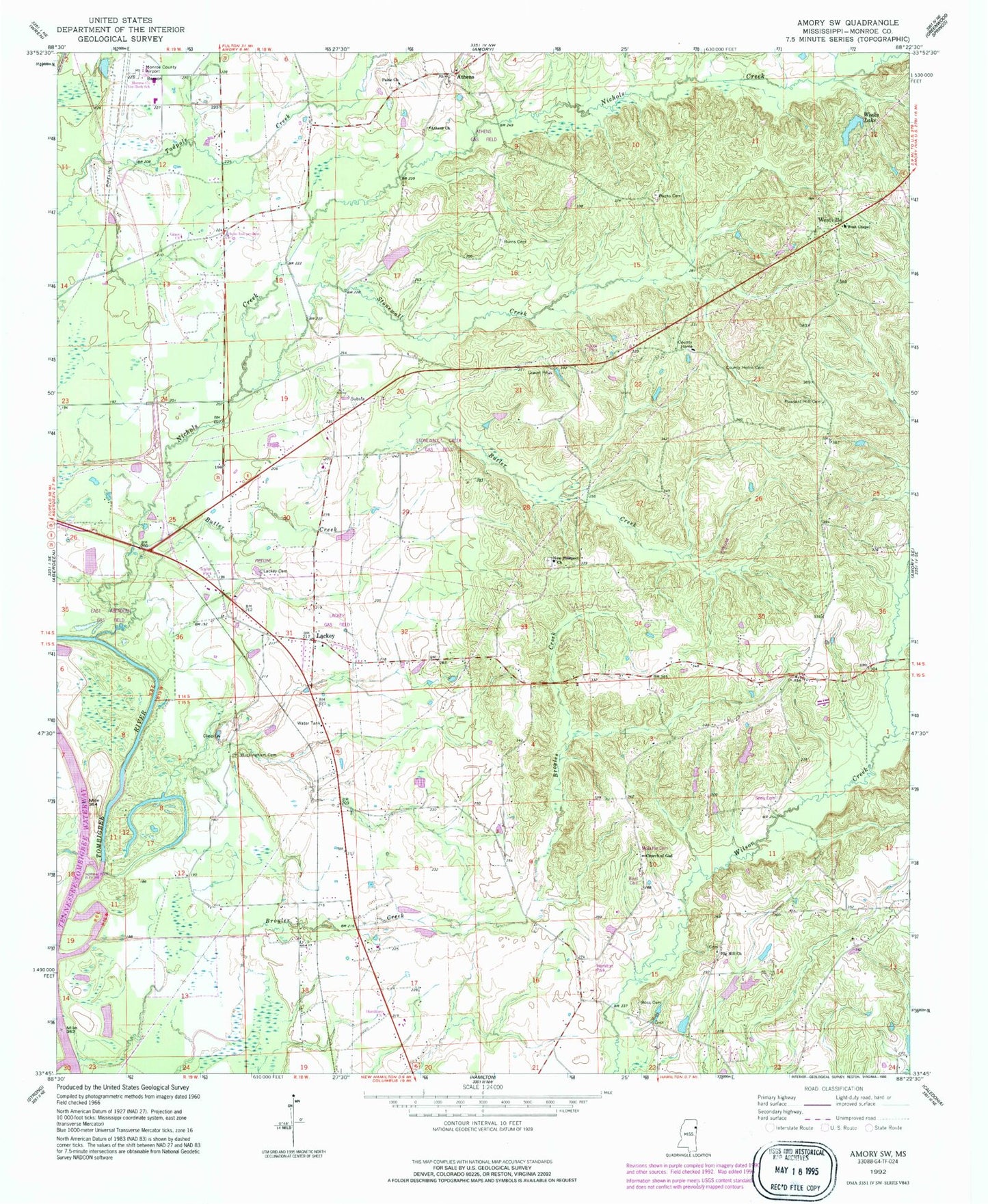
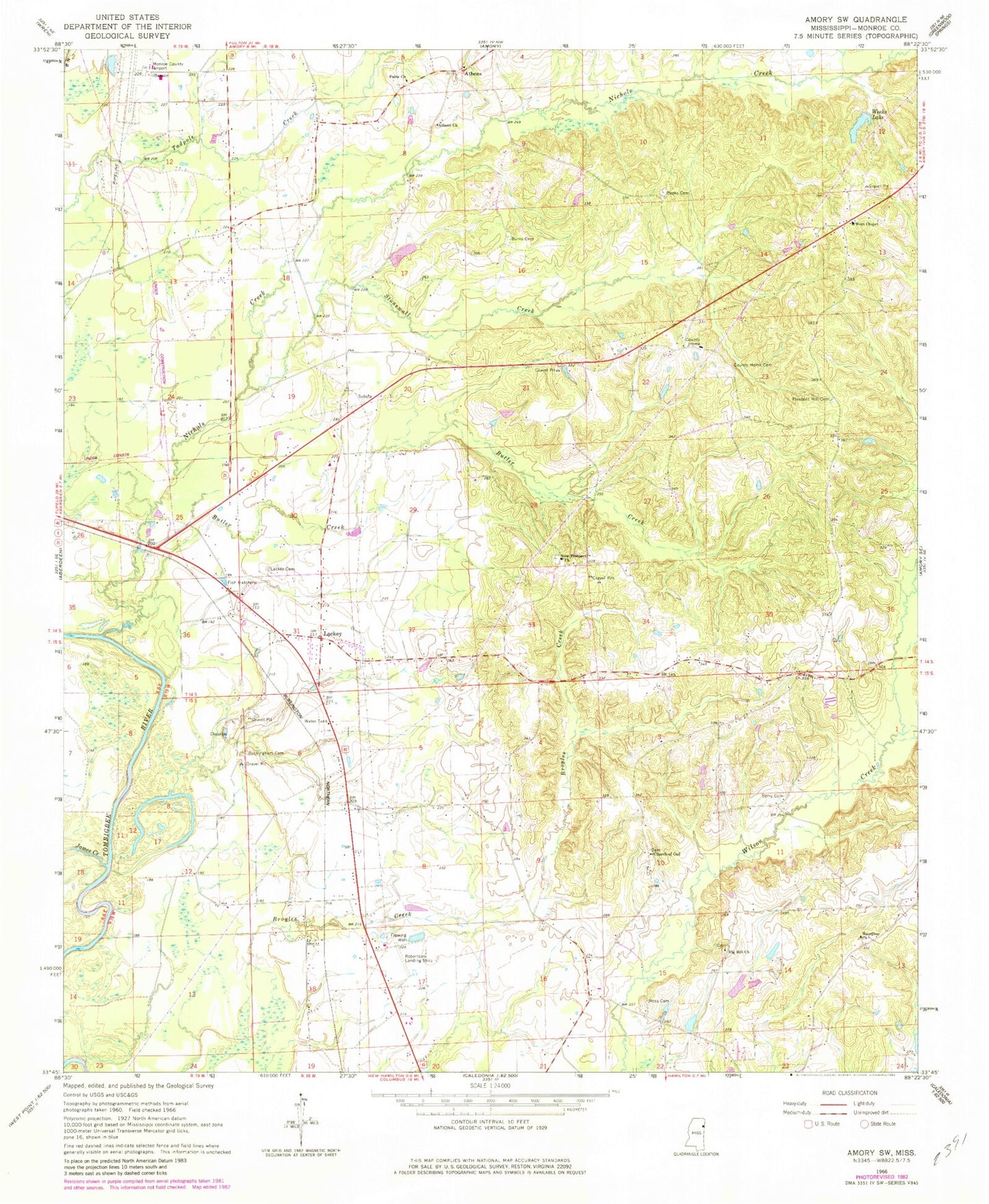
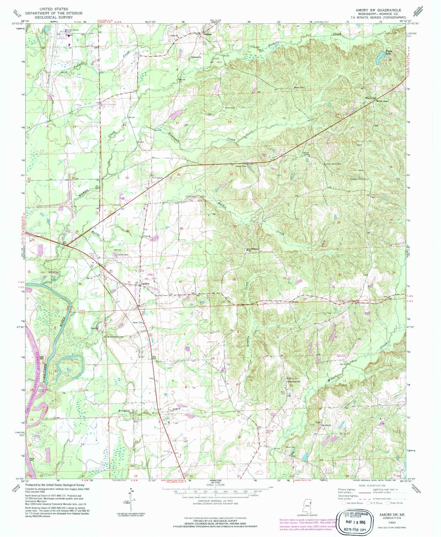
Classic USGS Amory SW Mississippi 7.5'x7.5' Topo Map
Couldn't load pickup availability
Historical USGS topographic quad map of Amory SW in the state of Mississippi. Map scale may vary for some years, but is generally around 1:24,000. Print size is approximately 24" x 27"
This quadrangle is in the following counties: Monroe.
The map contains contour lines, roads, rivers, towns, and lakes. Printed on high-quality waterproof paper with UV fade-resistant inks, and shipped rolled.
Contains the following named places: A L House Catfish Farm Dam, Ashland, Athens, Athens Baptist Church, Athens Independent Methodist Church, Beeks Cemetery, Berry Cemetery, Broyles Creek, Buckingham Cemetery, Burns Cemetery, Butler Creek, Church of God, County Home Cemetery, Fig Hill Church, Friendship United Methodist Church, Hamilton Baptist Church, Hamilton Church of God, James Creek, Lackey, Lackey Cemetery, Lackeys Ferry, Monroe County Airport, Monroe County Home, New Prospect Cemetery, New Prospect Church, Nichols Creek, None, Paine Memorial United Methodist Church, Pleasant Hill Cemetery, Pleasant Hill Methodist Church, Robert Williams Pond Dam, Ross Cemetery, Ross Mill, Stonewall Creek, Supervisor District 3, Vassar, Weeks Lake, Weeks Lake Dam, Wesley, West Chapel Church of Christ, Westville