MyTopo
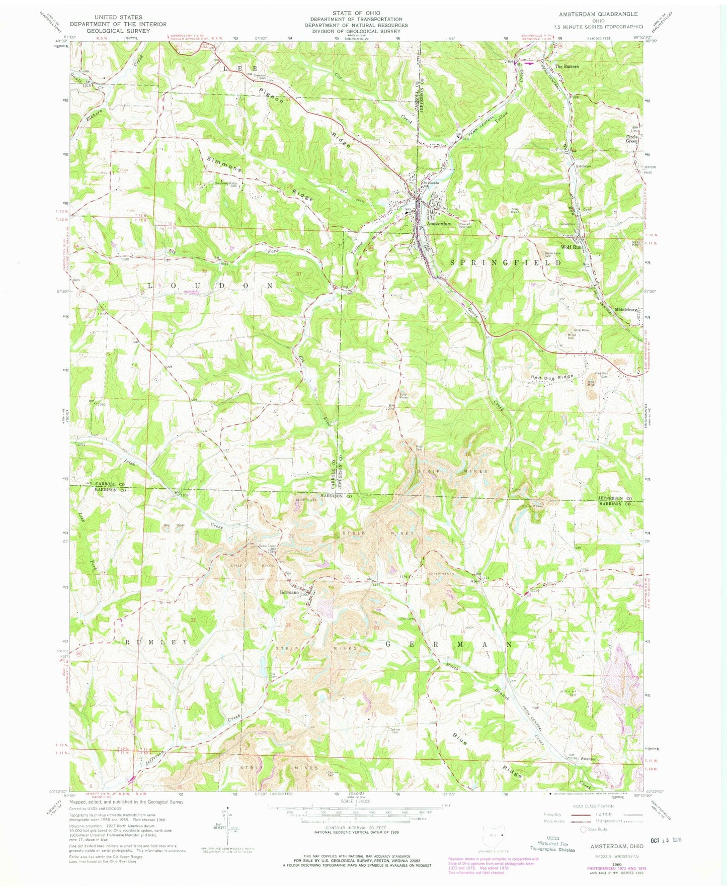
Classic USGS Amsterdam Ohio 7.5'x7.5' Topo Map
Couldn't load pickup availability
Historical USGS topographic quad map of Amsterdam in the state of Ohio. Map scale may vary for some years, but is generally around 1:24,000. Print size is approximately 24" x 27"
This quadrangle is in the following counties: Carroll, Harrison, Jefferson.
The map contains contour lines, roads, rivers, towns, and lakes. Printed on high-quality waterproof paper with UV fade-resistant inks, and shipped rolled.
Contains the following named places: Amsterdam, Amsterdam Cemetery, Amsterdam Post Office, Amsterdam Volunteer Fire Company, Apex, Apex Energy Landfill, Apex Sanitary Landfill, Arba Vue Farms, Blue Ridge, Buffalo Hill Cemetery, Cannan Cemetery, Circle Green, Circle Green Methodist Episcopal Cemetery, Circle Green Post Office, Cox Creek, Crawford Cemetery, Davidson Cemetery, Elk Fork, Elk Lick, Fay Dam, Fay Lake, Gault Creek, Germano, Germano Cemetery, Germano Post Office, Goose Creek, Greek Orthodox Cemetery, Indian Lake, Kisha Farm Cemetery, Middleburg, Miller Cemetery, Mizer Cemetery, Order of the Sacred & Immaculate Hearts of Jesus, Pigeon Ridge, Red Dog Ridge, Saint Josephs School, Simmons Cemetery, Simmons Ridge, Simmons Ridge Cemetery, Swanson, Tedrow Cemetery, The Eastern, Township of German, Township of Loudon, Township of Springfield, Village of Amsterdam, Wolf Run, Wolf Run Post Office, Zion Cemetery, ZIP Codes: 43903, 43970, 43986