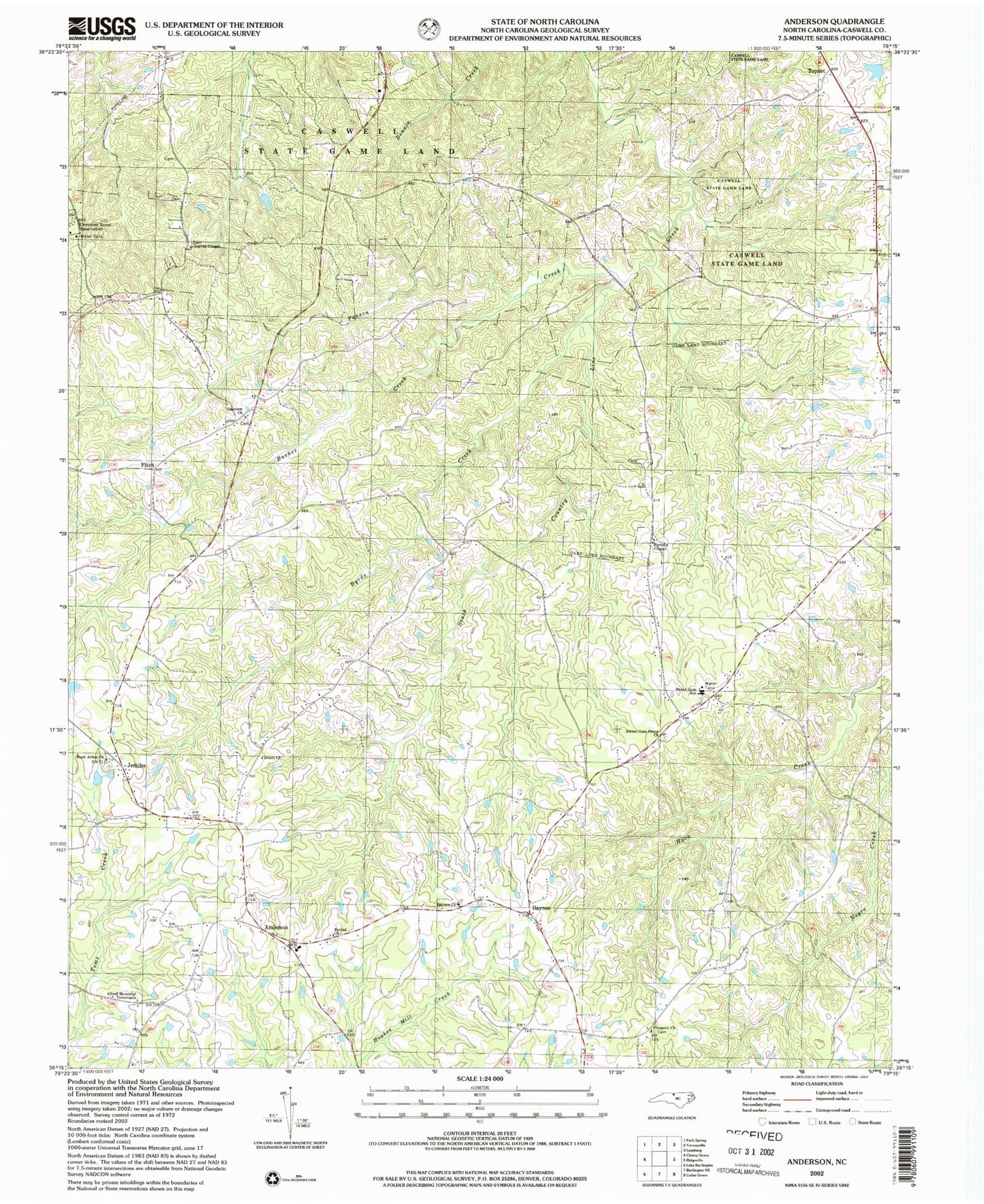
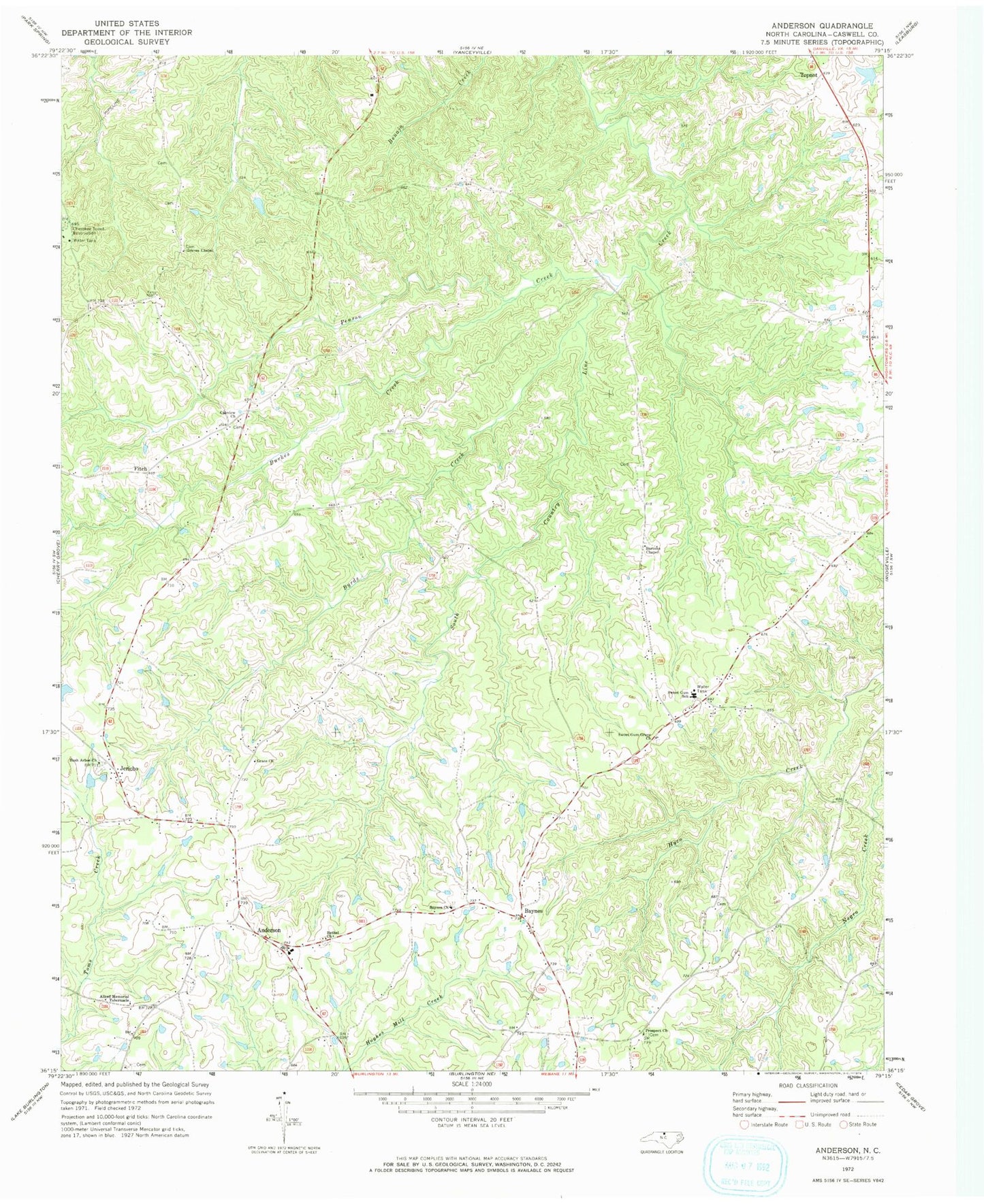
MyTopo
Classic USGS Anderson North Carolina 7.5'x7.5' Topo Map
Couldn't load pickup availability
Historical USGS topographic quad map of Anderson in the state of North Carolina. Typical map scale is 1:24,000, but may vary for certain years, if available. Print size: 24" x 27"
This quadrangle is in the following counties: Caswell.
The map contains contour lines, roads, rivers, towns, and lakes. Printed on high-quality waterproof paper with UV fade-resistant inks, and shipped rolled.
Contains the following named places: Allred Memorial Tabernacle, Baynes, Baynes Church, Bethel Church, Burkes Creek, Burtons Chapel, Bush Arbor Church, Byrds Creek, Grace Church, Graves Chapel, Jericho, Oakview Church, Penson Creek, Prospect Church, Sweet Gum Grove Church, Sweet Gum School, Williams Lake, Williams Lake Dam, Caswell Wildlife Mgmt Area Pond O, Caswell Wildlife Management Pond Dam Number One, Topnot, Anderson Elementary School, Anderson, Fitch, Township of Anderson, Anderson Township Volunteer Fire Department Station 2, Anderson Township Volunteer Fire Department