MyTopo
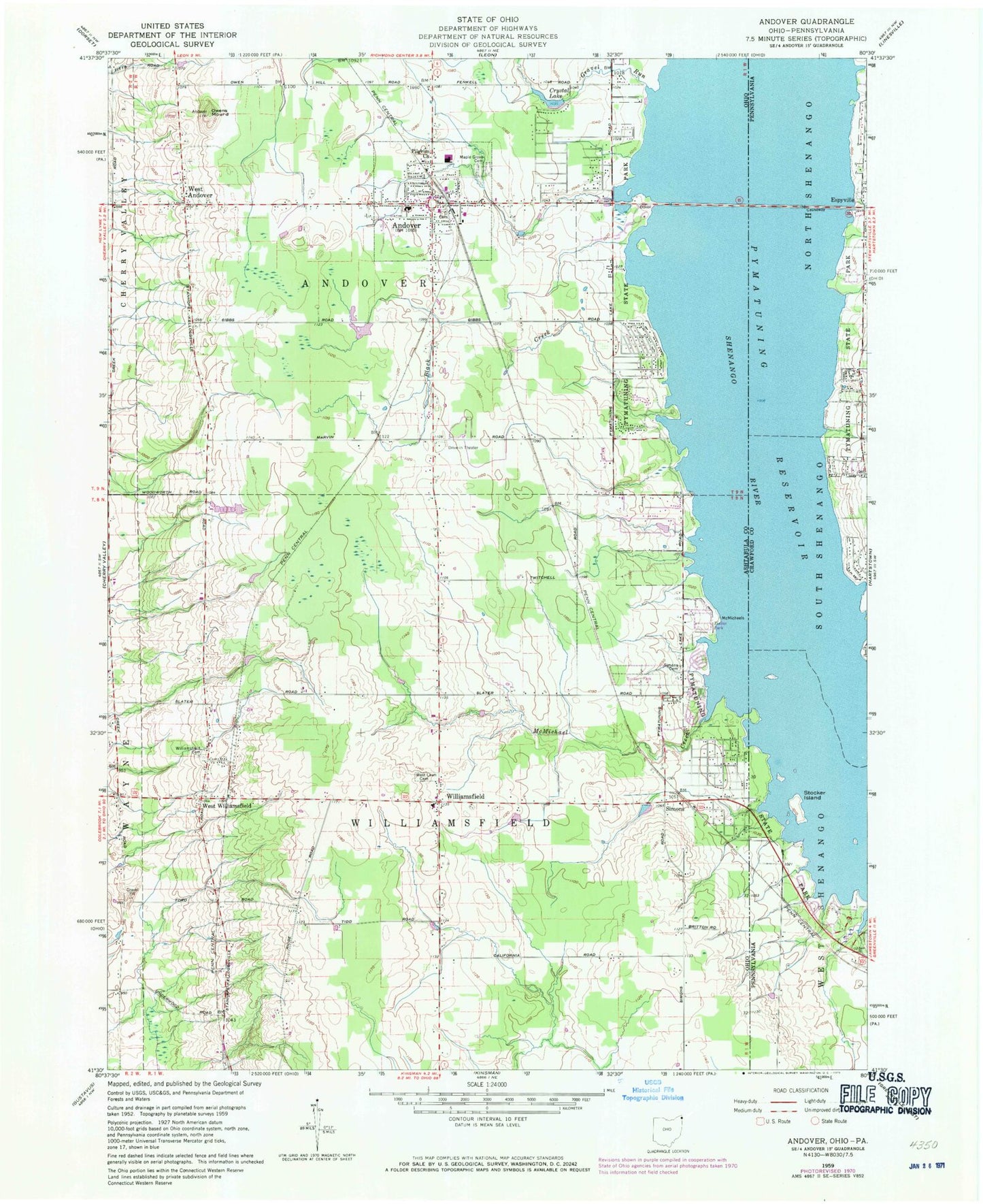
Classic USGS Andover Ohio 7.5'x7.5' Topo Map
Couldn't load pickup availability
Historical USGS topographic quad map of Andover in the states of Ohio, Pennsylvania. Map scale may vary for some years, but is generally around 1:24,000. Print size is approximately 24" x 27"
This quadrangle is in the following counties: Ashtabula, Crawford.
The map contains contour lines, roads, rivers, towns, and lakes. Printed on high-quality waterproof paper with UV fade-resistant inks, and shipped rolled.
Contains the following named places: Andover, Andover Cemetery, Andover Country Meadows, Andover Post Office, Andover Public Library, Andover Village Police Department, Andover Volunteer Fire Department, Black Creek, Crystal Lake, Golden Ridge Farm, Gravel Run, Hal Joy Airfield, Maple Grove Cemetery, McMichael Creek, Owens Mound, Pilgrim Church, Pilgrim Goose Hatchery, Pymatuning Ambulance Service, Pymatuning Lake Drive-In, Pymatuning Valley High School, Pymatuning Valley Primary School, Ri Valley Farm, Riceland Aerodrome, Roberts Cemetery, Simons, Simons Cemetery, Stocker Island, Topside Farms, Township of Andover, Township of Williamsfield, Village of Andover, West Andover, West Andover Cemetery, West Andover Post Office, West Lawn Cemetery, West Williamsfield, Williamsfield, Williamsfield Cemetery, Williamsfield Post Office, Williamsfield United Methodist Church, Windhorse Farm, Winding Brook Farms, ZIP Codes: 44003, 44093