MyTopo
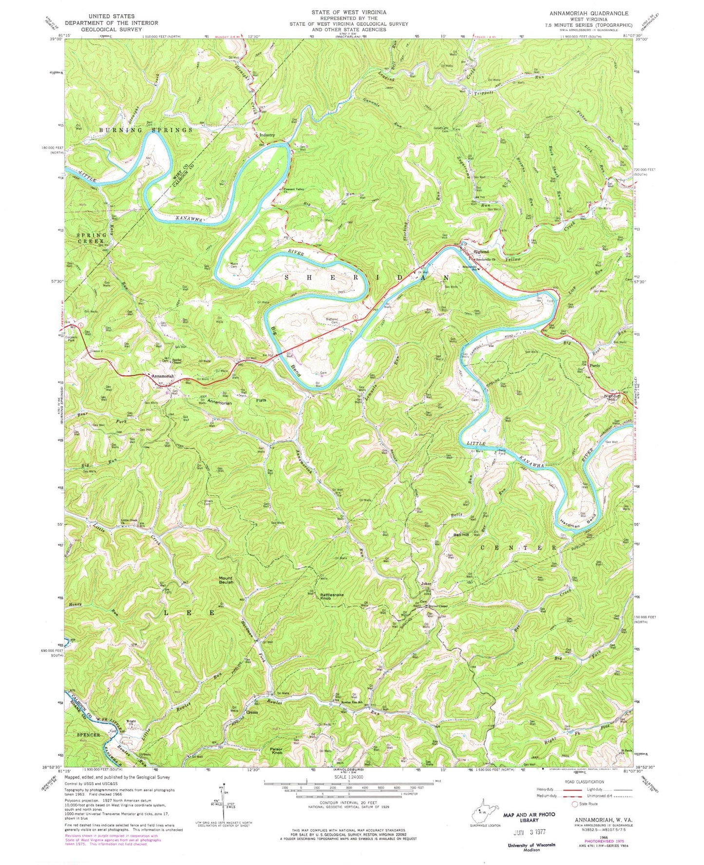
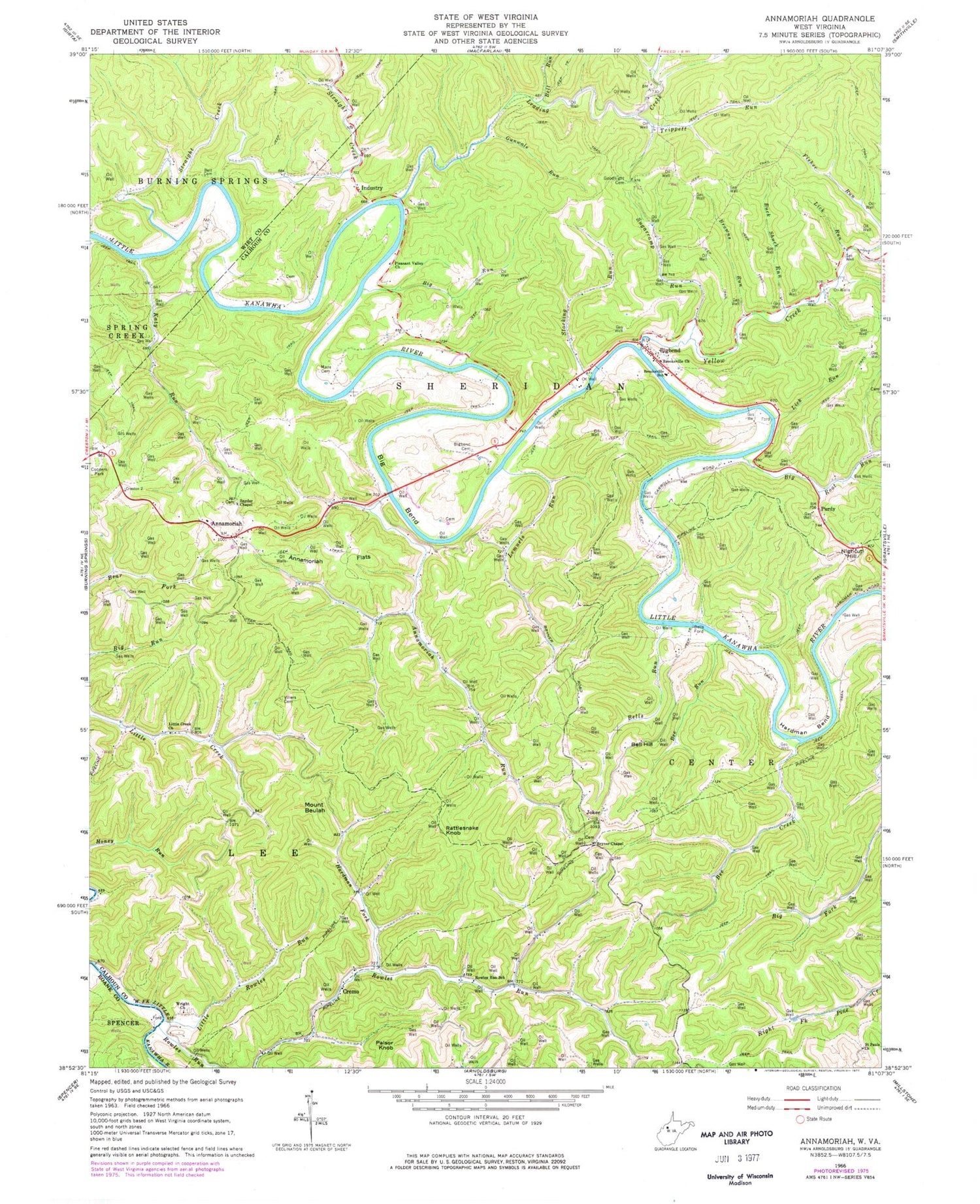
Classic USGS Annamoriah West Virginia 7.5'x7.5' Topo Map
Couldn't load pickup availability
Historical USGS topographic quad map of Annamoriah in the state of West Virginia. Map scale may vary for some years, but is generally around 1:24,000. Print size is approximately 24" x 27"
This quadrangle is in the following counties: Calhoun, Roane, Wirt.
The map contains contour lines, roads, rivers, towns, and lakes. Printed on high-quality waterproof paper with UV fade-resistant inks, and shipped rolled.
Contains the following named places: Annamoriah, Annamoriah Bridge, Annamoriah Flats, Annamoriah Post Office, Annamoriah Run, Annamoriah School, Bee Creek, Bee Run, Bell Hill, Bell Hill School, Bell Run, Bells Ford, Bells Run, Belt Cemetery, Big Bend, Big Bend Post Office, Big Bend School, Big Root Run, Big Run, Bigbend, Bigbend Cemetery, Brooksville Church, Brooksville School, Browns Run, Bryner Chapel, Bryners Chapel Cemetery, Buck Shuck Run, Cedar Grove School, Cooper Cemetery, Coopers Park, Cremo, Creston Flats, District 1, Fisher Run, Goodnight Cemetery, Gunwale Run, Hardman Bend, Hardman Fork, Industry, Joker, Katy Run, Leading Creek, Lemuels Run, Lemuels Run School, Lick Run, Little Creek Church, Little Rowles Run, Maze Cemetery, Mount Beulah, Mount Beulah School, Mount Vernon Church, Nighcut Hill, Palsor Knob, Pine Alley School, Pine Grove School, Pleasant Valley Church, Purdy, Rattlesnake Knob, Riverview School, Rowles Run, Rowles Run School, Saint Paul Cemetery, Saint Paul United Methodist Church, Sixteen Ridge Cemetery, Snyder Chapel Cemetery, Snyder Chapel United Methodist Church, Stocking Run, Straight Creek, Sugarcamp Run, Trippett Run, Villers Cemetery, Wright Cemetery, Wright Church, Yellow Creek, ZIP Codes: 26136, 26141, 26151