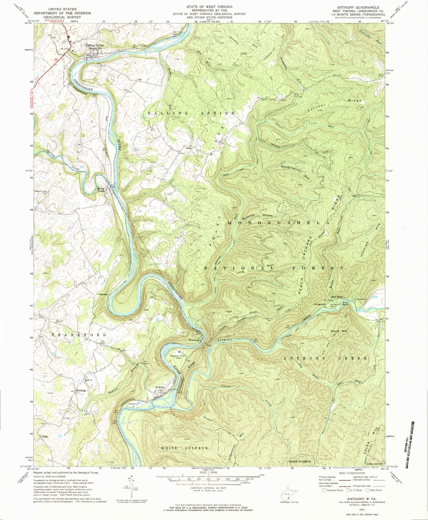

MyTopo
Classic USGS Anthony West Virginia 7.5'x7.5' Topo Map
Couldn't load pickup availability
Historical USGS topographic quad map of Anthony in the state of West Virginia. Typical map scale is 1:24,000, but may vary for certain years, if available. Print size: 24" x 27"
This quadrangle is in the following counties: Greenbrier.
The map contains contour lines, roads, rivers, towns, and lakes. Printed on high-quality waterproof paper with UV fade-resistant inks, and shipped rolled.
Contains the following named places: Boardinghouse Run, Anthony Creek, Auto, Big Draft, Big Run, Big Run Trail, Blue Bend, Blue Bend, Blue Bend Loop Trail, Blueline Hollow, Blueline Trail, Boggs Run, Civil War Trail, Coles Mountain Trail, Dodson Branch, Enon Baptist Church, Falling Spring, Greenbrier River Trail, Greenbrier Youth Camp, Gunpowder Ridge, Henning, Hopkins Mountain, Laurel Creek, Laurel Run, Laurel Run Trail, Long Spur, Panther Ridge, Peach Orchard Ridge, Peach Orchard Trail, Poley Ridge, Red Run, Rocky Run, South Boundary Trail, Spring Creek, Walnut Grove Cemetery, Blue Bend Campground, Gunpowder Ridge Overlook, Anthony Boat Launch, Boardinghouse Run, Anthony, Gardner, Round Mountain, Spring Creek, Vago, Woodman, Burdett School (historical), Clendenin School (historical), Gabbert School (historical), Gilboa School (historical), Henning School (historical), Pleasant View School (historical), Woodland School (historical), Anthony Baptist Church, Henning Church of God, Burns Cave Number 2 Spring, Falling Spring School (historical), Walnut Grove Church (historical), Anthony Post Office, Auto Post Office, Renick Post Office, Eastern District, Town of Falling Spring, Renick Volunteer Fire Department, Morning Side Cemetery, Renick Bridge, Big Draft Wilderness