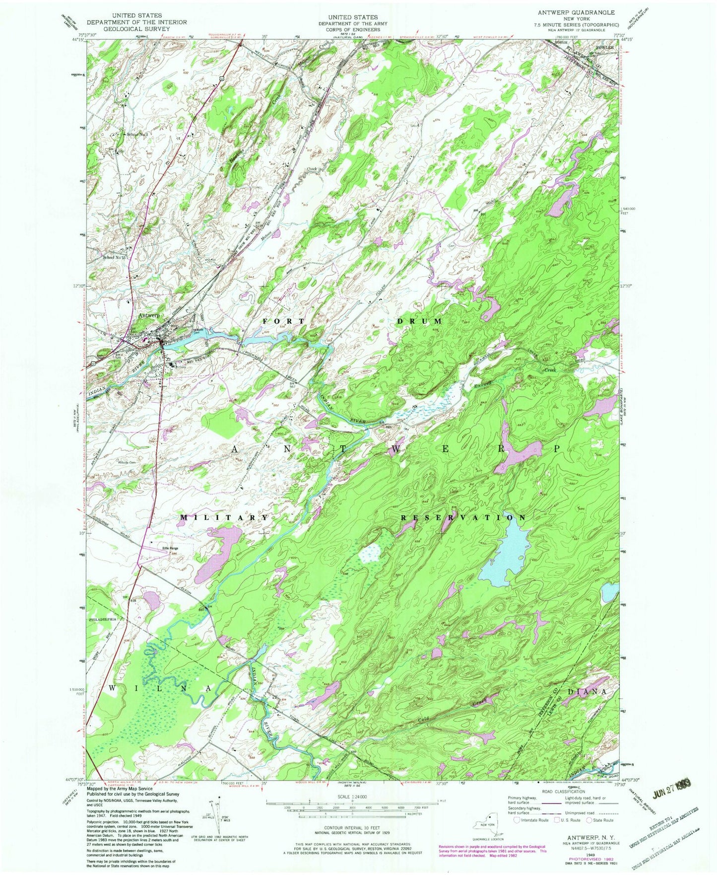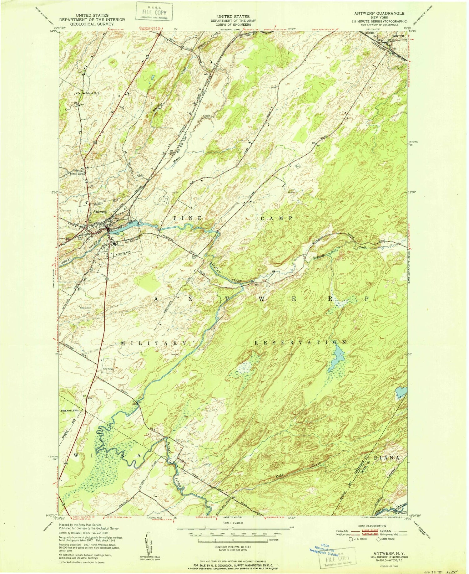

MyTopo
Classic USGS Antwerp New York 7.5'x7.5' Topo Map
Couldn't load pickup availability
Historical USGS topographic quad map of Antwerp in the state of New York. Map scale may vary for some years, but is generally around 1:24,000. Print size is approximately 24" x 27"
This quadrangle is in the following counties: Jefferson, Lewis, St. Lawrence.
The map contains contour lines, roads, rivers, towns, and lakes. Printed on high-quality waterproof paper with UV fade-resistant inks, and shipped rolled.
Contains the following named places: Antwerp, Antwerp High School, Antwerp Post Office, Antwerp Town Hall, Antwerp Village Police Department, Antwerp Volunteer Fire Department Number 04, Cold Creek, Crosby Public Library, Dority Pond, First Congregation Church of Christ, Hawkins Creek, Hillside Cemetery, Indian River Grange Hall, Monument Park, Rockwell Creek, School Number 15, School Number 3, Town of Antwerp, Village of Antwerp