MyTopo
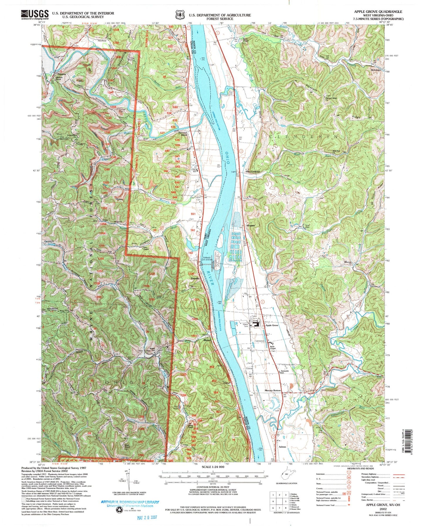
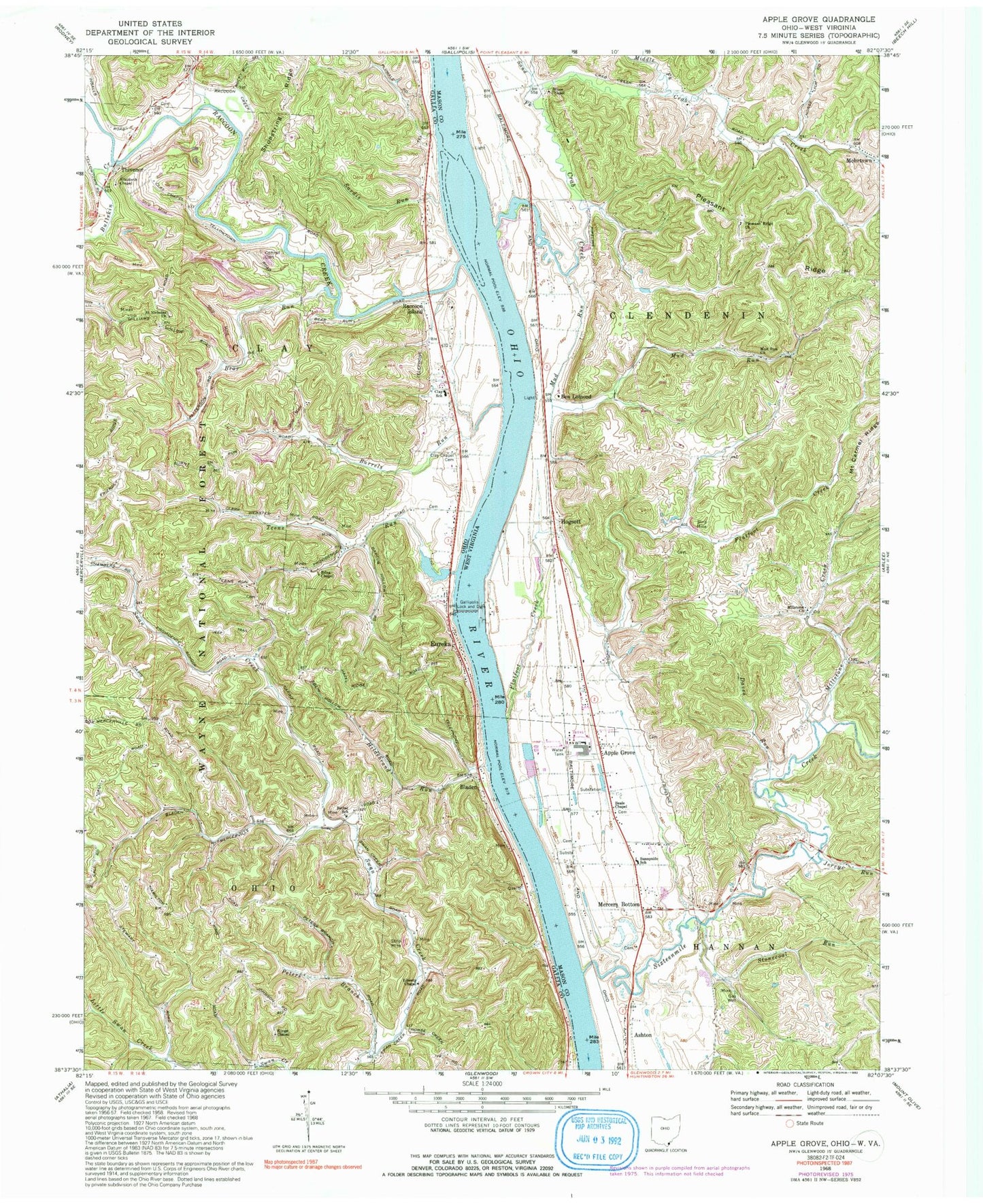
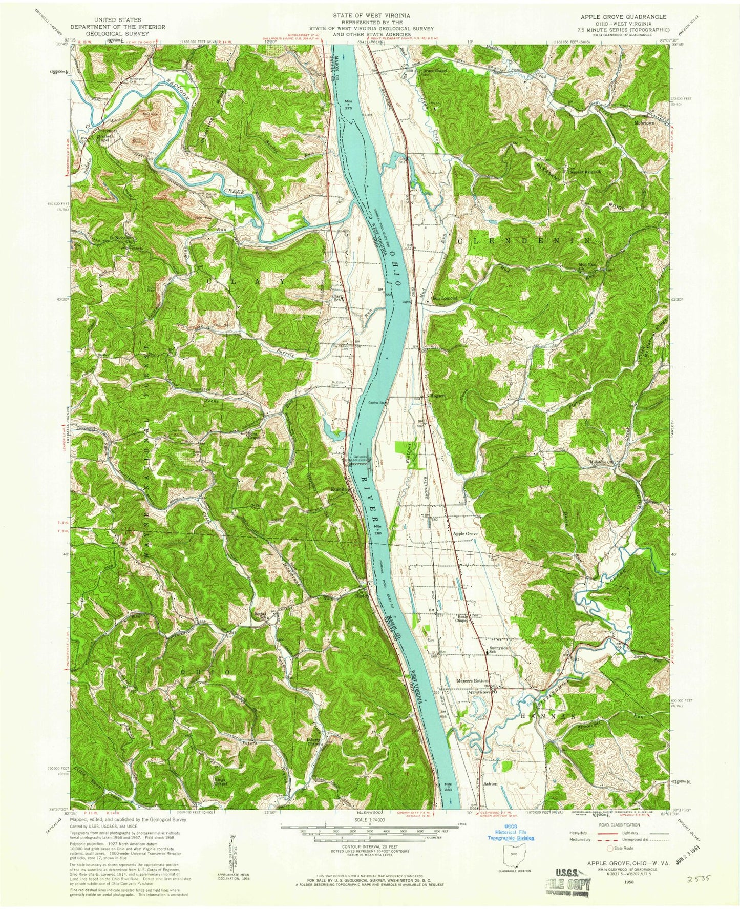
Classic USGS Apple Grove West Virginia 7.5'x7.5' Topo Map
Couldn't load pickup availability
Historical USGS topographic quad map of Apple Grove in the states of West Virginia, Ohio. Map scale may vary for some years, but is generally around 1:24,000. Print size is approximately 24" x 27"
This quadrangle is in the following counties: Gallia, Mason.
The map contains contour lines, roads, rivers, towns, and lakes. Printed on high-quality waterproof paper with UV fade-resistant inks, and shipped rolled.
Contains the following named places: Angola, Angola Post Office, Apple Grove, Apple Grove Census Designated Place, Apple Grove Memorial Gardens, Apple Grove Post Office, Ashton Elementary School, Ashton Post Office, Barkers Landing, Beale Chapel, Beale Chapel Cemetery, Bear Run, Ben Lomond, Bethel Methodist Episcopal Cemetery, Bethel School, Bladen, Bladen Post Office, Bruce Chapel, Bruce Chapel Cemetery, Bullskin Creek, Burrels Run, Bushs Mill, Campbells Landing, Clay Chapel Cemetery, Clay Chapel Methodist Church, Clay Elementary School, Clemma, Clemma Post Office, Coles Landing, Cottrell Cemetery, Crab Creek, Daves Run, Edna Chapel, Elizabeth Chapel, Eureka, Eureka Church of Christ, Eureka Church of God, Eureka Post Office, Flatfoot Creek, Fullers Run, Gallipolis Lock and Dam, Garland Mohr Spring, George Errington Spring, Halley, Halley Post Office, Hazel Cemetery, Hazlett Cemetery, Hereford Cemetery, Hildebrand Run, Hogsett, Holiday Hills, Jerrys Run, King Cemetery, Kings Chapel, Liberty Chapel, Lock and Dam Number 26, Lowery Spring, Mason County Emergency Ambulance Service Authority 200, McLellon Cemetery, Mercers Bottom, Middle Fork Crab Creek, Millstone Church, Millstone Creek, Mohrtown, Mud Run, Mud Run Church, Nicholas Church, Outons Landing, Peters Branch Swan Creek, Pleasant Ridge, Pleasant Ridge Cemetery, Pleasant Ridge Church, Raccoon Creek, Raccoon Island, Riggs Landing, Saint Nicholas Cemetery, Sand Fork Crab Creek, Sardis Run, Shoestring Ridge, Sixteenmile Creek, Smalls Landing, Stonecoal Run, Sunnyside School, Teens Run, Thivener, Thivener Post Office, Township of Clay, Township of Ohio, Valley Volunteer Fire Department