MyTopo
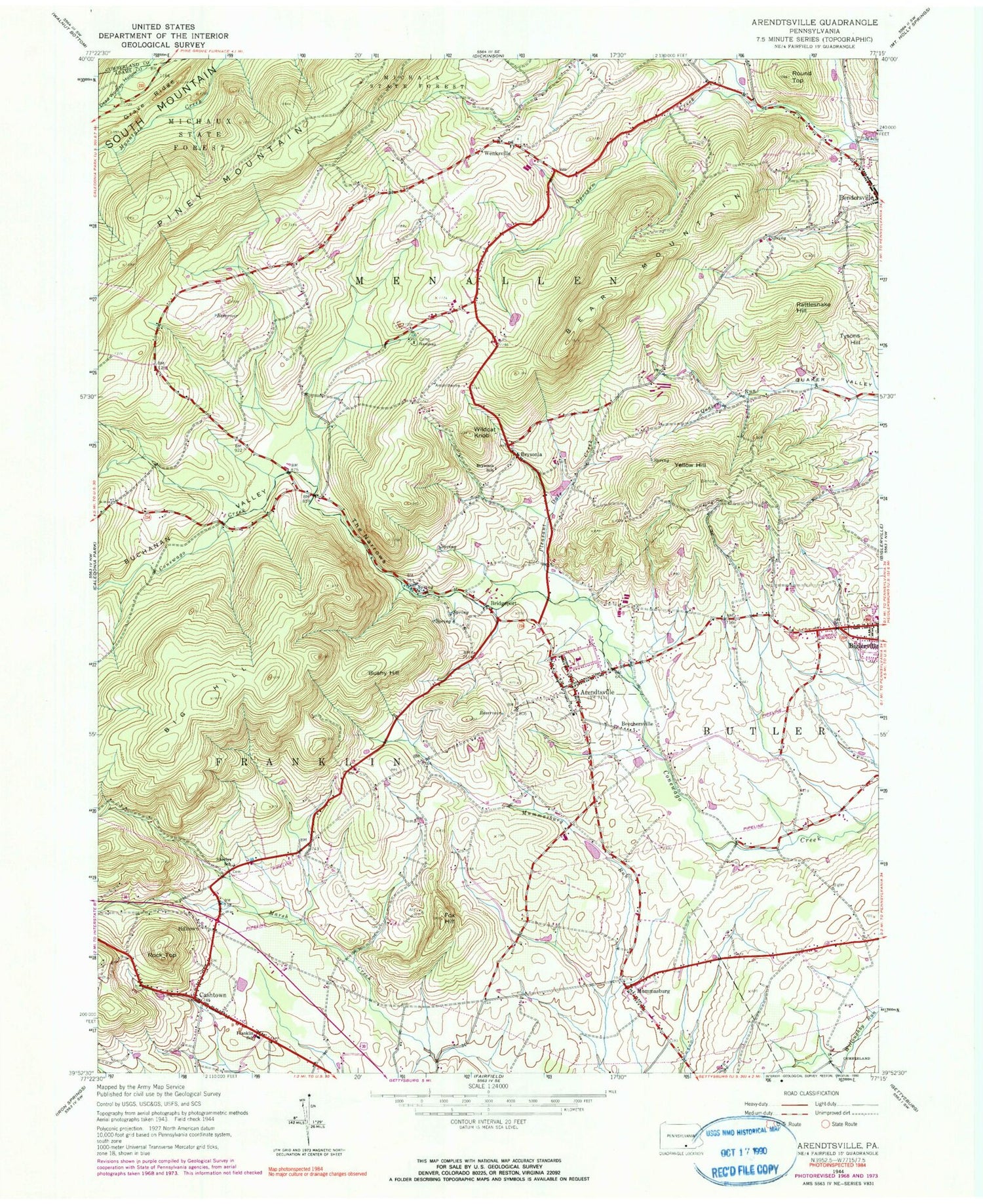
Classic USGS Arendtsville Pennsylvania 7.5'x7.5' Topo Map
Couldn't load pickup availability
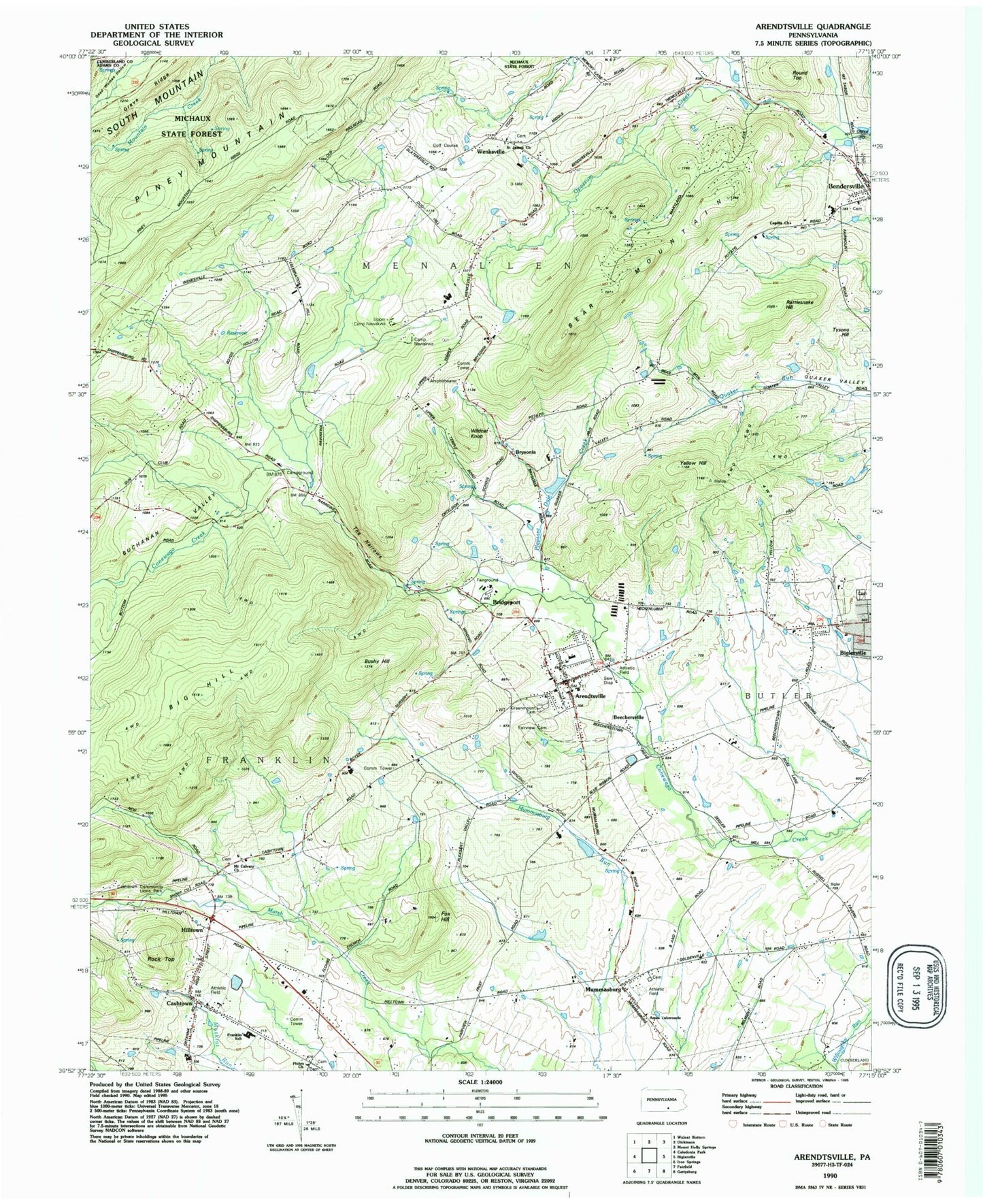
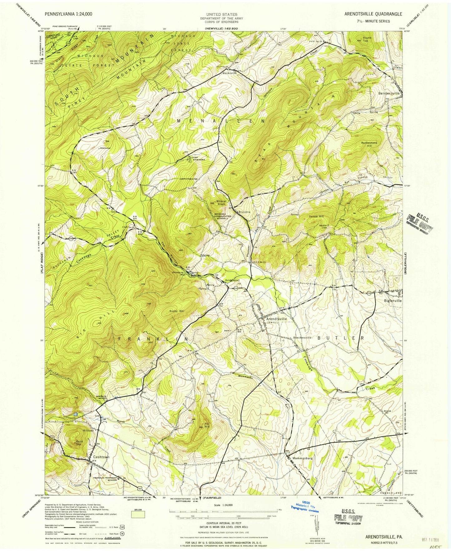
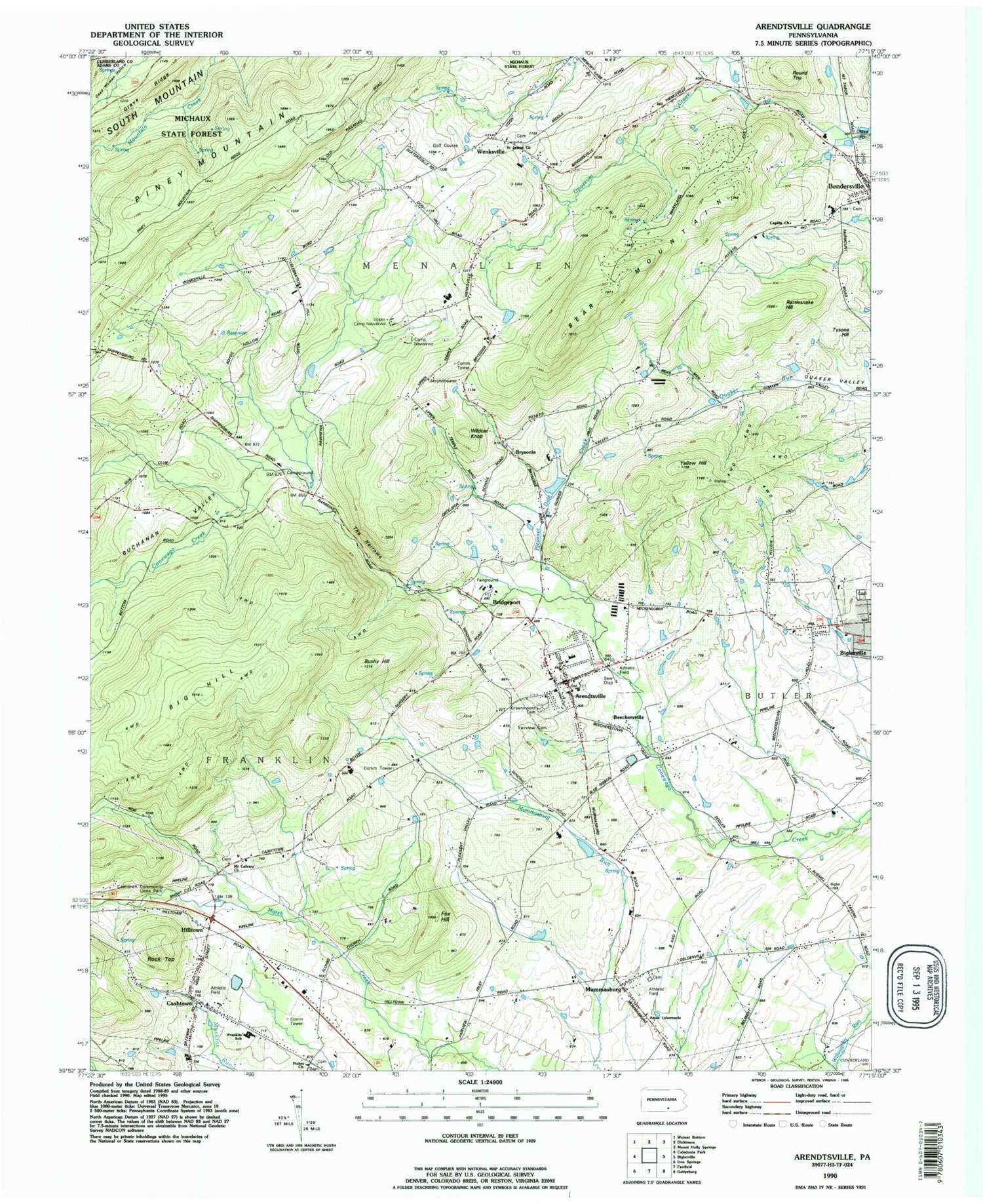
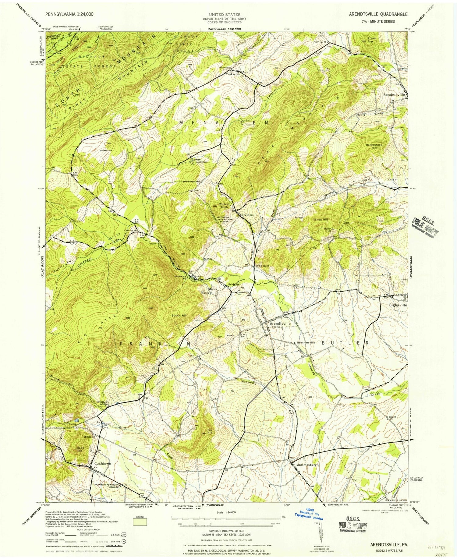
Historical USGS topographic quad map of Arendtsville in the state of Pennsylvania. Typical map scale is 1:24,000, but may vary for certain years, if available. Print size: 24" x 27"
This quadrangle is in the following counties: Adams, Cumberland.
The map contains contour lines, roads, rivers, towns, and lakes. Printed on high-quality waterproof paper with UV fade-resistant inks, and shipped rolled.
Contains the following named places: Arendtsville, Bear Mountain, Beechersville, Big Hill, Bridgeport, Brysonia, Brysonia School, Buchanan Valley, Bushy Hill, Camp Nawakwa, Cashtown, Fox Hill, Franklin Township Elementary School, Grave Ridge, Hilltown, Mummasburg, Pleasant Dale Creek, Rattlesnake Hill, Round Top, Sheelys School, The Narrows, Tysons Hill, Wenksville, Wildcat Knob, Yellow Hill, Michaux State Forest, Rock Top, Schulteis Airport, Clearspring School, Pinegrove School (historical), Rocky Grove School (historical), Eicholtz Mill (historical), Arendtsville Elementary School, Wenks Post Office, Borough of Arendtsville, Township of Menallen, Arendtsville Community Fire Company Station 5, Arendtsville Vocational School Community Center, Cashtown-McKnightstown Census Designated Place (historical), Greenmount Cemetery, Cashtown Census Designated Place, Cashtown Community Fire Department Station 4, Fairview Cemetery, Arendtsville Post Office, Biglerville Post Office, Cashtown Post Office, Flohrs Lutheran Church Cemetery, German Society Lutheran Calvinist Cemetery, Bendersville Cemetery, Mount Calvary Methodist Cemetery, Wenksville Cemetery, Biglerville Cemetery, Mummasburg Mennonite Cemetery, Arendtsville, Bear Mountain, Beechersville, Big Hill, Bridgeport, Brysonia, Brysonia School, Buchanan Valley, Bushy Hill, Camp Nawakwa, Cashtown, Fox Hill, Franklin Township Elementary School, Grave Ridge, Hilltown, Mummasburg, Pleasant Dale Creek, Rattlesnake Hill, Round Top, Sheelys School, The Narrows, Tysons Hill, Wenksville, Wildcat Knob, Yellow Hill, Michaux State Forest, Rock Top, Schulteis Airport, Clearspring School, Pinegrove School (historical), Rocky Grove School (historical), Eicholtz Mill (historical), Arendtsville Elementary School, Wenks Post Office, Borough of Arendtsville, Township of Menallen, Arendtsville Community Fire Company Station 5, Arendtsville Vocational School Community Center, Cashtown-McKnightstown Census Designated Place (historical), Greenmount Cemetery, Cashtown Census Designated Place, Cashtown Community Fire Department Station 4, Fairview Cemetery, Arendtsville Post Office, Biglerville Post Office, Cashtown Post Office, Flohrs Lutheran Church Cemetery, German Society Lutheran Calvinist Cemetery, Bendersville Cemetery, Mount Calvary Methodist Cemetery, Wenksville Cemetery, Biglerville Cemetery, Mummasburg Mennonite Cemetery