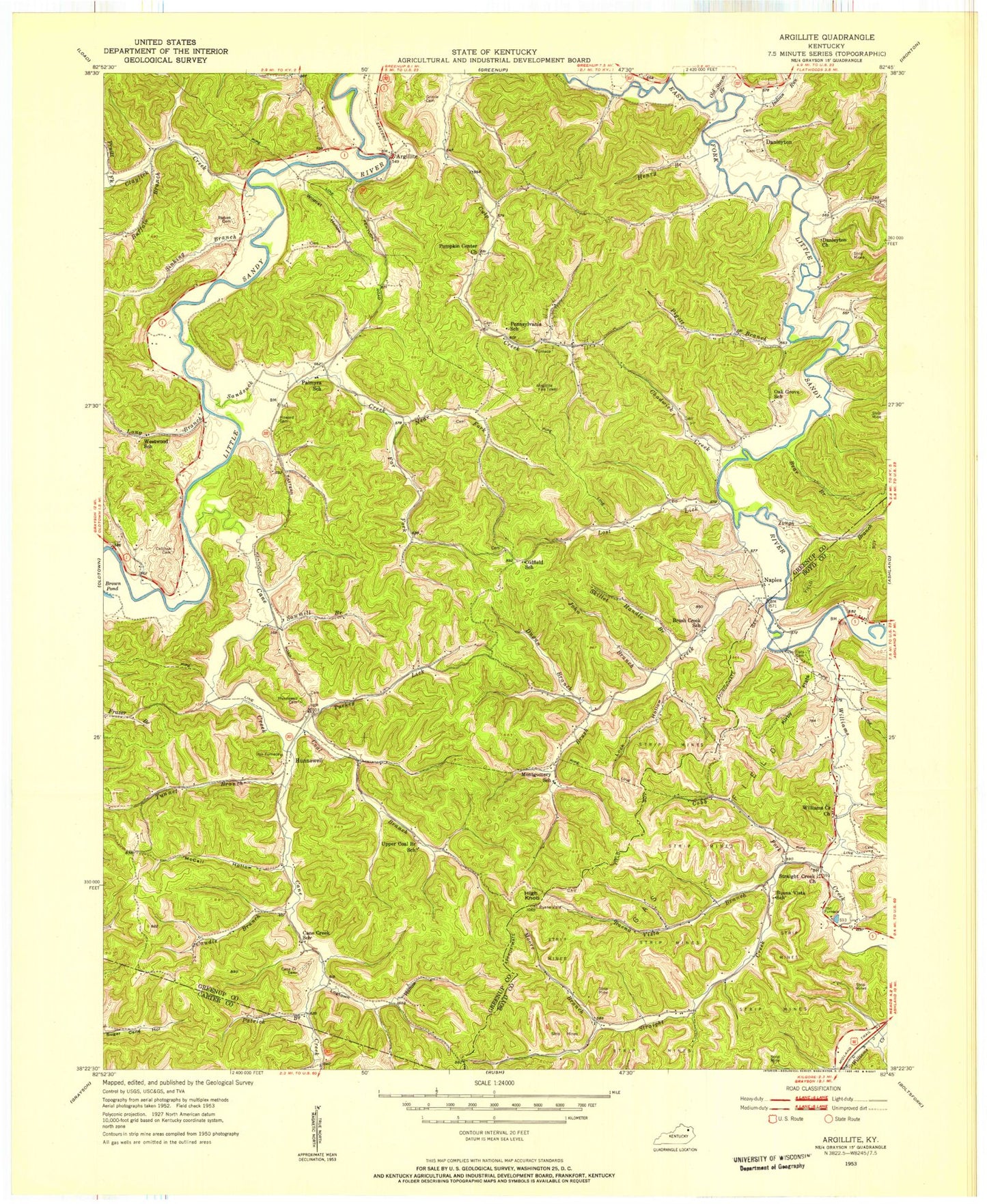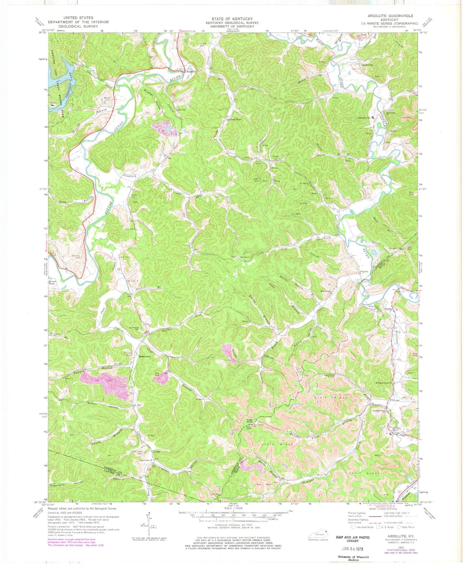

MyTopo
Classic USGS Argillite Kentucky 7.5'x7.5' Topo Map
Couldn't load pickup availability
Historical USGS topographic quad map of Argillite in the state of Kentucky. Typical map scale is 1:24,000, but may vary for certain years, if available. Print size: 24" x 27"
This quadrangle is in the following counties: Boyd, Carter, Greenup.
The map contains contour lines, roads, rivers, towns, and lakes. Printed on high-quality waterproof paper with UV fade-resistant inks, and shipped rolled.
Contains the following named places: Bear Branch, Brush Creek, Brush Creek Church, Buena Vista Branch, Callihan Cemetery, Cane Creek, Cane Creek Cemetery, Cane Creek Church, Caudle Branch, Chadwick Creek, Claylick Creek, Coal Branch, Cobb Fork, Culp Creek Chapel, Danleyton Church, Danleyton School, Dugan Branch, Far Fork Sandsuck Creek, Greenbo Lake, Grizzle Cemetery, Henry Branch, High Knob, Howard Cemetery, Hunnewell Cemetery, Indian Run, John Branch, Kirby Flats, Kirby Flats Cemetery, Lock Hollow, Logtown Hollow, Long Branch, Lost Lick, McCall Hollow, Moore Branch, Near Fork Sandsuck Creek, Old Stream Branch, Patrick Branch, Pigott Branch, Reeves Cemetery, Sand Gap Church, Sandsuck Creek, Sawmill Branch, Sinking Branch, Skillet Handle Branch, Straight Creek, Straight Creek Church, Tough Branch, Tunnel Branch, Turkey Lick, Wayside Church, Wildcat Hollow, Williams Creek, Williams Creek Church, Argillite, Danleyton, Hunnewell, Naples, Argillite Lookout Tower, Wurtland Division, Naples Post Office (historical), Kimbler Post Office (historical), Kirby Flats School, Williams Creek, Williams Creek Church, Click Cemetery, Buena Vista Iron Furnace (historical), Buena Vista School, McCalvin Cemetery, Little Sandy Volunteer Fire Department Station 2, Little Sandy Volunteer Fire Department Station 3, Eastern Kentucky Railway Historical Marker, Eastern Kentucky Railway in Hunnewell Historical Marker, Kentucky Veterans Cemetery Northeast, Argillite Post Office