MyTopo
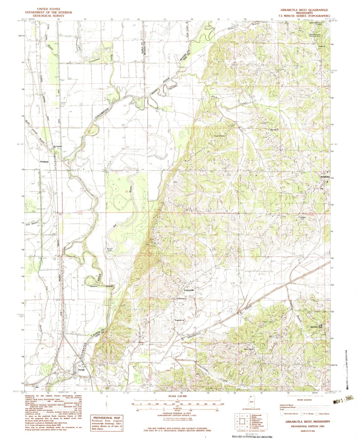
Classic USGS Arkabutla West Mississippi 7.5'x7.5' Topo Map
Couldn't load pickup availability
Historical USGS topographic quad map of Arkabutla West in the state of Mississippi. Typical map scale is 1:24,000, but may vary for certain years, if available. Print size: 24" x 27"
This quadrangle is in the following counties: DeSoto, Tate, Tunica.
The map contains contour lines, roads, rivers, towns, and lakes. Printed on high-quality waterproof paper with UV fade-resistant inks, and shipped rolled.
Contains the following named places: Surretts Cemetery, Big Bayou, Blue Hill Church, Caney Creek, Center Hill Church, Church of Christ, Ditch Number Eight, Green Church, Evansville Church, Flat Bayou, Forrest Tower, Holly Branch, Lost Lake Bayou, Rock Creek, Saint Maryland Church, Tee Bayou, The Shepard Church, E L Herron Pond Dam, Bill McLean Pond Dam, Cottonville, Dalehite Lake, Evansville, Long Lake, Mid-South College, Mosquito Lake, Mud Lake, Round Lake, South Abutment Public Use Area, Hudsons Ferry (historical), Thompsons Ferry (historical), Cub Lake Bayou, Lake Cormorant Bayou, Dooley, Prichard, Savage, Arkabutla Consolidated High School (historical), Northwest Academy, Supervisor District 2, Ella Green School (historical), Powell School (historical), Smith Chapel (historical), Sturdy School (historical), District One Volunteer Fire Department Station 2, Arkabutla Fire Department