MyTopo
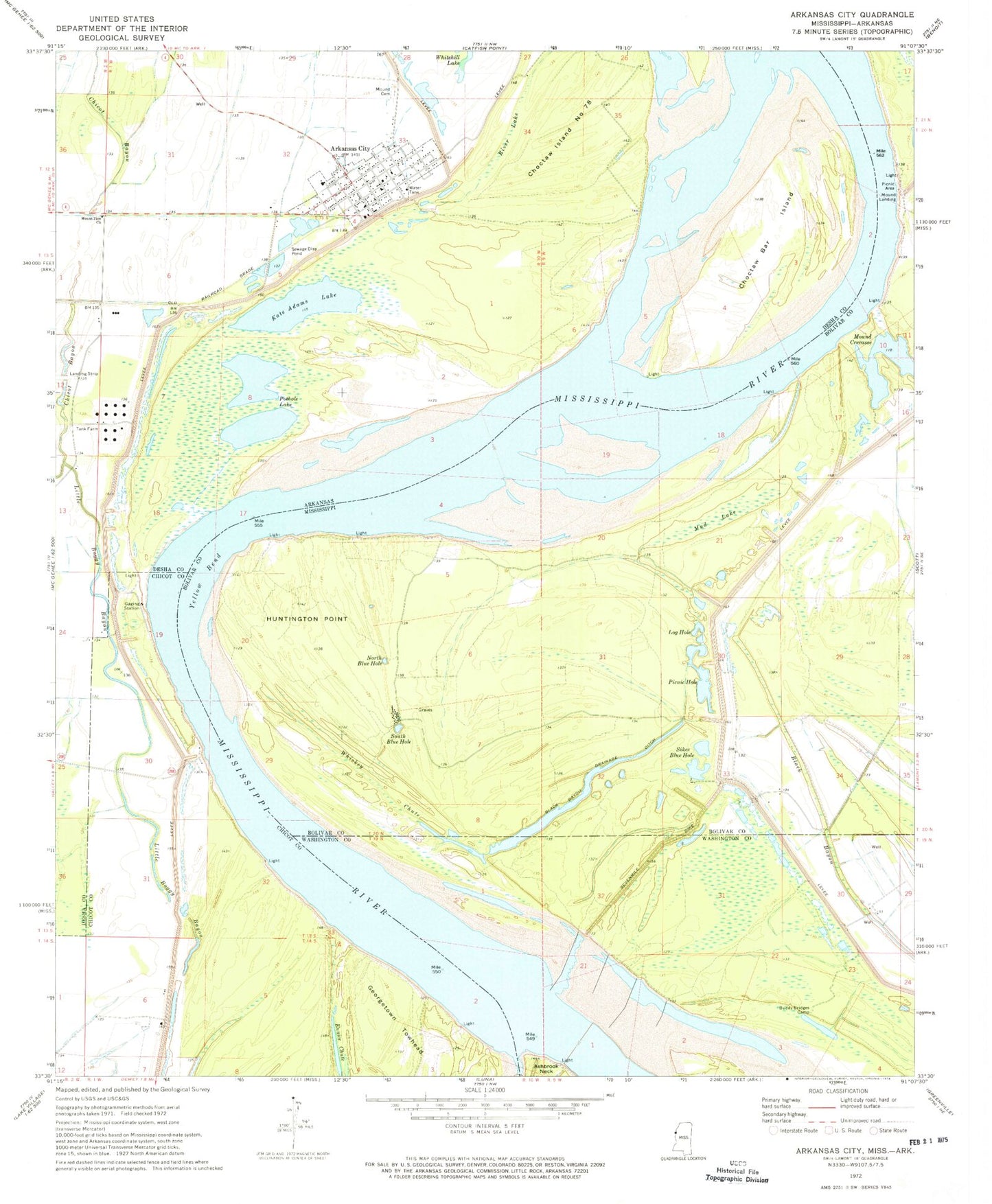
Classic USGS Arkansas City Arkansas 7.5'x7.5' Topo Map
Couldn't load pickup availability
Historical USGS topographic quad map of Arkansas City in the states of Arkansas, Mississippi. Map scale may vary for some years, but is generally around 1:24,000. Print size is approximately 24" x 27"
This quadrangle is in the following counties: Bolivar, Chicot, Desha, Washington.
The map contains contour lines, roads, rivers, towns, and lakes. Printed on high-quality waterproof paper with UV fade-resistant inks, and shipped rolled.
Contains the following named places: Arkansas City, Arkansas City Baptist Church, Arkansas City Elementary School, Arkansas City Fire Department, Arkansas City High School, Arkansas City Police Department, Arkansas City Post Office, Arkansas City Yellow Bend Revetment, Black Bayou Drainage Ditch, Buddy Bridges Camp, Chicot Bayou, Choctaw Bar Island, Choctaw Bend, Choctaw Island Number 78, Choctaw Revetment, City of Arkansas City, Desha County Courthouse, Desha County Sheriff's Office, Eunice Landing, Georgetown Bend, Georgetown Towhead, Huntington Bar, Huntington Point, Huntington Point Revetment, Island Number 80, Kate Adams Lake, Little Boggy Bayou, Log Hole, Morning Star Church, Morning Star School, Moss Lake Landing, Mound Cemetery, Mound Crevasse, Mound Landing, Mount Zion Church, Mud Lake, North Blue Hole, Offutt Landing, Pair O' Dice Revetment, Picnic Hole, Port Anderson, Pothole Lake, River Lake, Sevenmile Dike, Shadyside Landing, Sikes Blue Hole, South Blue Hole, Stop Landing, Timber Lake Plantation, Whiskey Chute, Yellow Bend, ZIP Codes: 38702, 71630