MyTopo
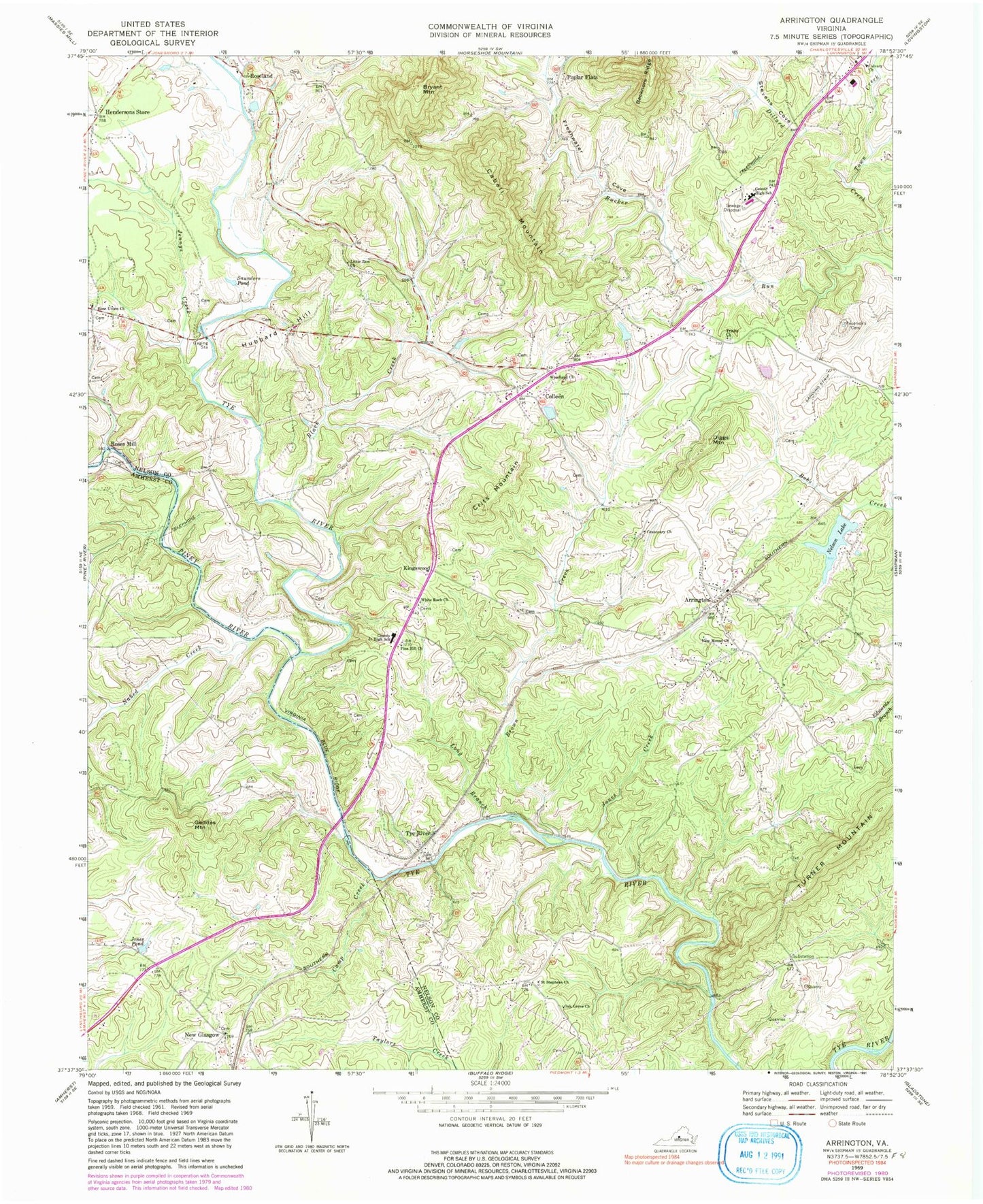
Classic USGS Arrington Virginia 7.5'x7.5' Topo Map
Couldn't load pickup availability
Historical USGS topographic quad map of Arrington in the state of Virginia. Typical map scale is 1:24,000, but may vary for certain years, if available. Print size: 24" x 27"
This quadrangle is in the following counties: Amherst, Nelson.
The map contains contour lines, roads, rivers, towns, and lakes. Printed on high-quality waterproof paper with UV fade-resistant inks, and shipped rolled.
Contains the following named places: Arrington, Black Creek, Brown Creek, Bryant Mountain, Cabell Mountain, Calvary Church, Camp Creek, Centenary Church, Colleen, Crits Mountain, Diggs Mountain, Hendersons Store, Jones Creek, Jones Pond, Little Zion Church, Long Branch, New Mount Church, Oak Grove Church, Pine Hill Church, Rose Union Church, Saint Stephens Church, Saunders Pond, Trinity Church, Turner Mountain, Tye River, White Rock Church, Woodland Church, Kingswood, New Glasgow, Poplar Flats, Roses Mill, Allen Creek, Freshwater Cove, Hat Creek, Jennys Creek, Naked Creek, Piney River, Roseland, Stevens Cove, Town Creek, Nelson Dam, Stevens Lake Dam, Stevens Lake, Watts Dam, Geddes Mountain, Hubbard Hill, Starr Airport, Flatwoods Airport, Tye River Airport, Nelson County High School, Nelson Middle School, Oak Ridge, Poplar Flat Baptist Church, White Rock Cemetery, Woodland Cemetery, Nelson Lake, Tye River Elementary School, Arrington Census Designated Place, Nelson County Rescue Squad Station 2, Arrington Post Office