
MyTopo
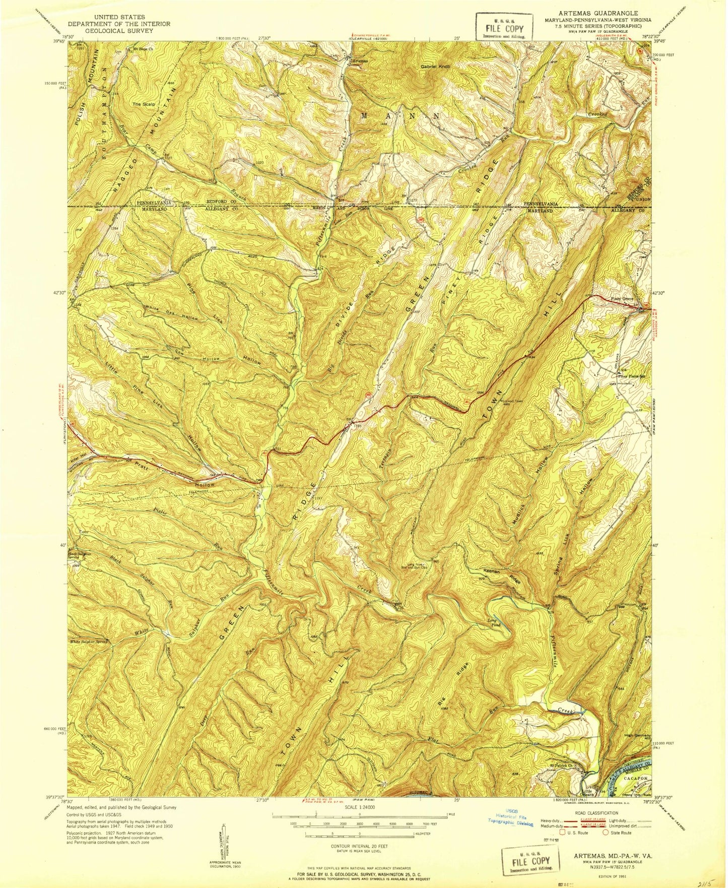
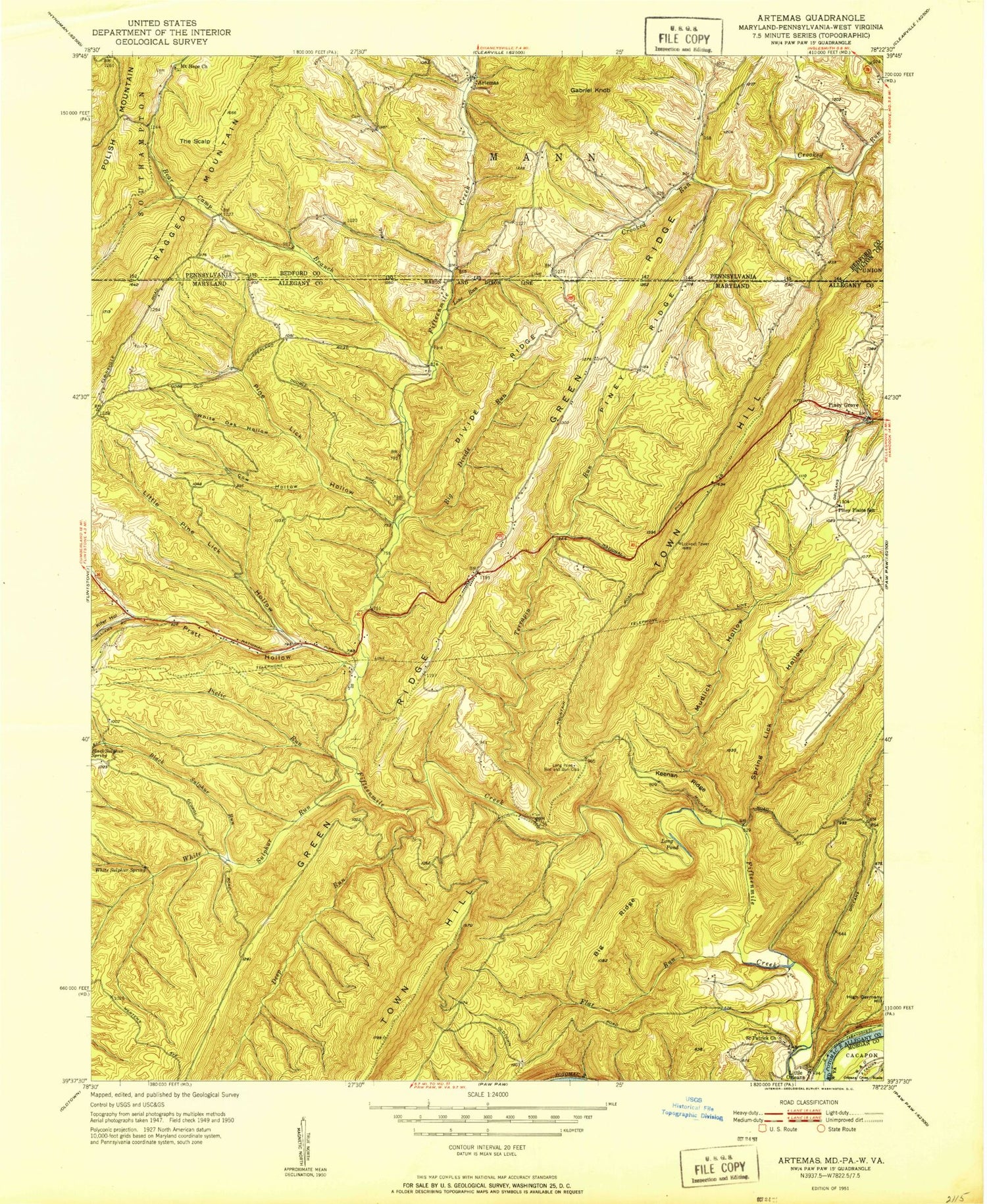
Classic USGS Artemas Pennsylvania 7.5'x7.5' Topo Map
Couldn't load pickup availability
Historical USGS topographic quad map of Artemas in the states of Pennsylvania, Maryland, West Virginia. Typical map scale is 1:24,000, but may vary for certain years, if available. Print size: 24" x 27"
This quadrangle is in the following counties: Allegany, Bedford, Fulton, Morgan.
The map contains contour lines, roads, rivers, towns, and lakes. Printed on high-quality waterproof paper with UV fade-resistant inks, and shipped rolled.
Contains the following named places: Artemas, Gabriel Knob, Mount Hope Church, The Scalp, Jim Trail, Hinkle Trail, Hines Trail, Imes Trail, Artemas Village Post Office, Bennett Cemetery, Collins Farm Cemetery, Mount Hope Cemetery, Bear Camp Branch, Big Divide Run, Big Ridge, Black Sulphur Run, Black Sulphur Spring, Cow Hollow, Deep Run, Divide Ridge, Flat Run, Keenan Ridge, Kifer Hollow, Line Run, Little Pine Lick Hollow, Long Pond, Mudlick Hollow, Piclic Run, Pine Lick Hollow, Piney Plains School, Piney Ridge, Pratt Hollow, Ragged Mountain, Saint Patrick Church, Spring Lick Hollow, Terrapin Run, Town Hill, White Oak Hollow, White Sulphur Run, White Sulphur Spring, Piney Grove, Little Orleans, Bear Camp Branch, Billmeyer Game Refuge, Saint Patricks Cemetery, District 1 Orleans, Orleans Volunteer Fire Department, Little Orleans Census Designated Place, Fischers Greenhouse, Orleans Cross Roads Methodist Episcopal Church